Mount Saint Helena
| Mount Saint Helena | |
|---|---|
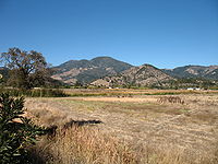
 Mount Saint Helena, viewed from Northern Napa Valley | |
| Highest point | |
| Elevation | 4,342 ft (1,323 m) NAVD 88[1] |
| Prominence | 1,823 ft (556 m)[2] |
| Listing | California county high points 44th |
| Coordinates | 38°40′10″N 122°38′01″W / 38.669340858°N 122.633487528°WCoordinates: 38°40′10″N 122°38′01″W / 38.669340858°N 122.633487528°W[1] |
| Geography | |
 Mount Saint Helena | |
| Parent range | Mayacamas Mountains |
| Topo map | USGS Mount Saint Helena |

Mount Saint Helena (Wappo: Kanamota, "Human Mountain")[3] is a peak in the Mayacamas Mountains with flanks in Napa, Sonoma, and Lake counties of California. Composed of uplifted 2.4-million-year-old volcanic rocks from the Clear Lake Volcanic Field, it is one of the few mountains in the San Francisco Bay Area to receive any snowfall during the winter.
The mountain has five peaks, arranged in a rough "M" shape. Its highest point, North Peak, is in Sonoma County. The second-tallest, immediately east of the main summit, is the highest point in Napa County.[4] The headwaters of the Napa River are on the southeast slope of Mount Saint Helena.[5][6]
History[]

Mount Saint Helena has had an explosive history of pyroclastic flows that resulted in California's Petrified Forest.
Mount Saint Helena, originally Mount Mayacamas, was renamed after a Russian survey party ascended the peak in 1841 and left a copper plate on the summit inscribed with the date of their visit. The plate also bore the name of Princess Helena de Gagarin, wife of Alexander G. Rotchev, the commanding officer of Fort Ross.[7][8]
Robert Louis Stevenson and Fanny Vandegrift Osbourne spent the summer of 1880 honeymooning in an abandoned mining camp on Mount Saint Helena. Stevenson's book The Silverado Squatters describes his experiences while living there.[9] The mount is also described by Ambrose Bierce in his ghost story The Death of Halpin Frayser. Ursula K. Le Guin's novel Always Coming Home is about a post-apocalyptic society that considers Mount Saint Helena sacred.
The peak is reachable by hiking trails leading from Robert Louis Stevenson State Park.[9] The trails are approximately 6 miles (9.7 km) long.
Mount Saint Helena

Another view of the mountain
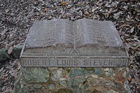
Robert Louis Stevenson monument in Robert Louis Stevenson State Park


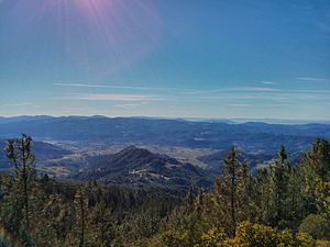
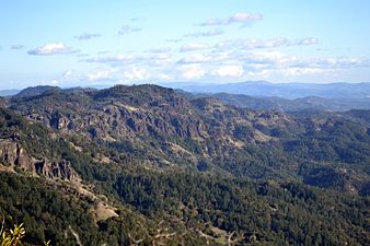
Views from the summit[]

Calistoga viewed from Mount Saint Helena
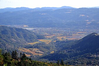
Northern Napa Valley viewed from Mount Saint Helena
A view from the mountain

Another view
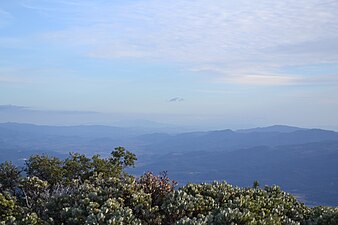
Another view

view after 2017 fire
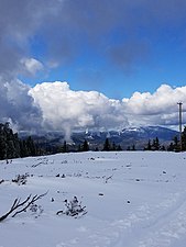
snow view


See also[]
References[]
- ^ Jump up to: a b "Mount Helena". NGS data sheet. U.S. National Geodetic Survey. Retrieved 2009-08-14.
- ^ "Mount Saint Helena, California". Peakbagger.com. Retrieved 2009-08-14.
- ^ "Wappo Language". Wappo Indians of Napa County. Archived from the original on 2012-02-08. Retrieved 2012-08-15.
- ^ "Mount Saint Helena-East Peak, California". Peakbagger.com. Retrieved 2009-12-24.
- ^ "Napa River". Geographic Names Information System. United States Geological Survey. Retrieved 2009-08-14.
- ^ Kevin Courtney (March 28, 2010). "A search for Napa River's start runs through the heart of the valley". Napa Valley Register. Napa Valley Publishing.
- ^ "Humboldt County, CA History". California Genealogy and History Archives. Retrieved 2009-08-14.
- ^ "Napa County History". California Genealogy and History Archives. Archived from the original on 2009-03-27. Retrieved 2009-08-14.
- ^ Jump up to: a b "Mount St. Helena, Robert Louis Stevenson State Park". Greenbelt Alliance. Archived from the original on 2010-07-05. Retrieved 2009-08-14.
External links[]
| Wikimedia Commons has media related to Mount Saint Helena. |
- "Mount Saint Helena". SummitPost.org. Retrieved 2011-05-07.

| show Authority control |
|---|
- Mayacamas Mountains
- Mountains of Lake County, California
- Mountains of Napa County, California
- Mountains of Sonoma County, California
- Mountains of the San Francisco Bay Area
- Mountains of Northern California