Mount Taka (Osaka/Hyōgo)
| Mount Taka | |
|---|---|
| 高岳 | |
 Seen from the SSE | |
| Highest point | |
| Elevation | 720.8 m (2,365 ft) |
| Coordinates | 35°0′6″N 135°21′11″E / 35.00167°N 135.35306°E |
| Naming | |
| Language of name | Japanese |
| Pronunciation | [takadake] |
| Geography | |
| Location | On the border of Inagawa, Hyōgo and Nose, Ōsaka, Japan |
| Parent range | |

Mount Taka (高岳, Taka-dake) is a 720.8 m (2,365 ft) mountain of the , located on the border of Inagawa, Hyōgo and Nose, Ōsaka, Japan. This mountain is one of , and an important part of Hokusetsu Natural Park.
Outline[]
Mount Taka is one of the major mountains of . Hokusetsu Mountains are themselves sometimes regarded as a part of . Mount Taka is a typical mountain in this area like Mount Kenpi, and .
Religion[]
Mount Taka which has a pyramidal shape has been an object of worship by the people around the mountain. The most religious spot in the middle of this mountain is .
Route[]
There are three routes to the top of the mountain. One is the most popular from via Inagawa Fudoson. It takes about two hours. From , there are two routes. It take roughly two and half hours from Morigami to the top.
Access[]
- of
- of
Gallery[]

Mount Taka from south
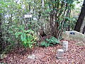
The top of Mount Taka
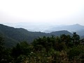
Southeast view from the top of Mount Taka

Southwest view from the top of Mount Taka

Kongo waterfall at Inagawa Fudoson Temple
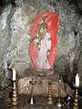
Acra at Inagawa Fudoson Temple
A view at Mount Taka


References[]
- Mountains of Hyōgo Prefecture
- Mountains of Osaka Prefecture