Mountains of Azerbaijan
Mountains of Azerbaijan cover approximately 60 percent of the country's land area.[1][2] There are three mountain ranges in the territory of Azerbaijan, which are the Greater Caucasus, the Lesser Caucasus, and the Talysh Mountains.[3]
The elevation of the central mountains of these three mountain ranges is approximately 1000 – 2000 meters.[1] The height of high mountains of the Greater Caucasus is higher than 2200 meters and the Lesser Caucasus is higher than 2000 meters.[1]
| Mountain ranges in Azerbaijan[1] | ||
| Mountain ranges | Area coverage (%) | Zones |
| Greater Caucasus | 30 | Foothill (lower than 500 meters) |
| Low mountains (500 – 1200 meters) | ||
| Middle mountain (1200 – 2200 meters) | ||
| High mountains (higher than 2200 meters) | ||
| Lesser Caucasus | 22 | Foothill (lower than 500 meters) |
| Low mountains (500 – 1200 meters) | ||
| Middle mountain (1200 – 2000 meters) | ||
| High mountains (higher than 2000 meters) | ||
| Talysh Mountains | 6 | Pre – mountain plains (lower than 600 meters) |
| Low mountains (600 – 1000 meters) | ||
| Middle mountain (1000 – 2500 meters) | ||
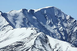
The Greater Caucasus range forms the north-east borders of Azerbaijan with Dagestan Autonomous Republic of Russia.[4] Bazarduzu, Shahdagh, and Tufandag are the high peaks of the mountain range.[5] The highest peak of the Greater Caucasus is Mount Bazarduzu, which is situated 14,652 feet (4466 meters) above the sea level, is also the highest point in Azerbaijan.[3][5] The mountains of the Greater Caucasus are located in the region of high degree of seismic activity.[5] The mountains are formed by rocks that date back to Jurassic and Cretaceous periods.[2]
The Lesser Caucasus is the second important mountain range in Azerbaijan and forms its south-western borders.[5] Mount Murovdag and Mount Zangezur are the main ridges of the Lesser Caucasus.[5] They are formed by sedimentary and volcanogenic rocks of Cretaceous and Jurassic periods.[2]
The Talysh Mountains cover the southeastern part of Azerbaijan and form part of its border with Iran.[4][5]
Mountains of the Greater Caucasus[]
Bazarduzu[]
The highest peak of the Greater Caucasus, Mount Bazarduzu, is the highest mountain in Azerbaijan.[3][6] It lies on the borders between Azerbaijan and Russia.[3] The rocks of Mount Bazarduzu are formed of shale porphyries.[7] Ice fields that consist of glaciers from Ice Age on the mountain are the biggest glaciers in the Eastern Caucasus.[7]
The first person who climbed the Mount Bazarduzu was Aleksej Aleksandrov from Russia in 1847.[3][7]

Shahdagh[]

The elevation of Mount Shahdagh is 13951 feet (4243 m), which is the second highest peak in the Greater Caucasus.[3][8] The mountain is located near to the border with Russia, in Gusar region of Azerbaijan.[3] There are caves at the base of the Mount Shahdagh, which show manmade activities around the mountain for over 9000 years.[3] The rocks of the mountain are formed by dolomites and limestones.[8]
Tufandag[]
Tufandağ is the third highest mountain in Azerbaijan with the height of 13770 feet (4191 m.).[3] Mount Tufandag lies in the Gusar region.[9]
| List of mountains of the Greater Caucasus[9] | |||
| Name | Original name | Elevation (m) | Region |
| Bazarduzu | Bazardüzü | 4466 | Russian – Gusar border |
| Shahdagh | Şahdağ | 4243 | Gusar |
| Tufandag | Tufandağ | 4191 | Gusar |
| Bazaryurd | Bazaryurd | 4126 | Gusar and Gabala |
| Yarudag | Yarıdağ | 4116 | Gusar |
| Chingiz Mustafayev | Çingiz Mustafayev | 4062 | Guba |
| Ilham Peak | İlham zirvəsi | 4042 | Gusar |
| Heydar Peak | Heydər zirvəsi | 3751 | Gusar |
| Khinalig | Xınalıq | 3713 | Guba |
| Ragdan | Raqdan | 4020 | Gabala |
| Babadag | Babadağ | 3629 | Ismayilli |
| Atatürk | Atatürk | 3759 | Guba |
| Olympia Peak | Olimpiya zirvəsi | 3455 | Gusar |
| Ateshgah | Atəşgah | 2151 | Guba |
| Gizil Gaya | Qızıl Qaya | 3726 | Guba |
Mountains of Lesser Caucasus[]

Murovdag[]
Within the Lesser Caucasus, the highest mountain ridge is Murovdag.[10] The range of the mountain is approximately 70 kilometers.[10]
Gamishdag[]

The highest peak of the Murovdag ridge is Gamishdag and its elevation is 3724 meters.[11]
Zangezur[]
The Zangezur mountain ridge bordered with Aghdaban peak in north-west and Araz river in south-east.[12] The range of the Zangezur ridge is approximately 130 kilometers.[12] In the center and south-east parts of the ridge, there are Gamigaya, Kaputjukh, Garangush, Davabouynu, Aychingil peaks.[12] Prominent mountains of the Zangezur ridge are Nahajir, Alinja, Ilandag, Gurddag, and Gizilboghaz mountains.[12]
Kaputjukh[]
Mount Kaputjukh is the highest peak of the Zangezur ridge and the highest mountain in the Lesser Caucasus.[11][13] The height of the mountain is 3904 meters.[11][13] It lies in Ordubad region of Nakhchivan.[13] There are ancient Gamigaya inscriptions on the rocks that are at the bottom of the mountain.[13]
Alinja[]

Mount Alinja is located in Julfa region of Nakhchivan, on the shore of the river with the same name as mountain.[13] The elevation of Mount Alinja is 1811 meters.[13] It has volcanic origins.[13]
| List of mountains of the Lesser Caucasus[14] | |||
| Name | Original name | Elevation (m) | Ridge |
| Kaputjukh | Qapıcıq | 3904 | Zangezur |
| Dalidag | Dəlidağ | 3616 | Garabagh volcanic highland |
| Gamish | Gamışdağ | 3724 | Murovdag |
| Kapaz | Kəpəz | 3066 | Murovdag |
| Goshgar | Qoşqar | 3361 | Murovdag |
| Hinaldag | Hinaldağ | 3367 | Murovdag |
| Gizilboghaz | Qızılboğaz | 3581 | Garabagh volcanic highland |
| Boyuk Ishigli | Böyük Işıqlı | 3550 | Garabagh volcanic highland |
| Alinja | Əlincə | 1811 | Zangezur |
Talysh Mountains[]

Talysh mountains are located in the south – east of Azerbaijan. There are three mountain ridge within the Talysh mountains, which of elevations reach 2477 meters.[2] They are Talysh, Burovar, and Peshteser.[2] There are few peaks that of heights are above 3000 meters (10000 ft).[15] The rocks of the mountains originated from volcanic rocks and carbonate rocks that date back to the Jurassic, Cretaceous, and Paleogene periods.[15]
Kyumyurkyoy[]
The highest peak of Talysh mountains is the Mount Kyumyurkyoy (2493 meters).[5]
Gizyurdu[]
Mount Gizyurdu is the second highest peak of Talysh mountains with the height of 2433 meters.[14]
| List of the highest peaks of Talysh Mountains[14] | ||
| Name | Original name | Elevation (m) |
| Kyumyurkyoy | Gömürgöy | 2493 |
| Gizyurdu | Qızyurdu | 2433 |
Other mountains[]


Mount Goyazan[]
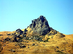
The elevation of Mount Goyazan is located 20 kilometers far from Qazakh district of Azerbaijan.[16] Its elevation is 250 meters.[16] The mountain has volcanic origin and it is not connected to any mountain ridges.[16] At the bottom of the mountain, there are ancient dwellings.[16]
Yanar Dag[]
Yanar Dag is located 27 kilometers far from Baku.[17] On the surface of Yanar Dag, there are fires of natural gas that flames continuously, and their height reaches to 10–15 meters.[17]
The historical-cultural and natural reserve was established in the territory of Yanar Dag by the presidential decree dated May 2, 2007.[17]
Gallery[]

Mountains of Gabala

Mountains in Lahic, Ismayilli

Mountains in Khinalig

Mountains in Shaki


See also[]
References[]
- ^ a b c d Price, Martin (2000). Cooperation in the European Mountains 2: The Caucasus. Switzerland: IUCN. ISBN 2831705347.
- ^ a b c d e "Azerbaijan". azerbaijan.az. Archived from the original on 2018-08-29. Retrieved 2018-08-27.
- ^ a b c d e f g h i "Tallest Mountains in Azerbaijan". WorldAtlas. Retrieved 2018-08-27.
- ^ a b Suny, Ronal (1996). Armenia, Azerbaijan, and Georgia. United States: DIANE Publishing. ISBN 0788128132.
- ^ a b c d e f g "Azerbaijan | History, People, & Facts". Encyclopedia Britannica. Retrieved 2018-08-27.
- ^ Verda, Matteo (2014). Azerbaijan: An introduction to the Country. Italy: Edizioni Epoké. ISBN 9788898014361.
- ^ a b c "Bazardüzü : Climbing, Hiking & Mountaineering : SummitPost". www.summitpost.org. Retrieved 2018-08-28.
- ^ a b "Шах-даг - Энциклопедия, Брокгауз-Ефрон". gatchina3000.ru (in Russian). Retrieved 2018-08-28.
- ^ a b "Zirvələr | Azərbaycan Respublikası Ekologiya və Təbii Sərvətlər Nazirliyi". eco.gov.az (in Azerbaijani). Retrieved 2018-08-28.
- ^ a b "Satellite map of Murovdag, Azerbaijan. Latitude: 40.2667 Longitude: 46.3167". Latitude.to, maps, geolocated articles, latitude longitude coordinate conversion. Retrieved 2018-08-29.
- ^ a b c Alizadeh, Akif; Guliyev, Ibrahim; Kadirov, Fakhraddin; Eppelbaum, Lev (2016). Geosciences of Azerbaijan: Volume I: Geology. Switzerland: Springer. ISBN 9783319273952.
- ^ a b c d Budagov, Budag (2005). Naxçıvan ensiklopediyası: II cild (in Azerbaijani). Nakhchivan. ISBN 5-8066-1468-9.
- ^ a b c d e f g Bunyadov, Teymur (2005). Naxçıvan ensiklopediyası: I cild (in Azerbaijani). Nakhchivan. ISBN 5-8066-1468-9.
- ^ a b c "Azərbaycanın relyefi". Kayzen (in Azerbaijani). Retrieved 2018-08-30.
- ^ a b "Talish Mountains | mountains, Azerbaijan-Iran". Encyclopedia Britannica. Retrieved 2018-08-30.
- ^ a b c d "Göyəzən dağı". gazakh.cls.az (in Azerbaijani). Retrieved 2018-08-30.
- ^ a b c ""Yanardağ" Dövlət Tarix-Mədəniyyət və Təbiət Qoruğu - Tarixi qoruqlar | Kataloq GoMap.Az". kataloq.gomap.az (in Azerbaijani). Retrieved 2018-08-30.
External links[]
- Mountains of Azerbaijan
- Geography of Azerbaijan
- Lists of mountains of Asia
- Lists of mountains of Europe