Mullingar (civil parish)
Mullingar
An Muileann gCearr | |
|---|---|
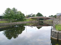 Royal Canal in Mullingar | |
 Mullingar Location of Mullingar within County Westmeath in the Republic of Ireland | |
| Coordinates: 53°31′22″N 7°22′15″W / 53.52278°N 7.37083°WCoordinates: 53°31′22″N 7°22′15″W / 53.52278°N 7.37083°W | |
| Country | Ireland |
| Province | Leinster |
| County | County Westmeath |
| Irish grid reference | N418527 |

Mullingar (Irish: An Muileann gCearr, meaning 'the left–handed mill')[1] is a civil parish in County Westmeath, Ireland. It includes Mullingar the county town of Westmeath, as well as the eponymous townland. Mullingar parish is located about 75 kilometres (47 mi) west of Dublin on the N4 road and the N52 road which meet east of Mullingar town. It is served by Mullingar railway station on the Dublin to Sligo line. The Royal Canal also passes through the parish and the town.
Lough Ennell lies to the south of Mullingar, Lough Owel to the north.
Mullingar is one of 3 civil parishes in the barony of Moyashel and Magheradernon in the Province of Leinster. The civil parish covers 22,435.6 acres (90.794 km2). Parts of the parish (, , part of and ) are in the neighbouring barony of Fartullagh.
Mullingar civil parish comprises 64 townlands: Ardivaghan, Ardmore, Balgarrett, Ballagh, Balleagny, Ballina, Ballinderry, Ballyglass, Ballynaclin, Balnamona (or Charlestown), Baltrasna, , , , , Brottonstown, Brottonstown Little, , Cartronganny, , , , Clownstown, , , Culleen More, , , , (or Rathgowan), , , , , Hanstown, Hopestown, Irishtown, , , , , Mullingar town, Marlinstown, Marlinstown Bog, , , Petitswood, , , , Robinstown (Levinge), Robinstown (Tyrrell), Russellstown, , Slanestown, , , , Strattonstown, , , Walshestown North, and
The neighbouring civil parishes are: Portnashangan (barony of Corkaree) to the north, Rathconnell to the north‑east, Killucan (barony of Farbill) to the east, Lynn (barony of Fartullagh) to the south‑east and south, Dysart and Churchtown (barony of Rathconrath) to the south‑west, Rathconrath (Rathconrath) to the west and Templeoran (barony of Moygoish) and Portloman (Corkaree) to the north‑west.[2][3]
See also[]
- Mullingar, the county town
References[]
- ^ Mullingar civil parish The Placenames Database of Ireland. Retrieved on 16 June 2015.
- ^ Mullingar civil parish, Co. Westmeath townlands.ie Retrieved on 16 June 2015.
- ^ Mullingar civil parish, Co. Westmeath The IreAtlas Townland Data Base. Retrieved on 16 June 2015.
External links[]
- Mullingar civil parish at the IreAtlas Townland Data Base
- Mullingar civil parish at townlands.ie
- Mullingar civil parish at the Placenames Database of Ireland
Places in County Westmeath | ||
|---|---|---|
| Towns |  | |
| Villages |
| |
| Baronies | ||
| ||
This article related to the geography of County Westmeath, Ireland is a stub. You can help Wikipedia by . |
- Civil parishes of County Westmeath
- County Westmeath geography stubs