Muya (river)
| Muya | |
|---|---|
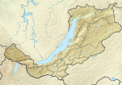 Mouth location in Buryatia, Russia | |
| Native name | Муя (Russian) |
| Location | |
| Country | Russia |
| Republic | Buryatia |
| Physical characteristics | |
| Source | Northern Muya Range |
| • elevation | 1,700 m (5,600 ft) |
| Mouth | Vitim |
• coordinates | 56°24′17″N 115°40′20″E / 56.4047°N 115.6723°ECoordinates: 56°24′17″N 115°40′20″E / 56.4047°N 115.6723°E |
• elevation | 467 m (1,532 ft) |
| Length | 365 km (227 mi) |
| Basin size | 11,900 km2 (4,600 sq mi) |
| Basin features | |
| Progression | Vitim→ Lena→ Laptev Sea |

The Muya (Russian: Муя) is a left tributary of the Vitim in Buryatia, Russia. It is 365 kilometres (227 mi) long, and has a drainage basin of 11,900 square kilometres (4,600 sq mi).[1]
The area through which the river flows is sparsely populated, the only settlement on the river being Taksimo, with the small village of Ust-Muya located where the river flows into the Vitim.[2] The Muya is navigable for small craft from the Vitim around 70 kilometres (43 mi) to Taksimo.
The Muya has lent its name to a number of other geographic features, including the Northern Muya Range, the Southern Muya Range, as well as the local Muya District.
 Basin of the Vitim |
See also[]
References[]
- ^ Река Муя in the State Water Register of Russia (Russian)
- ^ Kropotkin, Prince P (1904). "The Orography of Asia". The Geographical Journal. 23: 177.
This Buryatia location article is a stub. You can help Wikipedia by . |
This article related to a river in Russia is a stub. You can help Wikipedia by . |
- Tributaries of the Lena
- Rivers of Buryatia
- Stanovoy Highlands
- Buryatia geography stubs
- Buryatia stubs
- Russia river stubs