Nabatieh Fawka
Nabatieh Al Fawqa
الفوقا | |
|---|---|
Village | |
 Nabatieh Al Fawqa | |
| Coordinates: 33°21′22″N 35°29′44″E / 33.35611°N 35.49556°E | |
| Grid position | 127/158 L |
| Country | |
| Governorate | Nabatieh Governorate |
| District | Nabatieh |
| Time zone | GMT +3 |

Nabatieh Fawka (Arabic: النبطية الفوقا), also known as Upper Nabatieh is a Lebanese village in the Nabatieh Governorate.[1]
History[]
In the 1596 tax records in the early Ottoman era, it was named as a village, Nabatiyya al-Fawqa, in the nahiya (subdistrict) of Sagif under the liwa' (district) of Safad. It had a population of 104 households and 25 bachelors, all Muslim. The villagers paid 2,200 akçe in taxes on olive trees, 450 for "occasional revenues", 602 on goats and bee hives, 30 for an olive oil press, or a press for grape syrup, and 5000 as a fixed amount; a total of 8,276 akçe.[2][3]
In 1875, Victor Guérin described the village as being located on a hill, and having 500 Métualis inhabitants. It was surrounded by gardens planted with fig trees.[4]
References[]
Bibliography[]
- Guérin, V. (1880). Description Géographique Historique et Archéologique de la Palestine (in French). 3: Galilee, pt. 2. Paris: L'Imprimerie Nationale.
- Hütteroth, Wolf-Dieter; Abdulfattah, Kamal (1977). Historical Geography of Palestine, Transjordan and Southern Syria in the Late 16th Century. Erlanger Geographische Arbeiten, Sonderband 5. Erlangen, Germany: Vorstand der Fränkischen Geographischen Gesellschaft. ISBN 3-920405-41-2.
- Rhode, H. (1979). Administration and Population of the Sancak of Safed in the Sixteenth Century (PhD). Columbia University.
External links[]
- Nabatiyeh El Faouqa, localiban.org
| hide | ||
|---|---|---|
| Capital | 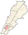 | |
| Towns and villages | ||
| Other | ||
- Populated places in Nabatieh District
- Populated places in Lebanon
- Shia Muslim communities in Lebanon