Naka-okachimachi Station
This article needs additional citations for verification. (March 2017) |
H17 Naka-okachimachi Station 仲御徒町駅 | |||||||||||
|---|---|---|---|---|---|---|---|---|---|---|---|
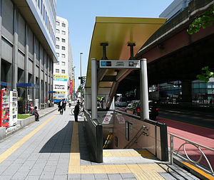 Entrance No. 4 in May 2010 | |||||||||||
| Location | 5-24-12 Ueno, Taito-ku, Tokyo | ||||||||||
| Operated by | |||||||||||
| Line(s) | H Tokyo Metro Hibiya Line | ||||||||||
| Distance | 5.8 km from Kita-senju | ||||||||||
| Platforms | 1 island platform | ||||||||||
| Tracks | 2 | ||||||||||
| Connections | E09 Ueno-okachimachi Station | ||||||||||
| Construction | |||||||||||
| Structure type | Underground | ||||||||||
| Other information | |||||||||||
| Station code | H-17 | ||||||||||
| Website | Official website | ||||||||||
| History | |||||||||||
| Opened | 28 March 1961 | ||||||||||
| Passengers | |||||||||||
| FY2011 | 42,317 daily | ||||||||||
| Services | |||||||||||
| |||||||||||
| Location | |||||||||||
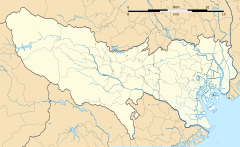 Naka-okachimachi Station Location within Tokyo | |||||||||||
Naka-okachimachi Station (仲御徒町駅, Naka-okachimachi-eki) is a subway station on the Tokyo Metro Hibiya Line in Taitō, Tokyo, Japan, operated by the Tokyo subway operator Tokyo Metro.
Lines[]
Naka-okachimachi Station is served by the Tokyo Metro Hibiya Line, and lies 5.8 km from the starting point of the line at Kita-Senju.[1]
The station is also situated relatively close to Ueno, Ueno-okachimachi, Okachimachi, and Keisei Ueno stations.
Station layout[]
The station has one island platform serving two tracks on the second basement ("B2F") level. Track 1 serves Naka-Meguro-bound trains, while Track 2 serves Kita-Senju-bound trains.
Platforms[]
| 1 | H Tokyo Metro Hibiya Line | for Ginza, Roppongi, and Naka-meguro |
| 2 | H Tokyo Metro Hibiya Line | for Ueno and Kita-senju TS Tobu Skytree Line for Tōbu-Dōbutsu-Kōen TN Tobu Nikko Line for Minami-Kurihashi |

The ticket barriers in May 2010
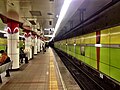
The platforms in April 2015


History[]
The station opened on 28 March 1961.[1]
Passenger statistics[]
In fiscal 2011, the station was used by an average of 42,317 passengers daily.[1]
Surrounding area[]
The following stations are situated nearby:
- Ueno Station (Tokyo Metro Ginza Line/Tokyo Metro Hibiya Line)
- Ueno-okachimachi Station (Toei Oedo Line)
- Okachimachi station (Keihin-Tohoku Line/Yamanote Line)
On March 16, 2009, Naka-okachimachi Station was connected to Keisei Ueno Station, and a transfer passage was opened.[citation needed]
See also[]
References[]
- ^ Jump up to: a b c Terada, Hirokazu (19 January 2013). データブック日本の私鉄 [Databook: Japan's Private Railways] (in Japanese). Japan: Neko Publishing. p. 215. ISBN 978-4-7770-1336-4.
External links[]
| Wikimedia Commons has media related to Naka-Okachimachi Station. |

Coordinates: 35°42′23″N 139°46′34″E / 35.7064°N 139.7760°E

- Railway stations in Tokyo
- Stations of Tokyo Metro
- Railway stations in Japan opened in 1961