Nantahala National Forest
| Nantahala National Forest | |
|---|---|
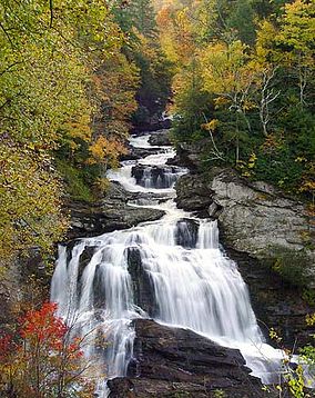 Cullasaja Falls, Nantahala National Forest, in Macon County, North Carolina | |
 | |
| Location | North Carolina, United States |
| Nearest city | Franklin, NC |
| Coordinates | 35°14′02″N 83°33′33″W / 35.233842°N 83.559265°WCoordinates: 35°14′02″N 83°33′33″W / 35.233842°N 83.559265°W |
| Area | 531,270 acres (2,150.0 km2)[1] |
| Established | February 6, 1907[2] |
| Governing body | U.S. Forest Service |
| Website | Nantahala National Forest |

The Nantahala National Forest (/ˌnæntəˈheɪlə/), is the largest of the four national forests in North Carolina, lying in the mountains and valleys of western North Carolina. Second to the Pacific Northwest, the Nantahala is the wettest region in the country. Due to its environmental importance and historical ties with the Cherokee, the forest was officially established on January 29, 1920 by President Woodrow Wilson.[3][4] The word "Nantahala" is a Cherokee derived, meaning "Land of the Noonday Sun." In some spots, the sun reaches the floors of the deep gorges of the forest only when it is high overhead at midday. This was part of the homeland of the historic Cherokee and their indigenous ancestors, who have occupied the region for thousands of years.
History[]
Cherokee[]
Colonists from South Carolina established a trade of deer hides with Cherokees from the Nantahala region, their homeland. This eventually lead to several signed treaties that left the Cherokee to give up their lands in present day South Carolina, Georgia, Virginia, and North Carolina, occurring between 1721 to 1777. After the establishment of the new American government, the Cherokee were forced to further give up territory in other parts of North Carolina and lands in Kentucky and Tennessee with the Treaty of Hopewell in 1785. Despite their 30 year efforts, their land was offered to Revolutionary War veterans of the colonists. The Cherokee were forced westward, which brings up the historical events of the Trail of Tears. This removal route was used between 1830 to 1850 and headed Fort Butler in Murphy, North Carolina to Oklahoma. However, present North Carolina still has a strong, pronounced population of Cherokee.[3][5]
Exploration[]
The Spanish conquistador Hernando de Soto explored the area in 1540, as did English colonist William Bartram (1739-1823) in the 18th century. The Nantahala River flows through the Nantahala National Forest.
William Bartram, son to John Bartram, is considered to be the "America's first native-born naturalist-illustrator". He journeyed through eight colonies to document the botanical, geographical, and cultural discoveries he made throughout the four years of exploration. At the age of 21, Bartram left home in Philadelphia to live with his uncle at Cape Fear River in North Carolina. His uncle, after being kidnapped as a child, welcomed his nephew to manage the trading post. Shortly after, John Bartram was appointed by King George III to be the royal botanist of the New World in 1765. Both John and William journeyed together to collect plants in South Carolina, Georgia, and Florida.[3]
Following this expedition, Bartram was sponsored by John Fothergill to make a 2,400 miles journey across southeastern America, this being his most memorialized trip. Bartram's work promoted an interest in the region's greenery and significantly contributed to natural history literature. Within the most recent century, Bartram's work has contributed to increased public awareness of environmental preservation.
Bartram Trail was created in his memory in the Nantahala Ranger District, where most of his travels occurred. The trail is not true to his exact path as a result of human development, but the trail spans from North Carolina's Cheoah River to Georgia's Russel Bridge at the Chattooga River. It it said that the most scenic portion of the trail is along Trimont Ridge in the Nantahala Mountains, where it crosses Fishhawk Mountains.[3]
Environmental Protection[]
Late 1800s[]
During this time, Dr. Chase P. Ambler made a vow to protect the western mountains of North Carolina. He created the Appalachian National Park Association and fought to protect the land. His work lead him to write to Congress about land preservation in 1901. Congress responded with a $5,000 find to survey the forest.[3]
Between that time, the Forest Reserve Act was passed by Congress 1891. Today, it may be known as the U.S. Forest Service, its name originating from President Benjamin Harrison. This act went on to protect national forests in the southeast by having the government purchase land to make them into national forests.[3][6]

Early 1900s[]
Following the Forest Reserve Act, the Weeks Act was presented to Congress in hopes to continue preserving forests with government funds being used to purchase both public and private lands. The Weeks Act, named after John Weeks, was signed by President William Taft to protect forests and has been named to be the most successful pieces of conservation legislation by protecting over 20 million acres of land.[7]
In previous years, the lands were occupied and abandoned by logging companies. These companies had often stripped the land of its resources before selling to maximize profits and evade taxation. To the government's surprise, they were able to purchase over 850 acres from 359 private owners. However, with many unwilling to sell, private land remains scattered throughout the Nantahala.[3]
January 29, 1920, President Woodrow Wilson made purchase to combined lands in Georgia, North Carolina, and South Carolina to form the Nantahala National Forest, which was much of the original territories of the Cherokee. This purchase, though, had initially excluded Cherokee, Graham, and Swain countries which President Warren Harding's formed into the Pisgah National Forest in 1921.[3]
Later in 1929, President Herbert Hoover "transferred" lands to expand its boundaries by combining both the Nantahala and Pisgah National Forests. The forest then faced major remapping in 1936.[3]

Geography[]
The terrain varies in elevation from 5,800 feet (1,767.8 m) at Lone Bald in Jackson County, to 1,200 feet (365.8 m) in Cherokee County along the Hiwassee River below the Appalachia Dam. It is the home of many western NC waterfalls. The last part of the Mountain Waters Scenic Byway travels through this forest. The total area under management is 531,270 acres (830.11 sq. mi.; 2,149.97 km2). In descending order of land area it is located in parts of Macon, Graham, Cherokee, Jackson, Clay, Swain and Transylvania counties.
The forest had initially spanned over Georgia, South Carolina, and North Carolina. However, in 1936, the forest was reorganized into following the state boundaries of North Carolina.
Several areas of old-growth forest have been identified in the Nantahala National Forest, totaling some 30,800 acres (125 km2).[8] The Joyce Kilmer-Slickrock Wilderness in particular contains nearly 6,000 acres (24 km2) of old-growth forest.
Within the Nantahala National Forest[]
Management[]
The Nantahala National Forest is administered by the United States Forest Service, part of the United States Department of Agriculture. The forest is managed together with the other three North Carolina National Forests (Croatan, Pisgah, and Uwharrie) from common headquarters in Asheville, North Carolina.
Cheoah Ranger District[]
The Cheoah Ranger District[9] has 120,110 acres (187.7 sq. mi.; 486.1 km2) in Graham and Swain Counties, and it is headquartered in Robbinsville, North Carolina. The district's name, Cheoah, is the Cherokee word for "otter", because the lands adjoin four large mountain reservoirs and contain numerous streams.
The Appalachian Trail winds through the Cheoah Ranger District after leaving the Nantahala Ranger District on its way to the Great Smoky Mountains National Park. The district also contains the Joyce Kilmer Memorial Forest and part of the Joyce Kilmer-Slickrock Wilderness. The Joyce Kilmer Memorial Forest within the national forest was dedicated on July 30, 1936 to, poet, Joyce Kilmer with trees that are over 450 years old![3]

Nantahala Ranger District[10][]
The Nantahala Ranger District is the largest of the forest's districts, covering an area of about 250,000 acres (390.6 sq. mi.; 1,011.7 km2) in Macon, Jackson and Swain counties. It was formed in 2007 by consolidating the former Highlands Ranger District and Wayah Ranger [11] District. The headquarters are in Franklin, North Carolina. Part of the district is adjacent to the Cherokee Indian Reservation.
This district's features include the 5,499-foot (1,676.10 m) Standing Indian Mountain, the Nantahala Gorge and Wayah Bald.
Four long distance trails pass through the district: the Appalachian, Bartram, Foothills, and Mountains-to-Sea Trails.
The district contains the 40,000-acre (62.5 sq. mi.; 161.9 km2) Roy Taylor Forest located in Jackson County, southwest of and adjacent to the Blue Ridge Parkway, that it acquired in 1981. The rugged and scenic Tuckasegee Gorge is within the Roy Taylor Forest.
During the consolidation, all the lands of the former Highlands Ranger District within Transylvania County, were transferred to the Pisgah Ranger District.
Tusquitee Ranger District[12][]
The 158,348-acre (247.4 sq. mi.; 640.8 km2) Tusquitee Ranger District is the forest's second largest district, and it is located in far southwestern tip of North Carolina, within Cherokee and Clay Counties. Tusquitee is Cherokee for "where the water dogs laughed," and the district is headquartered in Murphy, North Carolina.
The district's features include the Hiawassee River, as well as Lake Chatuge, , . All the lakes on or bordering the Tusquitee Ranger District are managed by TVA. The highest point on the district is (5,280 feet (1,609 m)) located in Clay County.
Wilderness Areas and Attractions[]

Three wilderness areas are located within the Nantahala National Forest[]
- Ellicott Rock Wilderness is located near Highlands, North Carolina at the intersection of North Carolina, South Carolina and Georgia state lines, with 3,900 acres (16 km²) in the North Carolina portion.
- The Southern Nantahala Wilderness includes 10,900 acres (17.0 sq. mi.; 44.1 km2) in the North Carolina portion and lies in the Tusquitee and Nantahala Ranger Districts. Joyce
- Kilmer-Slickrock Wilderness which includes another 13,100 acres (53.0 km2) in North Carolina.
These wilderness areas provide an opportunity for solitude in a rugged, natural setting. The Forest manages two Off-Highway Vehicle areas. The most famous being Tellico OHV area located in the Tusquitee Ranger District an additional OHV area is located in the Nantahala Ranger District. Many miles of trout water exist in the forest.
Attractions[]
- Appalachian Trail is between two of North Carolina's national forests: the Great Smoky Mountains National Park and the Nantahala National Forest.[3]
- Bartram Trail has been dedicated to William Bartram and his contribution to the forest's exploration and preservation of history.[3]
- Wayah Bald is intersection of the Appalachian and Bartram Trails. It is known as a historical overlook that was built by the civilian conservation core.[3]
- Whitewater Falls is the highest east of the Rocky's. Its upper falls goes down 411 feet, totaling 811 feet.[3]
See also[]
- List of U.S. national forests
- National Forest Management Act of 1976
References[]
- ^ "Land Areas of the National Forest System" (PDF). U.S. Forest Service. January 2012. Retrieved June 28, 2012.
- ^ "The National Forests of the United States" (PDF). ForestHistory.org. Archived from the original (PDF) on February 21, 2013. Retrieved July 28, 2012.
- ^ Jump up to: a b c d e f g h i j k l m n Spencer, Marci (2017). Nantahala National Forest. ISBN 978-1-4396-6219-9. OCLC 1132371691.
- ^ "Nantahala National Forest, Conservation Landmark | NC DNCR". www.ncdcr.gov. Retrieved 2021-04-17.
- ^ "Cherokee Indians - Part 1: Overview | NCpedia". www.ncpedia.org. Retrieved 2021-04-17.
- ^ "The National Forests of the United States" (PDF). www.webcitation.org. Retrieved 2021-04-17.
- ^ "The Weeks Act". Forest History Society. Retrieved 2021-04-17.
- ^ Mary Byrd Davis (23 January 2008). Old Growth in the East: A Survey. North Carolina. ISBN 9780963840202.
- ^ "Cheoah Ranger District".
- ^ "Nantahala Ranger District".
- ^ (PDF). 2008-08-27 https://web.archive.org/web/20080827173431/http://files.wncoutdoors.info/highlands_consolidation.pdf. Archived from the original (PDF) on 2008-08-27. Retrieved 2021-04-17. Missing or empty
|title=(help) - ^ "Tusquitee Ranger District".
Cite error: A list-defined reference named "USFSweb-NNF" is not used in the content (see the help page).
Cite error: A list-defined reference named "USFSweb-Cheoah" is not used in the content (see the help page).
Cite error: A list-defined reference named "USFSweb-Nantahala" is not used in the content (see the help page).
Cite error: A list-defined reference named "USFSweb-Tusquitee" is not used in the content (see the help page).
Cite error: A list-defined reference named "USFS-Consolidation" is not used in the content (see the help page).
Cite error: A list-defined reference named "Taylor_forest_dedication" is not used in the content (see the help page).
Cite error: A list-defined reference named "RoyTaylorForest" is not used in the content (see the help page).
External links[]
| Wikimedia Commons has media related to Nantahala National Forest. |
- Nantahala National Forest
- National Forests of North Carolina
- National Forests of the Appalachians
- Blue Ridge National Heritage Area
- Old-growth forests
- Protected areas of Macon County, North Carolina
- Protected areas of Graham County, North Carolina
- Protected areas of Cherokee County, North Carolina
- Protected areas of Jackson County, North Carolina
- Protected areas of Clay County, North Carolina
- Protected areas of Swain County, North Carolina
- Protected areas established in 1907
- 1907 establishments in North Carolina
- Western North Carolina