Narusawa, Yamanashi
Narusawa
鳴沢村 | |
|---|---|
Village | |
 Mt Fuji from Narusawa michi-no-eki | |
 Flag  Seal | |
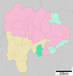 Location of Narusawa in Yamanashi Prefecture | |
 Narusawa | |
| Coordinates: 35°28′52.9″N 138°42′23.2″E / 35.481361°N 138.706444°ECoordinates: 35°28′52.9″N 138°42′23.2″E / 35.481361°N 138.706444°E | |
| Country | Japan |
| Region | Chūbu Tōkai |
| Prefecture | Yamanashi Prefecture |
| District | Minamitsuru |
| Area | |
| • Total | 89.58 km2 (34.59 sq mi) |
| Population (June 1, 2019) | |
| • Total | 3,152 |
| • Density | 35/km2 (91/sq mi) |
| Time zone | UTC+9 (Japan Standard Time) |
| Phone number | 0555-85-2311 |
| Address | 1575 Narusawa-mura Minimitsuru-gun, Yamanashi-ken 401-0398 |
| Website | Official website |

Narusawa (鳴沢村, Narusawa-mura) is a village located in Yamanashi Prefecture, Japan. As of 1 June 2019, the village had an estimated population of 3,152 in 1257 households,[1] and a population density of 32.6 persons per km². The total area of the village is 89.58 square kilometres (34.59 sq mi).
Geography[]
Narusawa is located in southern Yamanashi Prefecture, in the foothills of Mount Fuji. The entire village is located within the borders of the Fuji-Hakone-Izu National Park.
Neighboring municipalities[]
Yamanashi Prefecture
- Fujiyoshida
- Fujikawaguchiko
Shizuoka Prefecture
History[]
The place name "Narusawa" is mentioned in the Kamakura period chronicle Azuma Kagami as a hamlet on the road connecting Kai Province with Suruga Province. During the Edo period, all of Kai Province was tenryō territory under direct control of the Tokugawa shogunate. With the establishment of the modern municipalities system in the early Meiji period on July 1, 1889, the village of Narusawa was created within Minamitsuru District, Yamanashi Prefecture.
Demographics[]
Per Japanese census data,[2] the population of Narusawa has slowly grown over the past 30 years.
| Year | Pop. | ±% |
|---|---|---|
| 1940 | 2,096 | — |
| 1950 | 2,316 | +10.5% |
| 1960 | 2,316 | +0.0% |
| 1970 | 2,097 | −9.5% |
| 1980 | 2,249 | +7.2% |
| 1990 | 2,650 | +17.8% |
| 2000 | 2,864 | +8.1% |
| 2010 | 2,963 | +3.5% |
Climate[]
The city has a climate characterized by characterized by hot and humid summers, and relatively mild winters (Köppen climate classification Cfb). The average annual temperature in Kōshū is 9.6 °C. The average annual rainfall is 1751 mm with September as the wettest month.[3]
Education[]
Narusawa has one public elementary school operated by the village government. The village does not have a junior high school or a high school.
Transportation[]
Railway[]
- Narusawa does not have any railway services
Highway[]
Local attractions[]
The Kawaguchiko Motor Museum is located in Narusawa.[4]
Sister city relations[]
 - Sellières, Jura, Franche-Comté, France[5]
References[]
- ^ [Narusawa Village official statistics](in Japanese)
- ^ Narusawa population statistics
- ^ Narusawa climate data
- ^ Kawaguchiko Motor Museum / Zero Fighter Museum Retrieved August 19, 2016
- ^ "International Exchange". List of Affiliation Partners within Prefectures. Council of Local Authorities for International Relations (CLAIR). Archived from the original on 5 February 2016. Retrieved 21 November 2015.
External links[]
![]() Media related to Narusawa, Yamanashi at Wikimedia Commons
Media related to Narusawa, Yamanashi at Wikimedia Commons
- Official Website (in Japanese)
 Geographic data related to Narusawa, Yamanashi at OpenStreetMap
| Core city | ||
|---|---|---|
| Cities | ||
| Districts | ||
Authority control | |
|---|---|
| General | |
| National libraries | |
- Narusawa, Yamanashi
- Villages in Yamanashi Prefecture