National Highway 109K (India)
 | ||||
|---|---|---|---|---|
Map of the National Highway in red | ||||
| Route information | ||||
| Length | 230 km (140 mi) | |||
| Major junctions | ||||
| West end | Simli, Karnaprayag | |||
| East end | Jauljibi | |||
| Location | ||||
| States | Uttarakhand | |||
| Highway system | ||||
| ||||
| ||||
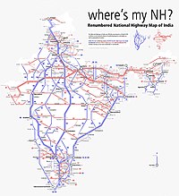
Schematic map of National Highways in India
National Highway 109K, commonly referred to as NH 109K, is a National highway connecting the city of Simli to Jauljibi in the Indian State of Uttarakhand.[1][2][3][4] The Highway was Notified on 12 Feb 2021[5] under the Bharatmala project of Government of India.
Route[]
It starts at Simli and ends at Jauljibi. The NH109K lies entirely in Uttarakhand and passes through the Districts of Chamoli, Bageshwar and Pithoragarh.
The National Highway 109K connects cities and towns of different districts as follows: Simli, Tharali, Gwaldam, Baijnath, Bageshwar, Kapkot, Tejam, Munsiari, Madkot and Jauljibi.
Junctions[]
 NH 109 Terminal near Simli, Karnaprayag.
 NH 309A at Bageshwar.
 NH 9 Terminal near Jauljibi.
References[]
- ^ "Union Govt notifies a new National Highway in U'khand". The Pioneer. Retrieved 18 February 2021.
- ^ Singh, Kautilya (February 18, 2021). "Uttarakhand's Simli-Bageshwar-Jauljibi route to Nepal border now National Highway, says Centre". The Times of India. Retrieved 18 February 2021.
- ^ "उत्तराखंड: 230 किमी लंबा सिमली-बागेश्वर-जौलजीवी मार्ग राष्ट्रीय राजमार्ग '109 के' घोषित". Amar Ujala (in Hindi). Retrieved 18 February 2021.
- ^ "केंद्र सरकार ने सिमली-ग्वालदम-बागेश्वर-जौलजीवी राजमार्ग को घोषित किया राष्ट्रीय राजमार्ग". Dainik Jagran (in Hindi). Retrieved 18 February 2021.
- ^ Gazette of India notification dated 12 February 2021
External links[]
| Expressways |
|    |
|---|---|---|
| National Highways (list) |
| |
| State highways |
| |
| Notable |
| |

Categories:
- National Highways in Uttarakhand