National Highway 46 (India, old numbering)
This article needs additional citations for verification. (June 2016) |
 | ||||
|---|---|---|---|---|
 Map of Old NH46 in red | ||||
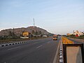
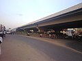
 Old NH 46 near Vellore | ||||
| Route information | ||||
| Length | 148 km (92 mi) | |||
| Major junctions | ||||
| West end | Krishnagiri, Tamil Nadu | |||
| East end | Walajapet, Vellore district, Tamil Nadu | |||
| Location | ||||
| States | Tamil Nadu: 148 km (92 mi) | |||
| Primary destinations | Vaniyambadi - Ambur - Vellore - Arcot | |||
| Highway system | ||||
| ||||
National Highway 46 was a national highway in the Indian state of Tamil Nadu. It ran from Krishnagiri to Walajapet in the state.[1] It passed through Vellore and it was a highly important connecting road for vehicles travelling between Chennai and Bangalore. The total Length of NH 46 was 148 km (92 mi). The Krishnagiri-Walajapet section is being upgraded to six lanes by L&T on a build-operate-transfer basis.[2]
Renumbering[]
Old national highway 46 has been renumbered as National Highway 48, which runs from Delhi to Chennai via Mumbai and Bangalore.[3]
Route[]
Krishnagiri, Bargur, , Vaniyambadi, Ambur, Pallikonda, Vellore, Arcot, Ranipet and Walajapet.[4]
Gallery[]

NH 46
NH 46 near Krishnagiri

NH 46

Vaniyambadi-Toll-Plaza on NH46
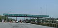
Pallikonda Toll-Plaza on NH46
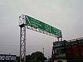
Sign board on NH 46 between Chennai and Vellore.
Green Circle Junction flyover on NH 46 in Vellore city

NationalHighway46India


See also[]
References[]
- ^ "National Highways Starting and Terminal Stations". Ministry of Road Transport & Highways. Retrieved 2 December 2012.
- ^ "L&T bags NHAI Order for Six Laning of Krishnagiri-Walajahpet Highway". Business Standard. 14 May 2010. Retrieved 16 July 2012.
- ^ "New Numbering of National Highways notification - Government of India" (PDF). The Gazette of India. Retrieved 9 December 2018.
- ^ "Google Maps".
External links[]
| Wikimedia Commons has media related to NH 46 (India). |
| National Highways (List of Old NHs) |  | |
|---|---|---|
| Highways in India | ||
This article about a National Highway in India is a stub. You can help Wikipedia by . |
- National Highways in Tamil Nadu
- Golden Quadrilateral
- National highways in India (old numbering)
- Indian National Highway stubs