[3] Name on the Register
Image
Date listed[4]
Location
Neighborhood
Description
1
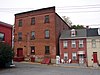
American/Consolidated Tobacco Companies
September 21, 1990 (#90001398 ) 820-830 North Prince Street 40°03′01″N 76°18′38″W / 40.050278°N 76.310556°W / 40.050278; -76.310556 (American/Consolidated Tobacco Companies ) Stadium District
2
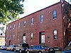
B.F. Good & Company Leaf Tobacco Warehouse
January 3, 1985 (#85000035 ) 49-53 West James Street 40°02′45″N 76°18′32″W / 40.045833°N 76.308889°W / 40.045833; -76.308889 (B.F. Good & Company Leaf Tobacco Warehouse ) Stadium District
3
Basch & Fisher Tobacco Warehouse
September 21, 1990 (#90001399 ) 348 New Holland Avenue 40°02′40″N 76°17′56″W / 40.044583°N 76.298889°W / 40.044583; -76.298889 (Basch & Fisher Tobacco Warehouse )
4
Jacob Bowman Tobacco Warehouse
September 21, 1990 (#90001400 ) 226-230 East Grant Street 40°02′22″N 76°18′03″W / 40.039361°N 76.300889°W / 40.039361; -76.300889 (Jacob Bowman Tobacco Warehouse )
5
John Brimmer Tobacco Warehouse
September 21, 1990 (#90001390 ) 226 North Prince Street 40°02′30″N 76°17′31″W / 40.041611°N 76.291944°W / 40.041611; -76.291944 (John Brimmer Tobacco Warehouse )
6
Central Market
July 12, 1972 (#72001127 ) William Henry Place, Penn Square 40°02′18″N 76°18′23″W / 40.038333°N 76.306389°W / 40.038333; -76.306389 (Central Market )
7
Conestoga Cork Works Building
March 28, 1996 (#96000324 ) 215-235 East Fulton Street 40°02′32″N 76°18′04″W / 40.042222°N 76.301111°W / 40.042222; -76.301111 (Conestoga Cork Works Building )
8
Eisenlohr-Bayuk Tobacco Historic District
September 21, 1990 (#90001397 ) North Water Street, at West Liberty Street 40°03′04″N 76°18′43″W / 40.051111°N 76.311944°W / 40.051111; -76.311944 (Eisenlohr-Bayuk Tobacco Historic District ) Stadium District
9
Andrew Ellicott House
January 13, 1972 (#72001128 ) 123 North Prince Street 40°02′24″N 76°18′29″W / 40.04°N 76.308056°W / 40.04; -76.308056 (Andrew Ellicott House )
10
Farmer's Southern Market
November 10, 1986 (#86003090 ) 106 South Queen Street 40°02′10″N 76°18′20″W / 40.036111°N 76.305556°W / 40.036111; -76.305556 (Farmer's Southern Market )
11
Follmer, Clogg and Company Umbrella Factory
August 21, 1986 (#86001775 ) 254-260 West King Street 40°02′14″N 76°18′37″W / 40.037222°N 76.310278°W / 40.037222; -76.310278 (Follmer, Clogg and Company Umbrella Factory ) Stadium District
12
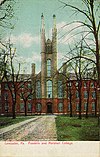
Franklin and Marshall College Campus Historic District
November 21, 2003 (#03001190 ) College Avenue 40°02′46″N 76°19′12″W / 40.046111°N 76.32°W / 40.046111; -76.32 (Franklin and Marshall College Campus Historic District )
13
Jacob L. Frey Tobacco Warehouse
September 21, 1990 (#90001396 ) 210 West Grant Street 40°02′18″N 76°18′33″W / 40.038333°N 76.309028°W / 40.038333; -76.309028 (Jacob L. Frey Tobacco Warehouse )
14
Henry B. Friedman Tobacco Warehouse
September 21, 1990 (#90001392 ) 309-311 Harrisburg Avenue, rear 40°02′53″N 76°18′42″W / 40.048056°N 76.311667°W / 40.048056; -76.311667 (Henry B. Friedman Tobacco Warehouse ) Stadium District
15
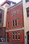
Fulton Opera House
August 11, 1969 (#69000156 ) 12-14 North Prince Street 40°02′17″N 76°18′29″W / 40.038056°N 76.307917°W / 40.038056; -76.307917 (Fulton Opera House )
16
Germania Turnverein Building
April 10, 1980 (#80003524 ) 33-35 North Market Street 40°02′19″N 76°18′24″W / 40.038694°N 76.306667°W / 40.038694; -76.306667 (Germania Turnverein Building )
17
W.W. Griest Building
June 25, 1999 (#99000755 ) 8 North Queen Street 40°02′18″N 76°18′21″W / 40.038333°N 76.305833°W / 40.038333; -76.305833 (W.W. Griest Building )
18
Hager Building
October 16, 1979 (#79002255 ) 25 West King Street 40°02′17″N 76°18′25″W / 40.038056°N 76.306806°W / 40.038056; -76.306806 (Hager Building )
19
Hamilton Apartments
June 28, 1984 (#84003430 ) 247-249 North Duke Street and 104-118 East Walnut Street 40°02′34″N 76°18′15″W / 40.042778°N 76.304167°W / 40.042778; -76.304167 (Hamilton Apartments )
20
Harrisburg Avenue Tobacco Historic District
September 21, 1990 (#90001393 ) Harrisburg Avenue at North Mulberry Street 40°02′49″N 76°18′45″W / 40.046944°N 76.3125°W / 40.046944; -76.3125 (Harrisburg Avenue Tobacco Historic District ) Stadium District
21
A.B. Hess Cigar Factory, and Warehouses
August 24, 1982 (#82003792 ) 231 North Shippen Street 40°02′35″N 76°18′00″W / 40.042917°N 76.300000°W / 40.042917; -76.300000 (A.B. Hess Cigar Factory, and Warehouses )
22
Kirk Johnson Building
July 7, 1983 (#83002252 ) 16-18 West King Street 40°02′16″N 76°18′23″W / 40.037778°N 76.306389°W / 40.037778; -76.306389 (Kirk Johnson Building )
23
Henry Krauskap House
October 7, 1982 (#82001539 ) 301-303½ West King Street 40°02′15″N 76°18′38″W / 40.0375°N 76.310694°W / 40.0375; -76.310694 (Henry Krauskap House )
24
Lancaster Armory
November 14, 1991 (#91001699 ) 438 North Queen Street 40°02′43″N 76°18′26″W / 40.045139°N 76.307222°W / 40.045139; -76.307222 (Lancaster Armory )
25
Lancaster City Historic District
September 7, 2001 (#01000956 ) Roughly bounded by Liberty Street, Broad Street, Greenwood Avenue, Race Avenue, 40°02′29″N 76°18′25″W / 40.041389°N 76.306944°W / 40.041389; -76.306944 (Lancaster City Historic District ) All neighborhoods
Extends into Manheim Township , elsewhere in Lancaster County
26
Lancaster County Courthouse
November 7, 1978 (#78002415 ) 43 East King Street 40°02′19″N 76°18′14″W / 40.038611°N 76.303889°W / 40.038611; -76.303889 (Lancaster County Courthouse )
27
Lancaster Crematorium
April 14, 1983 (#83002253 ) Greenwood Cemetery, 719 Highland Avenue 40°01′37″N 76°18′02″W / 40.026806°N 76.300694°W / 40.026806; -76.300694 (Lancaster Crematorium )
28
Lancaster Historic District
November 15, 1979 (#79002256 ) Roughly bounded by Howard Avenue, Queen, Church, Duke, Chestnut and Plum Streets; also bounded by East Vine, South Christian, Washington, South Duke, and Church Streets; also King Street 40°02′10″N 76°18′10″W / 40.036111°N 76.302778°W / 40.036111; -76.302778 (Lancaster Historic District ) , , and
Second and third sets of boundaries represent boundary increases of November 10, 1983 and June 21, 1984 respectively
29
Lancaster Trust Company
November 3, 1983 (#83004221 ) 37-41 North Market Street 40°02′20″N 76°18′25″W / 40.038806°N 76.306806°W / 40.038806; -76.306806 (Lancaster Trust Company )
30
Lancaster Watch Company
August 24, 1982 (#82003793 ) 901 Columbia Avenue 40°02′21″N 76°19′29″W / 40.039167°N 76.324722°W / 40.039167; -76.324722 (Lancaster Watch Company )
31
B.B. Martin Tobacco Warehouse
September 21, 1990 (#90001394 ) 422-428 North Water Street 40°02′42″N 76°18′39″W / 40.045°N 76.310833°W / 40.045; -76.310833 (B.B. Martin Tobacco Warehouse ) Stadium District
32
Edward McGovern Tobacco Warehouse
September 21, 1990 (#90001395 ) 302-304 North Plum Street 40°02′36″N 76°17′55″W / 40.043333°N 76.298611°W / 40.043333; -76.298611 (Edward McGovern Tobacco Warehouse )
33
David H. Miller Tobacco Warehouse
September 21, 1990 (#90001407 ) 512 North Market Street 40°02′49″N 76°18′29″W / 40.046944°N 76.308056°W / 40.046944; -76.308056 (David H. Miller Tobacco Warehouse ) Stadium District
34
J.B. Milleysack Cigar Factory
September 21, 1990 (#90001401 ) 820 Columbia Avenue, rear 40°02′15″N 76°19′22″W / 40.0375°N 76.322778°W / 40.0375; -76.322778 (J.B. Milleysack Cigar Factory )
35
William Montgomery House
May 18, 2000 (#00000519 ) 19-21 South Queen Street 40°02′14″N 76°18′19″W / 40.037222°N 76.305278°W / 40.037222; -76.305278 (William Montgomery House )
36
North Shippen-Tobacco Avenue Historic District
September 21, 1990 (#90001402 ) Roughly bounded by North Shippen Street, Tobacco Avenue, and East Fulton Street 40°02′34″N 76°17′57″W / 40.042778°N 76.299167°W / 40.042778; -76.299167 (North Shippen-Tobacco Avenue Historic District )
37
New Era Building
July 14, 1983 (#83002256 ) 39-41 North Queen Street 40°02′18″N 76°18′21″W / 40.038333°N 76.305833°W / 40.038333; -76.305833 (New Era Building )
38
Nissly-Stauffer Tobacco Warehouses
August 7, 1989 (#89001051 ) 322-324 North Arch Street and 317-319 North Mulberry Street 40°02′35″N 76°18′39″W / 40.042917°N 76.310833°W / 40.042917; -76.310833 (Nissly-Stauffer Tobacco Warehouses )
39
North Charlotte Street Historic District
August 31, 1989 (#89001206 ) Roughly North Charlotte Street from Harrisburg Pike to West James Street 40°02′47″N 76°18′52″W / 40.046389°N 76.314444°W / 40.046389; -76.314444 (North Charlotte Street Historic District ) Stadium District
40
North Prince Street Historic District
August 18, 1989 (#89001054 ) Roughly North Prince Street and West Lemon Street 40°02′39″N 76°18′31″W / 40.044167°N 76.308611°W / 40.044167; -76.308611 (North Prince Street Historic District ) and Stadium Districts
41
Old City Hall
June 30, 1972 (#72001129 ) Penn Square 40°02′17″N 76°18′23″W / 40.038056°N 76.306389°W / 40.038056; -76.306389 (Old City Hall )
42
Old Main, Goethean Hall, and Diagnothian Hall
July 30, 1975 (#75001645 ) Franklin and Marshall College campus 40°02′43″N 76°19′12″W / 40.045278°N 76.32°W / 40.045278; -76.32 (Old Main, Goethean Hall, and Diagnothian Hall )
43
Reilly Brothers and Raub Building
November 3, 1983 (#83004222 ) 44-46 North Queen Street and 45 North Market Street 40°02′20″N 76°18′21″W / 40.038889°N 76.305833°W / 40.038889; -76.305833 (Reilly Brothers and Raub Building )
44
R.K. Schnader & Sons Tobacco Warehouse
September 21, 1990 (#90001404 ) 437-439 West Grant Street 40°02′16″N 76°18′54″W / 40.037778°N 76.315°W / 40.037778; -76.315 (R.K. Schnader & Sons Tobacco Warehouse )
45
Walter Schnader Tobacco Warehouse
September 21, 1990 (#90001391 ) 417-419 West Grant Street 40°02′17″N 76°18′50″W / 40.038056°N 76.313889°W / 40.038056; -76.313889 (Walter Schnader Tobacco Warehouse )
46
L.G. Sherman Tobacco Warehouse
September 21, 1990 (#90001405 ) 602 East Marion Street 40°02′29″N 76°17′36″W / 40.041389°N 76.293472°W / 40.041389; -76.293472 (L.G. Sherman Tobacco Warehouse )
47
Slater Cigar Company
September 21, 1990 (#90001403 ) 625 and 626-628 Columbia Avenue 40°02′16″N 76°19′04″W / 40.037639°N 76.317639°W / 40.037639; -76.317639 (Slater Cigar Company ) and
48
Soldiers and Sailors Monument
April 2, 1973 (#73001635 ) Penn Square 40°02′16″N 76°18′21″W / 40.037778°N 76.305833°W / 40.037778; -76.305833 (Soldiers and Sailors Monument )
49
Sprenger Brewery
November 27, 1979 (#79002257 ) 125-131 East King Street 40°02′18″N 76°18′10″W / 40.038333°N 76.302778°W / 40.038333; -76.302778 (Sprenger Brewery )
50
Steinman Hardware Store
October 18, 1979 (#79002258 ) 26-28 West King Street 40°02′13″N 76°18′21″W / 40.036944°N 76.305833°W / 40.036944; -76.305833 (Steinman Hardware Store )
51
Stevens High School
June 30, 1983 (#83002257 ) West Chestnut and Charlotte Streets 40°02′27″N 76°18′46″W / 40.040972°N 76.312778°W / 40.040972; -76.312778 (Stevens High School )
52
Teller Brothers-Reed Tobacco Historic District
September 21, 1990 (#90001406 ) North Prince Street, 200 block, east side 40°02′30″N 76°18′30″W / 40.041667°N 76.308333°W / 40.041667; -76.308333 (Teller Brothers-Reed Tobacco Historic District )
53
U.S. Post Office
July 23, 1981 (#81000545 ) 50 West Chestnut Street 40°02′26″N 76°18′28″W / 40.040556°N 76.307778°W / 40.040556; -76.307778 (U.S. Post Office )
54
Charlie Wagner's Cafe
December 29, 1983 (#83004223 ) 40 East Grant Street 40°02′20″N 76°18′21″W / 40.038889°N 76.305833°W / 40.038889; -76.305833 (Charlie Wagner's Cafe )
55
West Lawn
May 3, 1984 (#84003453 ) 407 West Chestnut Street 40°02′26″N 76°18′49″W / 40.040556°N 76.313611°W / 40.040556; -76.313611 (West Lawn )
56
Woodward Hill Cemetery
February 24, 2005 (#05000098 ) Bounded by Strawberry Street, South Queen Street, and Chesapeake Street 40°01′45″N 76°18′07″W / 40.029167°N 76.301944°W / 40.029167; -76.301944 (Woodward Hill Cemetery )
57
Jasper Yeates House
September 23, 1982 (#82003794 ) 24 South Queen Street 40°02′14″N 76°18′21″W / 40.037222°N 76.305833°W / 40.037222; -76.305833 (Jasper Yeates House )