National Register of Historic Places listings in Winneshiek County, Iowa

Location of Winneshiek County in Iowa
This is a list of the National Register of Historic Places listings in Winneshiek County, Iowa.
This is intended to be a complete list of the properties and districts on the National Register of Historic Places in Winneshiek County, Iowa, United States. Latitude and longitude coordinates are provided for many National Register properties and districts; these locations may be seen together in a map.[1]
There are 33 properties and districts listed on the National Register in the county. Five other properties have been delisted.
- This National Park Service list is complete through NPS recent listings posted January 14, 2022.[2]


Former listings[]
Five properties were once listed on the Register, but have been removed:
| [3] | Name on the Register | Image | Date listed | Date removed | Location | City or town | Description |
|---|---|---|---|---|---|---|---|
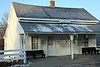
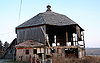
| 1 | 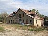 |
July 15, 2009 (#09000516) | December 19, 2014 | 113 North Main Street 43°12′27″N 91°57′03″W / 43.207375°N 91.950717°W | Spillville | Demolished June 23, 2011. | |
| 2 | December 10, 1993 (#93001356) | May 8, 2002 | 504 Heivly Street | Decorah | |||
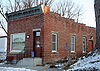
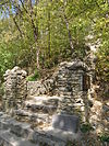
| 3 |  |
September 25, 1998 (#98001204) | September 10, 2008 | 210 Vernon Street | Decorah | ||
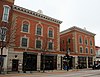
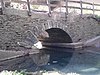
| 4 |  |
April 19, 1984 (#84001407) | September 10, 2008 | Spans Upper Iowa River | Freeport vicinity | Delisted after relocation | |
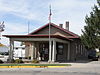
| 5 | Ten Mile Creek Bridge |  |
May 15, 1998 (#98000466) | May 2, 2017 | Happy Hollow Road over Ten Mile Creek 43°20′17″N 91°53′18″W / 43.338056°N 91.888333°W | Decorah | |
| 6 | May 15, 1998 (#98000468) | October 15, 2014 | Little Church Road over the Turkey River 43°05′06″N 91°53′38″W / 43.085°N 91.893889°W | Festina vicinity | Demolished and replaced in 2010[8] |
See also[]
| Wikimedia Commons has media related to National Register of Historic Places in Winneshiek County, Iowa. |
- List of National Historic Landmarks in Iowa
- National Register of Historic Places listings in Iowa
- Listings in neighboring counties: Allamakee, Chickasaw, Clayton, Fayette, Fillmore (MN), Houston (MN), Howard
References[]
- ^ The latitude and longitude information provided in this table was derived originally from the National Register Information System, which has been found to be fairly accurate for about 99% of listings. Some locations in this table may have been corrected to current GPS standards.
- ^ National Park Service, United States Department of the Interior, "National Register of Historic Places: Weekly List Actions", retrieved January 14, 2022.
- ^ a b Numbers represent an alphabetical ordering by significant words. Various colorings, defined here, differentiate National Historic Landmarks and historic districts from other NRHP buildings, structures, sites or objects.
- ^ "National Register Information System". National Register of Historic Places. National Park Service. April 24, 2008.
- ^ The eight-digit number below each date is the number assigned to each location in the National Register Information System database, which can be viewed by clicking the number.
- ^ Peterson, Cynthia L.; David G. Stanley (2012-09-05). "National Register of Historic Places Multiple Property Documentation Form: Historic Properties of the Ho-Chunk (Winnebago) Removal to the Neutral Ground" (PDF). National Park Service. Retrieved 2013-12-29. Cite journal requires
|journal=(help) - ^ Des Moines Register
- ^ "Turkey River Bridge". Bridgehunter.com. Retrieved April 4, 2011.
U.S. National Register of Historic Places | |
|---|---|
| Topics |
|
| Lists by state |
|
| Lists by insular areas | |
| Lists by associated state | |
| Other areas | |
| Related | |
| |
|  | ||
Municipalities and communities of Winneshiek County, Iowa, United States | ||
|---|---|---|
County seat: Decorah | ||
| Cities | ||
| Townships | ||
| CDP | ||
| Unincorporated community | ||
| Ghost town | ||
| ||
Categories:
- Lists of National Register of Historic Places in Iowa by county
- National Register of Historic Places in Winneshiek County, Iowa
- Buildings and structures in Winneshiek County, Iowa