Naushahro Feroze
This article needs additional citations for verification. (January 2012) |
Naushahro Feroze | |
|---|---|
 Naushahro Feroze | |
| Coordinates: 26°51′N 68°08′E / 26.850°N 68.133°ECoordinates: 26°51′N 68°08′E / 26.850°N 68.133°E | |
| Country | |
| Province | |
| Elevation | 38 m (125 ft) |
| Population | |
| • Total | 38,181 |
| Time zone | UTC+5 (PST) |
| Website | www |


Naushahro Feroze (Urdu: نوشہروفِيروز, Sindhi: نوشهرو فیروز), is the capital city of Naushahro Feroze District in Sindh province of Pakistan.[2] The district is located at 26°50'0N 68°7'0E with an altitude of 38 metres (127 feet).[3]
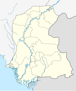
Naushahro Feroze District borders Khairpur District in the north-east, Dadu District to the west Indus river makes a natural boundary between the two districts, Larkana District in the north-west, and its south-east border is surrounded by Nawabshah District.
Languages spoken include Sindhi, Seraiki, Balochi, Urdu, Punjabi, Pushto, Bagri, Brohi, and others.
Talukas[]
- Naushahro Feroze
- Moro
- Bhiria
- Mehrabpur
- Kandiaro
- Taluka or (Taluko as said in Sindhi language) Mehrabpur originally part of kandiaro and Bhiria, became a new taluka in July 2005.
Climate[]
Naushahro Feroze has a hot desert climate (Köppen climate classification BWh) with extremely hot summers and mild winters. There is very little rain, and it mainly falls in the monsoon season from July to September.
| Climate data for Naushahro Feroze | |||||||||||||
|---|---|---|---|---|---|---|---|---|---|---|---|---|---|
| Month | Jan | Feb | Mar | Apr | May | Jun | Jul | Aug | Sep | Oct | Nov | Dec | Year |
| Record high °C (°F) | 39.0 (102.2) |
37.0 (98.6) |
41.1 (106.0) |
47.3 (117.1) |
50.0 (122.0) |
51.0 (123.8) |
48.0 (118.4) |
47.0 (116.6) |
44.4 (111.9) |
43.0 (109.4) |
38.3 (100.9) |
32.7 (90.9) |
51.0 (123.8) |
| Average high °C (°F) | 23.2 (73.8) |
26.0 (78.8) |
32.2 (90.0) |
39.0 (102.2) |
43.5 (110.3) |
44.2 (111.6) |
41.2 (106.2) |
39.3 (102.7) |
38.8 (101.8) |
36.7 (98.1) |
30.7 (87.3) |
24.5 (76.1) |
34.9 (94.9) |
| Daily mean °C (°F) | 14.2 (57.6) |
16.9 (62.4) |
23.0 (73.4) |
29.6 (85.3) |
34.2 (93.6) |
35.9 (96.6) |
34.5 (94.1) |
32.8 (91.0) |
31.2 (88.2) |
27.2 (81.0) |
21.2 (70.2) |
15.6 (60.1) |
26.4 (79.5) |
| Average low °C (°F) | 5.3 (41.5) |
8.1 (46.6) |
14.0 (57.2) |
20.2 (68.4) |
24.7 (76.5) |
27.6 (81.7) |
27.5 (81.5) |
26.3 (79.3) |
23.5 (74.3) |
17.7 (63.9) |
11.6 (52.9) |
6.6 (43.9) |
17.8 (64.0) |
| Record low °C (°F) | −2.8 (27.0) |
−3.0 (26.6) |
3.0 (37.4) |
10.0 (50.0) |
11.5 (52.7) |
— | 18.5 (65.3) |
18.9 (66.0) |
14.0 (57.2) |
7.0 (44.6) |
1.1 (34.0) |
−1.1 (30.0) |
−3.0 (26.6) |
| Average precipitation mm (inches) | 1.2 (0.05) |
4.5 (0.18) |
4.5 (0.18) |
2.1 (0.08) |
1.5 (0.06) |
3.2 (0.13) |
41.7 (1.64) |
30.7 (1.21) |
11.8 (0.46) |
1.9 (0.07) |
2.1 (0.08) |
3.3 (0.13) |
108.5 (4.27) |
| Source: NOAA (1961–1990) [4] | |||||||||||||
References[]
- ^ "Sindh (Pakistan): Province, Major Cities, Municipalites & Towns - Population Statistics, Maps, Charts, Weather and Web Information".
- ^ Tehsils & Unions in the District of Naushero Feroze- Government of Pakistan
- ^ Location of Naushahro Feroze – Falling Rain Genomics[permanent dead link]
- ^ "Padidan Climate Normals 1961–1990". National Oceanic and Atmospheric Administration. Retrieved January 17, 2013. Data for the record minimum in June was obviously erroneous, so not included.
- Naushahro Feroze District
- Populated places in Naushahro Feroze District