Nefasit
Nefasit
نفاسيت | |
|---|---|
Town | |
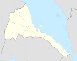 Nefasit Location in Eritrea | |
| Coordinates: 15°20′00″N 39°03′43″E / 15.33333°N 39.06194°E | |
| Country | |
| Region | Northern Red Sea |
| District | Ghinda |
| Elevation | 1,700 m (5,500 ft) |
| Population (2005) | |
| • Total | 5,000 |
| Climate | Cfa |

Nefasit (Arabic: نفاسيت, Tigrinya: ነፋሲት Tigrinya pronunciation: [nɐfasit]), also known as Tappa Nefasit, is a small town in the Northern Red Sea Region of Eritrea. Monastery of Debre Bizen is located at the mountains above.
According to multiple tour groups the stretch between the capital Asmara and Nefasit is the most beautiful in Eritrea. There's a colonial era Italian railway that occasionally runs from Asmara.
Climate[]
| hideClimate data for Nefasit | |||||||||||||
|---|---|---|---|---|---|---|---|---|---|---|---|---|---|
| Month | Jan | Feb | Mar | Apr | May | Jun | Jul | Aug | Sep | Oct | Nov | Dec | Year |
| Average high °C (°F) | 25.1 (77.2) |
26.0 (78.8) |
27.5 (81.5) |
28.6 (83.5) |
29.7 (85.5) |
30.3 (86.5) |
27.0 (80.6) |
26.7 (80.1) |
28.5 (83.3) |
27.5 (81.5) |
25.6 (78.1) |
24.7 (76.5) |
27.3 (81.1) |
| Average low °C (°F) | 8.9 (48.0) |
9.6 (49.3) |
11.1 (52.0) |
12.7 (54.9) |
14.5 (58.1) |
16.8 (62.2) |
16.6 (61.9) |
17.3 (63.1) |
15.6 (60.1) |
12.8 (55.0) |
10.6 (51.1) |
9.5 (49.1) |
13.0 (55.4) |
| Average precipitation mm (inches) | 65 (2.6) |
71 (2.8) |
48 (1.9) |
54 (2.1) |
41 (1.6) |
26 (1.0) |
125 (4.9) |
126 (5.0) |
39 (1.5) |
58 (2.3) |
45 (1.8) |
68 (2.7) |
766 (30.2) |
| Source: Climate Data | |||||||||||||
References[]
| Authority control |
|
|---|
Coordinates: 15°20′00″N 39°03′43″E / 15.33333°N 39.06194°E
This Eritrea location article is a stub. You can help Wikipedia by . |
Categories:
- Populated places in Eritrea
- Northern Red Sea Region
- Eritrea geography stubs