Negernbötel
Negernbötel | |
|---|---|
 Coat of arms | |
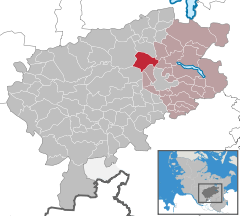
show Location of Negernbötel within Segeberg district | |
 Negernbötel | |
| Coordinates: 53°59′4″N 10°15′1″E / 53.98444°N 10.25028°ECoordinates: 53°59′4″N 10°15′1″E / 53.98444°N 10.25028°E | |
| Country | Germany |
| State | Schleswig-Holstein |
| District | Segeberg |
| Municipal assoc. | Trave-Land |
| Government | |
| • Mayor | Dieter Beuk |
| Area | |
| • Total | 16.97 km2 (6.55 sq mi) |
| Elevation | 41 m (135 ft) |
| Population (2020-12-31)[1] | |
| • Total | 966 |
| • Density | 57/km2 (150/sq mi) |
| Time zone | UTC+01:00 (CET) |
| • Summer (DST) | UTC+02:00 (CEST) |
| Postal codes | 23795 |
| Dialling codes | 04328, 04551 |
| Vehicle registration | SE |
| Website | www.amt-trave- land.de |


Negernbötel is a municipality in the district of Segeberg, in Schleswig-Holstein, Germany.
References[]
| Authority control |
|---|
This Segeberg location article is a stub. You can help Wikipedia by . |
Categories:
- Municipalities in Schleswig-Holstein
- Segeberg
- Segeberg geography stubs