Neukölln Ship Canal
This article relies largely or entirely on a single source. (January 2016) |
| Neukölln Ship Canal | |
|---|---|
 The Lohmuehlenbruecke across the Neukölln Ship Canal | |
| Specifications | |
| Length | 4.1 km (2.5 miles) |
| Geography | |
| Start point | Landwehr Canal |
| End point | Teltow Canal and the Britz Canal |
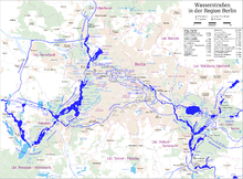
Map of waterways in the Berlin region
The Neukölln Ship Canal, or Neuköllner Schiffahrtskanal, is a 4.1-kilometre (2.5 mi) long canal in Berlin, Germany. It connects with the Landwehr Canal at its northern end, and with the Teltow Canal and the Britz Canal at its southern end.[1]
The canal has a single lock, the Schleuse Neukölln, towards its southern end. The lock rises from the level of the Landwehr Canal to that of the Teltow and Britz canals.[1]
References[]
Coordinates: 52°28′39″N 13°27′29″E / 52.47750°N 13.45806°E

| Wikimedia Commons has media related to Neuköllner Schiffahrtskanal. |
This Berlin location article is a stub. You can help Wikipedia by . |
This article related to water transport is a stub. You can help Wikipedia by . |
This article about a Berlin building or structure is a stub. You can help Wikipedia by . |
Categories:
- Canals in Berlin
- Buildings and structures in Neukölln
- Canals opened in 1913
- 1913 establishments in Germany
- Havel basin
- Berlin geography stubs
- Water transport stubs
- Berlin building and structure stubs