New Alipurduar railway station
This article does not cite any sources. (July 2015) |
New Alipurduar | |||||||||||
|---|---|---|---|---|---|---|---|---|---|---|---|
| Indian Railways station | |||||||||||
 New Alipurduar railway station | |||||||||||
| Location | New Alipurduar, West Bengal India | ||||||||||
| Coordinates | 26°31′25″N 89°32′01″E / 26.5237°N 89.5335°ECoordinates: 26°31′25″N 89°32′01″E / 26.5237°N 89.5335°E | ||||||||||
| Elevation | 46 metres (150ft) | ||||||||||
| Owned by | Indian Railways | ||||||||||
| Operated by | North East Frontier Railway | ||||||||||
| Line(s) | Barauni–Guwahati line | ||||||||||
| Platforms | 3 (more under construction) | ||||||||||
| Tracks | 1,676 mm (5 ft 6 in) broad gauge | ||||||||||
| Construction | |||||||||||
| Structure type | At ground | ||||||||||
| Parking | Available | ||||||||||
| Other information | |||||||||||
| Status | Functioning | ||||||||||
| Station code | NOQ | ||||||||||
| Zone(s) | North East Frontier Railway | ||||||||||
| Division(s) | Alipurduar | ||||||||||
| History | |||||||||||
| Electrified | Yes 2021 | ||||||||||
| Previous names | Assam Bengal Railway | ||||||||||
| Services | |||||||||||
| |||||||||||
| Location | |||||||||||
 New Alipurduar Location in West Bengal | |||||||||||


New Alipurduar is one of the four railway stations that serve Alipurduar city in Alipurduar district in north Bengal in the Indian state of West Bengal. Its station code is NOQ. The other three adjacent railway stations are Alipurduar Junction (station code APDJ), Alipurduar Court (station code APDC) and Alipurduar (station code APD).
History[]
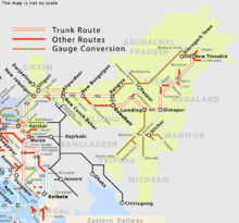
During British rule, all links from the northern part of Bengal and Assam to the rest of India were through the eastern part of Bengal. The most important connection was the Calcutta–Parbatipur–Haldibari–Siliguri link first established in 1878 and then developed in stages (for details see Howrah–New Jalpaiguri line). During the nineteenth century, Lalmonirhat was linked to the Dooars. In pre-independence days, a 1,000 mm (3 ft 3+3⁄8 in) metre gauge railway track running via Radhikapur, Biral, Parbatipur, Tista, Gitaldaha and Golokganj connected Fakiragram in Assam with Katihar in Bihar.
With the partition of India in 1947, all these links were lost. Indian Railways took up the Assam Link Project in 1948 to build a rail link between Fakiragram and Kishanganj. Fakiragram was connected to the Indian railway system in 1950 through the Indian portion of north Bengal with a 1,000 mm (3 ft 3+3⁄8 in) metre gauge track. The New Jalpaiguri–New Bongaigaon section was partly new construction, partly old line converted to 1,676 mm (5 ft 6 in) broad gauge in 1966. The 265 km long 1,676 mm (5 ft 6 in) broad gauge Siliguri–Jogihopa railway line was constructed between 1963 and 1965.
Importance over other adjacent stations[]
Most of the long-distance trains from other parts of India pass through and stop at New Alipurdur railway junction as it is connected with double track to Assam and the rest of Bengal. The older Alipurduar Junction was on metre-gauge track that was converted to broad gauge much later and fewer trains pass through Alipurduar Jn station. This station is the biggest railway station in Alipurduar , with stopping over more than 90+ trains daily and 3trains daily originating
References[]
External links[]
- New Jalpaiguri–New Bongaigaon section
- Northeast Frontier Railway zone
- Alipurduar junction railway station
- Alipurduar
- Alipurduar railway division
- Railway stations in Alipurduar district
- Transport in Alipurduar