New Caoling Lake
| New Caoling Lake | |
|---|---|
 New Caoling Lake | |
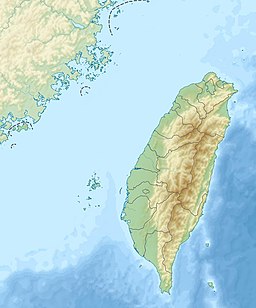
| Location | Gukeng, Yunlin and Meishan, Chiayi |
| Coordinates | 23°34′33″N 120°41′36″E / 23.5759°N 120.6934°ECoordinates: 23°34′33″N 120°41′36″E / 23.5759°N 120.6934°E |
| Type | Barrier lake |
| Native name | 新草嶺潭 (Chinese) |
| River sources | Qingshui River |
| First flooded | September 21, 1999 |
| Max. length | 5 km (3.1 mi) |
| Max. depth | 58 m (190 ft) |
| Water volume | 46,000,000 m3 (1.6×10⁹ cu ft) |
| References | [1] |

New Caoling Lake[2] (Chinese: 新草嶺潭; pinyin: Xīn Cǎolǐng Tán)[Note 1] was a short-lived barrier lake on the border of Gukeng, Yunlin County and Meishan, Chiayi County, near the village of Caoling in Taiwan. Located on the Qingshui River, a tributary of the Zhuoshui River, the lake formed due to a landslide during the 1999 Jiji earthquake on September 21, 1999. The lake disappeared during a flood caused by Typhoon Mindulle in July 2004.
Past lakes[]
The area around Caoling is mountainous and prone to landslides. Historically, there have been four instances of barrier lakes forming in this area. The first recorded instance was during the , which lasted until 1898. During the 1941 Chungpu earthquake, a landslide formed a 70 m tall dam; in 1942, another landslide caused the dam to grow to 170 m tall. On 18 May 1951, the dam abruptly failed, killing hundreds of people downstream, including 74 soldiers constructing a road up to the lake. On 15 August 1979, a landslide caused by 1979 typhoons caused a lake to form, which failed on 24 August the same year.[3][4]
History[]
During the 1999 Jiji earthquake on September 21, 1999, a landslide west of Caoling formed a 50 m tall barrier that once again dammed up the Qingshui River.[3] After the earthquake, the Water Resources Agency announced that the lake's dam was stable and the newly formed lake could potentially be used as a reservoir and serve as a substitute for Shigang Dam, which was damaged in the earthquake. However, this plan was never carried out.[5]
Though the lake covered over some of Caoling's scenic attractions, the new lake was still popular among tourists.[6] However, the lake was short-lived as sedimentation gradually raised the lake's floor. Also, water channels formed on the dam, which decreased the retention time of the water. In July 2004, a flood caused by Typhoon Mindulle (known as the Seven-Two Flood) raised the lake's surface above the dam, washing away the barrier and returning the river to its original state.[1]
References[]
- ^ a b 李建堂. "變遷中的地景 「新草嶺潭」的地景變遷". National Taiwan University (in Chinese). Archived from the original on 17 March 2016. Retrieved 15 November 2020.
- ^ 蘇榮泉; 郭春輝 (20 September 2019). "九二一走過20年 夢幻草嶺潭、大飛山成為永遠印記" (in Chinese). Now News. Retrieved 15 November 2020.
- ^ a b 何立德. "草嶺潭". Encyclopedia of Taiwan (in Chinese). Ministry of Culture. Retrieved 15 November 2020.
- ^ 張炎銘 (3 October 2014). "1951年5月18日-草嶺潭崩潰". Water Resources Agency (in Chinese). Retrieved 15 November 2020.
- ^ 劉在武 (24 September 1999). "新草嶺潭 ��水量相當石門水庫" (in Chinese). China Times. Archived from the original on 9 August 2014. Retrieved 15 November 2020.
- ^ 王晴玲 (30 September 2004). "再見‧草嶺潭". Our Island (in Chinese). Public Television Service. Retrieved 15 November 2020.
Notes[]
- ^ The name "Caoling Lake" typically refers to all four instances of this lake, while "New Caoling Lake" only refers to the 1999-2004 lake.
- Landslide-dammed lakes
- Lakes of Taiwan
- Landforms of Yunlin County
- Landforms of Chiayi County