Newport Bay (California)

Newport Beach CA
Coordinates: 33°36′30″N 117°54′33″W / 33.60833°N 117.90917°W

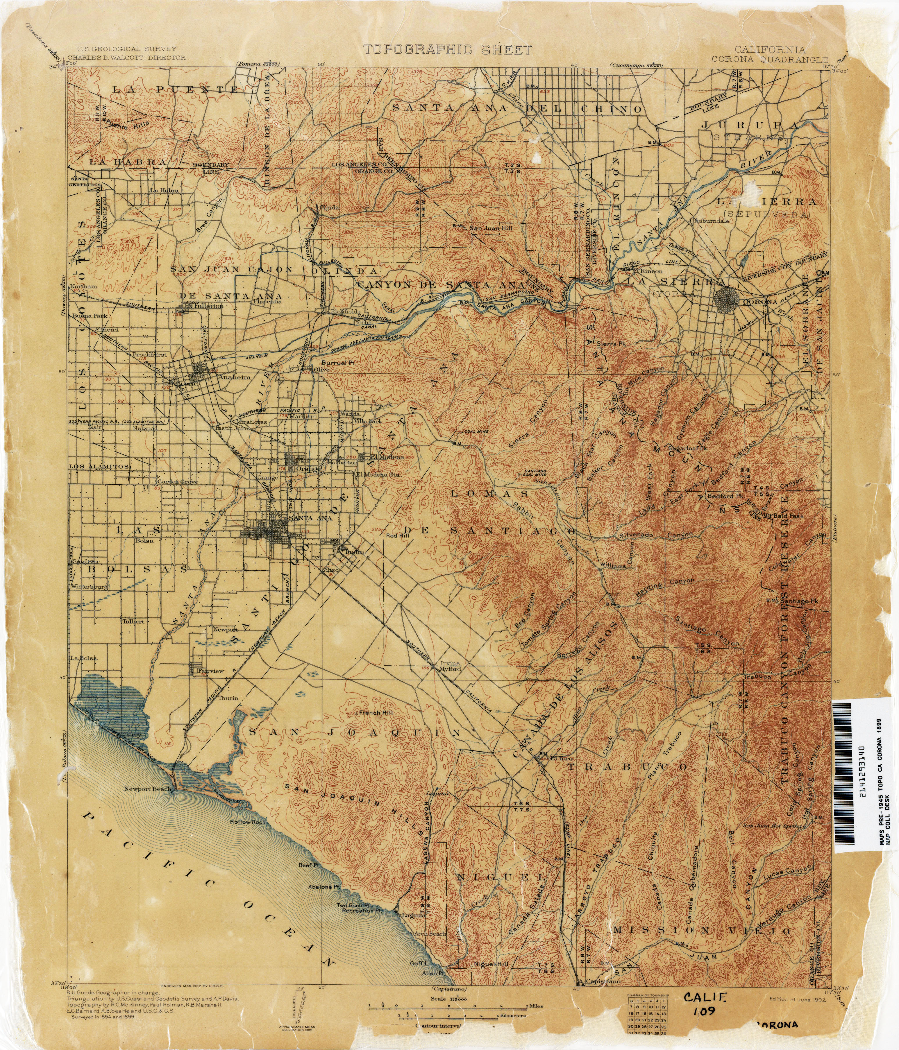
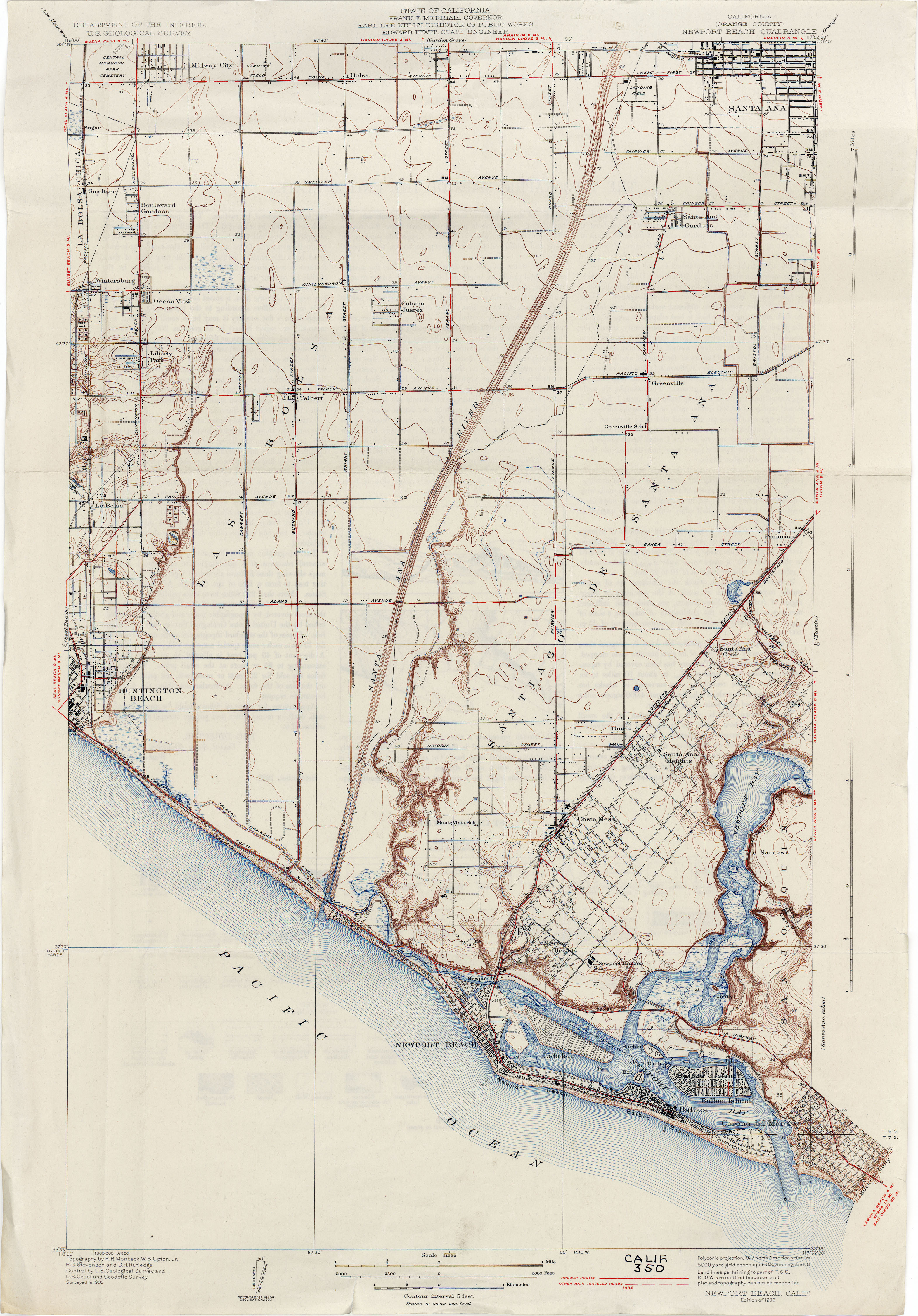
Newport Bay, in Southern California is the lower bay formed along the coast below the Upper Newport Bay, after the end of the Pleistocene. It was formed by sand, brought by ocean currents from the Santa Ana River and other rivers to the north, which constructed an offshore beach, now called the Balboa Peninsula. An estuary of the Santa Ana River in the late 19th century, it was dredged to form Newport Harbor, the harbor of Newport Beach.[1][2][3]

References[]
- ^ USGS Map Name: Corona, CA 1899 1:125,000; Perry–Castañeda Library Map Collection; California Topographic Maps from http://www.lib.utexas.edu accessed 4/25/2013
- ^ USGS Map Name: Newport Beach (Orange County), Calif., 1932, (1927 data), 1:31,680; Perry–Castañeda Library Map Collection; California Topographic Maps from http://www.lib.utexas.edu accessed 8/30/2013
- ^ Newport Bay, California, on USGS Map Name: Newport Beach, CA, Map Center: N33° 36' 30" W117° 54' 33" from topoquest.com accessed on 4/23/2013
| Authority control |
|---|
This Orange County, California–related article is a stub. You can help Wikipedia by . |
Categories:
- Bays of California
- Bodies of water of Orange County, California
- Newport Beach, California
- Orange County, California geography stubs