Nimrod Glacier

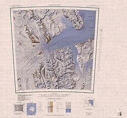
The Nimrod Glacier is a major glacier about 135 km (85 mi) long, flowing from the polar plateau in a northerly direction through the Transantarctic Mountains between the Geologists and Miller Ranges, then northeasterly between the Churchill Mountains and Queen Elizabeth Range, and finally spilling into Shackleton Inlet and the Ross Ice Shelf between Capes Wilson and Lyttelton.
It was photographed from the air by USN Operation Highjump, 1946–47. The name, given by US-ACAN, is in association with Shackleton Inlet and is for the Nimrod, the ship of the British Antarctic Expedition (1907–09) under Ernest Shackleton.
See also[]
- List of glaciers in the Antarctic
References[]
External links[]
 Media related to Nimrod Glacier at Wikimedia Commons
Coordinates:  81°21′S 163°00′E / 81.350°S 163.000°E / -81.350; 163.000
Glaciers in the Antarctic | |
|---|---|
|
Glaciers of the Ross Dependency | |
|---|---|
| King Edward VII Land |
|
| Ross Dependency |
|
This article about a glacier in Shackleton Coast is a stub. You can help Wikipedia by . |
- v
- t
This article about a glacier in Oates Land is a stub. You can help Wikipedia by . |
- v
- t
- Glaciers of Shackleton Coast
- Oates Land
- Ross Dependency glacier stubs
- Shackleton Coast geography stubs
- Oates Land glacier stubs
- Articles with short description
- Short description is different from Wikidata
- Commons category link is on Wikidata
- Coordinates on Wikidata
- All stub articles