Niobrara State Park
| Niobrara State Park | |
|---|---|
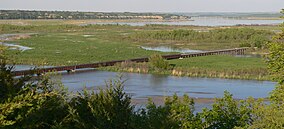
 Historic Niobrara State Park River Bridge | |
 Location in Nebraska | |
| Location | Knox County, Nebraska. United States |
| Nearest town | Niobrara, Nebraska |
| Coordinates | 42°45′05″N 98°03′57″W / 42.75139°N 98.06583°WCoordinates: 42°45′05″N 98°03′57″W / 42.75139°N 98.06583°W |
| Area | 1,236.59 acres (500.43 ha)[1] |
| Elevation | 1,230 ft (370 m)[2] |
| Designation | Nebraska state park |
| Established | 1987 (originally Niobrara Island State Park, est. 1930)[3] |
| Visitors | 132,950 (in 2018)[4] |
| Administrator | Nebraska Game and Parks Commission |
| Website | Niobrara State Park |
Niobrara State Park is a public recreation area located at the confluence of the Missouri and Niobrara rivers in the northeast corner of Nebraska.[5] The state park occupies river bluffs to the west of the village of Niobrara and the Niobrara River. The park includes the Niobrara River Bridge, a decommissioned railroad bridge listed on the National Register of Historic Places.[6] A variety of animals, notably white-tailed deer and wild turkeys, roam the park by day, while at night, coyotes and whip-poor-wills mingle their cries and calls.[7] The park is managed by the Nebraska Game and Parks Commission.
History[]
The first state park at the mouth of the Niobrara River was called Niobrara Island State Park. Niobrara Island had been a Niobrara town park until it was transferred to the state in 1930. Both the state and the Civilian Conservation Corps made improvements to the site in the 1930s. The park's present-day site opened in 1987 after the Nebraska Game and Parks Commission purchased 1,231 acres of higher land to the west of the original park. Cabins at the old park that were still in use in 1987 were subsequently abandoned because of high water in the area.[3]
Activities and amenities[]
Park facilities include a swimming pool and interpretive center. Visitors can tour the park via seven miles (11 km) of roads and fourteen miles (23 km) of hiking trails. The park offers RV and primitive camping as well as cabins that overlook the river.[5]
References[]
- ^ "Niobrara State Park". NGPC Map and Data Portal. March 1, 2017. Retrieved June 10, 2020.
- ^ "Niobrara State Park". Geographic Names Information System. United States Geological Survey.
- ^ a b Charles A. Flowerday; R.F. Diffendal, Jr., eds. (1997). "Geology of Niobrara State Park, Knox County, Nebraska, and Adjacent Areas—with a Brief History of the Park, Gavins Point Dam, and Lewis and Clark Lake". University of Nebraska - Lincoln, Conservation and Survey Division. pp. 5–6. Retrieved June 10, 2020.
- ^ "2018 Nebraska Attraction Attendance Counts" (PDF). Nebraska Tourism Commission. Retrieved June 10, 2020.
- ^ a b "Niobrara State Park". Nebraska Game and Parks Commission. Retrieved January 9, 2017.
- ^ Carl McWilliams, Research Historian (June 26, 1992). "Niobrara River Bridge". NPGallery Digital Asset Management System. National Register of Historic Places Inventory Nomination Form. National Park Service. Retrieved June 10, 2020.
- ^ "Niobrara State Park". Nebraska Game and Parks Commission. Archived from the original on May 23, 2010. Retrieved March 8, 2007.
External links[]
| Wikimedia Commons has media related to Niobrara State Park. |
- Niobrara State Park Nebraska Game and Parks Commission
- Niobrara State Park Map Nebraska Game and Parks Commission
- Protected areas of Knox County, Nebraska
- Missouri River
- State parks of Nebraska
- Civilian Conservation Corps in Nebraska
- Protected areas established in 1987
- 1987 establishments in Nebraska
- Protected areas established in 1930
- 1930 establishments in Nebraska
