Nishimera, Miyazaki
Nishimera
西米良村 | |
|---|---|
Village | |
 Nishimera Village | |
 Flag  Chapter | |
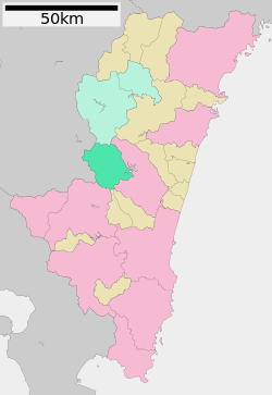 Location of Nishimera in Miyazaki Prefecture | |
 Nishimera Location in Japan | |
| Coordinates: 32°14′2″N 131°9′24″E / 32.23389°N 131.15667°ECoordinates: 32°14′2″N 131°9′24″E / 32.23389°N 131.15667°E | |
| Country | Japan |
| Region | Kyushu |
| Prefecture | Miyazaki Prefecture |
| District | Koyu |
| Area | |
| • Total | 271.51 km2 (104.83 sq mi) |
| Population (October 1, 2019) | |
| • Total | 1,013 |
| • Density | 3.7/km2 (9.7/sq mi) |
| Time zone | UTC+09:00 (JST) |
| Website | www |

Nishimera (西米良村, Nishimera-son) is a village located in Koyu District, Miyazaki Prefecture, Japan.
As of 1 October 2019, the village has an estimated population of 1,013[1] and the density of 3.73 persons per km2. The total area is 271.51 km2.
Nishimera is made up of the hamlets of Murasho, Ogawa, Koshino, Yokono, Takehara, Kanmera, and Itaya.
The main hamlet of Nishimera is called Murasho, has a population of 639 and has one traffic light. However such isolation is balanced by the mountains which surround the village and the river which runs through it.[original research?]
Twin towns – sister cities[]
Nishimera is twinned with:
 Kikuchi, Kumamoto, Japan
- Tōno, Iwate, Japan
Transportation[]
Highways[]
References[]
- ^ "Population of Nishimera Village" (in Japanese). Japan: Nishimera Village. Retrieved 28 April 2017.[permanent dead link]
External links[]
 Media related to Nishimera, Miyazaki at Wikimedia Commons
- Nishimera official website (in Japanese)
 Geographic data related to Nishimera, Miyazaki at OpenStreetMap
| show Authority control |
|---|
This Miyazaki Prefecture location article is a stub. You can help Wikipedia by . |
Categories:
- Villages in Miyazaki Prefecture
- Miyazaki geography stubs