Nonnweiler
Nonnweiler | |
|---|---|
 | |
 Coat of arms | |
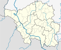
show Location of Nonnweiler within Sankt Wendel district | |
 Nonnweiler | |
| Coordinates: 49°37′N 6°57′E / 49.617°N 6.950°ECoordinates: 49°37′N 6°57′E / 49.617°N 6.950°E | |
| Country | Germany |
| State | Saarland |
| District | Sankt Wendel |
| Subdivisions | 8 |
| Government | |
| • Mayor (2019–24) | Franz-Josef Barth[1] (SPD) |
| Area | |
| • Total | 66.71 km2 (25.76 sq mi) |
| Elevation | 414 m (1,358 ft) |
| Population (2020-12-31)[2] | |
| • Total | 8,466 |
| • Density | 130/km2 (330/sq mi) |
| Time zone | UTC+01:00 (CET) |
| • Summer (DST) | UTC+02:00 (CEST) |
| Postal codes | 66616–66620 |
| Dialling codes | 06873 |
| Vehicle registration | WND |
| Website | www.nonnweiler.de |
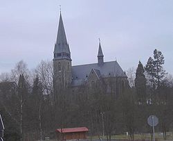
Nonnweiler is a municipality in the district of Sankt Wendel, in Saarland, Germany.
Overview[]
It is situated approximately 20 km northwest of Sankt Wendel, and 30 km southeast of Trier. The village is well known for the "Hillfort of Otzenhausen", a huge wall (former castle) of Celtic origin.
References[]
- ^ Gewählte Ober-/Bürgermeister*innen, Landrät*innen und Regionalverbandsdirektor*in im Saarland, accessed 18 June 2021.
- ^ "Saarland.de – Amtliche Einwohnerzahlen Stand 31. Dezember 2020" (PDF). Statistisches Amt des Saarlandes (in German). June 2021.
External links[]
 Media related to Nonnweiler at Wikimedia Commons
Categories:
- Municipalities in Saarland
- Sankt Wendel (district)
- Saarland geography stubs


