Northkill Creek
| Northkill | |
|---|---|
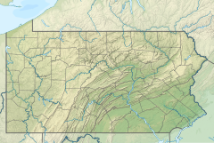 Location of the mouth in Pennsylvania | |
| Etymology | Kille is middle Dutch for "water channel" |
| Location | |
| Country | United States |
| State | Pennsylvania |
| Cities | Bernville, Pennsylvania, Strausstown, Pennsylvania, Shartlesville, Pennsylvania, New Shaefferstown, Pennsylvania |
| Physical characteristics | |
| Source | Blue Mountain, Pennsylvania |
| Mouth | Tulpehocken Creek |
• location | Pennsylvania, United States |
• coordinates | 40°25′31″N 76°06′45″W / 40.4252°N 76.1124°WCoordinates: 40°25′31″N 76°06′45″W / 40.4252°N 76.1124°W |
| Length | 11 mi (18 km) |
| Basin size | 42 sq mi (110 km2) |
| Basin features | |
| Tributaries | |
| • left | |
| • right | Mollhead Creek, Little Northkill Creek |

Northkill Creek is a stream primarily located in Berks County, Pennsylvania. It feeds into Tulpehocken Creek and covers part of the Schuylkill River and Delaware River watersheds. Northkill Creek and its tributaries are high quality trout streams.
Geography[]
Northkill Creek begins in the Northkill Gap on Blue Mountain near Shartlesville. The creek flows nearly 11 miles (18 km) roughly south to its confluence with Tulpehocken Creek just south of Bernville. Tributaries include Little Northkill, Mollhead and Wolf Creeks. The confluence with Little Northkill Creek is at Bernville. Northkill Creek's watershed covers approximately 42 square miles (110 km2) in Jefferson, Penn, Tulpehocken, Upper Bern and Upper Tulpehocken Townships and Bernville Borough in Berks County and South Manheim and Wayne Townships in Schuylkill County. The Little Northkill sub-watershed drains 52.5% of this area and provides approximately 60% of the total flow.[1]
The bedrock is primarily sandstone interbedded with shale, slate, quartzite, chert and limestone fragments. Blue Mountain is underlain by sandstone, with quartz-rich rock. More moderate slopes are underlain by shale. This bedrock does not provide significant ability to neutralize acidic pollution. The shale component limits the bedrock's water-bearing properties and hence draught resistance.[1]
Land use[]
In the Northkill watershed, 61% of land is classified as agricultural and 37% as forested. Loss of farmland to non-agricultural use is estimated at 2,000 acres (8.1 km2) annually.[1]
Stream quality[]
That portion of Northkill Creek from its source to the I-78 bridge is designated by the Pennsylvania Department of Environmental Protection as an Exceptional Value stream. The remainder (from I-78 to the Tulpehocken) is designated Cold Water Fishery. The Pennsylvania Fish and Boat Commission designates Northkill Creek and its tributaries as wild trout streams. As such Northkill Creek and its tributaries are important nurseries and refuges for wild trout. The creek is stocked with both brown and brook trout. The watershed has historically hosted American eel, but dams have contributed to a decline in that population. Other significant populations include cutlips minnow, common shiner, eastern blacknose dace, creek chub, and white sucker. Stream quality is stressed by acid rain (primarily from Ohio power plants), agricultural discharge (nitrates and phosphates), and non-agricultural development (siltation, road salt, animal waste, sewage).[1][2]
History[]
The water and associated flora and fauna of Northkill Creek supported the Lenape and early European settlers. Anabaptists and Lutherans settled the Northkill watershed in the early 18th century. In 1736, several Amish families purchased land along Northkill Creek. The Northkill Amish Settlement was the first organized Amish congregation in the U.S. The Hochstetlers, Yoders, Hetzlers and Millers were joined by Zugs, Jotters, Glicks, Kauffmans, and Bishop Jacob Hartzler, and eventually included more than 150 residents. They constructed stone houses, planted apple orchards, and harvested hay, wheat, and rye.[3] This community would later disband and move elsewhere. In 1754, Fort Northkill was built about two miles (3 km) east of Strausstown, near the Northkill Creek and about one mile (1.6 km) south of the base of the Blue Mountain.[4][5][6]
See also[]
References[]
- ^ a b c d "Northkill Creek Watershed Coldwater Conservation Plan" (PDF). The Delaware Riverkeeper Network. Jan 2006. Retrieved 2008-11-18.
- ^ "Analysis of Samples Collected at Special-Study Sites, Synoptic Assessment of Water Quality in the Northkill Creek Basin, Berks County, Pennsylvania" (PDF). Annual Water Data Report--WY 2002. New Cumberland, PA: USGS Pennsylvania Water Science Center. 2002: 446. Retrieved 2008-11-19.
The Northkill Creek is among Berks County's highest quality streams, designated as exceptional value in its headwaters and with all tributaries designated cold-water fisheries. * * * [W]ater-quality degradation and only warm-water fishes were found in lower reaches near Bernville. Suburban development, sewage discharges, and poor farming practices were suggested as principal causes of watershed problems.
Cite journal requires|journal=(help) - ^ "Northkill Amish Historical Marker". WITF, Inc. 2003. Retrieved 2008-11-19.
Marker Text: The first organized Amish Mennonite congregation in America. Established by 1740. Disbanded following Indian attack, September 29, 1757, in which a Provincial soldier and three members of the Jacob Hochstetler family were killed near this point.
- ^ "Upper Tulpehocken". Upper Tulpehocken Township, Pennsylvania. 2005. Archived from the original on 2012-02-19. Retrieved 2008-11-19.
- ^ Wagner, A E; F W Balthaser; D K Hoch (1913). "Fort Northkill". The Story of Berks County (PDF). Reading, PA: Eagle Book and Job Press. pp. 57–58. Retrieved 2008-11-19.
- ^ Busch, Clarence M. (1896). "Report of the Commission to Locate the Site of the Frontier Forts of Pennsylvania". 1. State Printer of Pennsylvania. Cite journal requires
|journal=(help) chapter on Fort Northkill, includes drawing of "Present Site of Fort Northkill
External links[]
- Schneck, Marcus (2008-06-22). "Nature's Navigator: Northkill Gap". Wild About PA Blog. The Patriot-News. Retrieved 2008-11-18.
- Northkill Creek Water Sampling data
- Sharp, J. E.; J. D. Ingold (2002-10-16). "Northkill Amish Settlement, Berks County, Pennsylvania". Historical Committee and Archives. Mennonite Church USA. Retrieved 2008-11-18.
- Rivers of Pennsylvania
- Tributaries of the Schuylkill River
- Rivers of Berks County, Pennsylvania