Northumberland County Airport
Northumberland County Airport | |||||||||||
|---|---|---|---|---|---|---|---|---|---|---|---|
| Summary | |||||||||||
| Airport type | Public | ||||||||||
| Owner | Northumberland County Airport Authority | ||||||||||
| Serves | Shamokin / Elysburg | ||||||||||
| Elevation AMSL | 880.6 ft / 268.4 m | ||||||||||
| Coordinates | 40°50′12″N 076°33′08″W / 40.83667°N 76.55222°WCoordinates: 40°50′12″N 076°33′08″W / 40.83667°N 76.55222°W | ||||||||||
| Map | |||||||||||
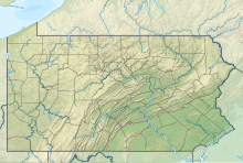 N79 Location of airport in Pennsylvania | |||||||||||
| Runways | |||||||||||
| |||||||||||
| Statistics (2016) | |||||||||||
| |||||||||||


Northumberland County Airport is a small general aviation non-towered airport located in Paxinos, Pennsylvania. It is centrally located between Shamokin and Elysburg. The airport has one asphalt runway (8/26) which is 3297 x 75 ft. / 1005 x 23 m. As of late 2016 there are 23 aircraft based on the field of them 21 are single engine, one being multi engine fixed wing and 1 helicopter aircraft.[1][2]
The airport is a public use facility and is owned and maintained by the Northumberland County Airport Authority. Aircraft operations average 63 per day with approximately 22,000 a year. 65% local general aviation, 35% transient general aviation and <1% military.
See also[]
References[]
- ^ "N79 - Northumberland County Airport". Sky Vector. Retrieved 23 August 2017.
- ^ "Northumberland County Airport and other public airports..." TollFreeAirline.com. 11 January 2011. Retrieved 23 August 2017.
External links[]
- Official website
- N79 at Facebook.com
- N79 at AirNav.com
- N79 at Globalair.com
Categories:
- Airports in Pennsylvania
- County airports in Pennsylvania
- Transportation buildings and structures in Northumberland County, Pennsylvania