Nova Scotia Route 358
| Route information | ||||
|---|---|---|---|---|
| Maintained by Nova Scotia Department of Transportation and Infrastructure Renewal | ||||
| Length | 30 km[1] (19 mi) | |||
| Major junctions | ||||
| South end | ||||
| North end | Rogers Road in Scot's Bay | |||
| Highway system | ||||
| ||||
Route 358 is a collector road in the Canadian province of Nova Scotia.
It is located in Kings County and connects Greenwich at Trunk 1 with Scot's Bay. Between Port Williams and Canard, the highway crosses the Canard River and the low fields of the riverbank in a wide curve, tracing the path of the Grand Dyke, built by the Acadians about 1750.[2]
Communities[]
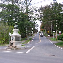
Route 358 in Canning
- Greenwich
- Port Williams
- Canard
- Hillaton
- Canning
- The Lookoff
- Scot's Bay
Parks[]
- Scots Bay Provincial Park
- Blomidon Provincial Park
- Cape Split Provincial Park Reserve
History[]
The section of the Collector Highway 358 from Canard to Canning was designated as part of the Trunk Highway 41.
See also[]
References[]
This Nova Scotia road, road transport or highway-related article is a stub. You can help Wikipedia by . |
Categories:
- Nova Scotia provincial highways
- Roads in Kings County, Nova Scotia
- Nova Scotia road stubs