Nowy Łupków
Nowy Łupków | |
|---|---|
Village | |
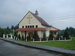 Village church | |
 Nowy Łupków | |
| Coordinates: 49°15′24″N 22°5′2″E / 49.25667��N 22.08389°E | |
| Country | |
| Voivodeship | Subcarpathian |
| County | Sanok |
| Gmina | Komańcza |
| Population | 390 |

Nowy Łupków [ˈnɔvɨ ˈwupkuf] (Ukrainian: Новий Лупків, Novyi Lupkiv) is a village in the administrative district of Gmina Komańcza, within Sanok County, Subcarpathian Voivodeship, in south-eastern Poland, close to the border with Slovakia.[1] It lies approximately 11 kilometres (7 mi) south of Komańcza, 34 km (21 mi) south of Sanok, and 87 km (54 mi) south of the regional capital Rzeszów. The village has a population of 390.
The village emerged when the local railway station was built in 1872, along the line from Zagórz to then-Hungarian-owned Slovakia (First Hungarian-Galician Railway, Erste Ungarisch-Galizische Eisenbahn). At first, its inhabitants were mostly working on the railways. Currently, it is the southernmost railroad station in Poland, and a rail border crossing with Slovakia. In 1890-1898 the village was also linked with narrow-gauge Bieszczadzka Forest Railway.
A penal colony was built here after the Second World War, in which a number of Solidarność representatives were imprisoned during the Martial law in Poland period in 1981 and 1982.
References[]
| Wikimedia Commons has media related to Nowy Łupków. |
Coordinates: 49°15′24″N 22°5′2″E / 49.25667°N 22.08389°E
This Sanok County location article is a stub. You can help Wikipedia by . |
- Villages in Sanok County
- Sanok County geography stubs