Ošupis
| Ošupis | |
|---|---|
 Ošupis to the east from | |
| Location | |
| Country | Lithuania |
| Physical characteristics | |
| Source | |
| • location | , Palanga, Lithuania |
| Mouth | |
• location | Baltic Sea (, Palanga, Lithuania) |
| Length | 5.4 km (3.4 mi) |
| Basin size | 7.5 km2 (2.9 sq mi) |
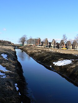
The Ošupis is a stream[1] in the west of Lithuania in the municipality Palanga in Klaipėda County in Samogitia. The total length of the stream is 5.4 kilometres (3.4 mi) and the drainage basin area is 7.5 square kilometres (2.9 sq mi).[2]
It begins in (in the district of Palanga). It flows at first to the north then from the village to the west and afterward joins the stream [3] and flows into the Baltic Sea[4] near (north of Palanga).
Etymology[]
Ošupis is composed from the Lithuanian words ošti meaning "foam" and upė meaning "river".
References[]
- ^ "Ošupis, p. 16" (PDF). Archived from the original (PDF) on 2012-03-31. Retrieved 2012-03-25.
- ^ Gailiušis, B; Jablonskis, J; Kovalenkovienė, M (2001). Lietuvos upės (in Lithuanian). Kaunas: Lietuvos energetikos institutas. p. 617.
- ^ "Confluence Ošupis and Kaniavasis". Maps.lt. Retrieved 2012-03-25.
- ^ "Official classification of the Lithuanian rivers" (PDF). Retrieved 2012-03-25.
| Wikimedia Commons has media related to Ošupis. |
Coordinates: 55°58′45″N 21°04′16″E / 55.97917°N 21.07111°E

Categories:
- Rivers of Lithuania
- Lithuania river stubs