Okuku, New Zealand
Okuku | |
|---|---|
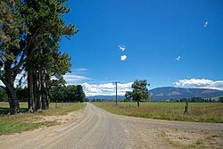 Okuku countryside | |
 | |
| Coordinates: 43°14′46″S 172°27′07″E / 43.246°S 172.452°ECoordinates: 43°14′46″S 172°27′07″E / 43.246°S 172.452°E | |
| Country | New Zealand |
| Region | Canterbury |
| Territorial authority | Waimakariri District |
| Ward |
|
| Area | |
| • Total | 838.68 km2 (323.82 sq mi) |
| Population (June 2020)[2] | |
| • Total | 760 |
| • Density | 0.91/km2 (2.3/sq mi) |

Okuku is a small farming community located in North Canterbury, New Zealand, lying 20 kilometres northwest of Rangiora. Okuku consists of a mix of flat and undulating farmland, and river beds that drain a catchment area in the foothills to the north. Okuku is bounded to the south by the Ashley River (the major river in the area), to the east by the Okuku River, and to the west by the Garry River. is the highest point at a height of 1023m.[3]
Demographics[]
The Okuku statistical area, which also includes Glentui, covers 838.68 km2 (323.82 sq mi).[1] It had an estimated population of 760 as of June 2020,[2] with a population density of 0.91 people per km2.
| Year | Pop. | ±% p.a. |
|---|---|---|
| 2006 | 495 | — |
| 2013 | 648 | +3.92% |
| 2018 | 726 | +2.30% |
| Source: [4] | ||
Okuku had a population of 726 at the 2018 New Zealand census, an increase of 78 people (12.0%) since the 2013 census, and an increase of 231 people (46.7%) since the 2006 census. There were 258 households. There were 360 males and 363 females, giving a sex ratio of 0.99 males per female. The median age was 42.6 years (compared with 37.4 years nationally), with 156 people (21.5%) aged under 15 years, 99 (13.6%) aged 15 to 29, 405 (55.8%) aged 30 to 64, and 66 (9.1%) aged 65 or older.
Ethnicities were 95.5% European/Pākehā, 3.3% Māori, 2.1% Pacific peoples, 0.8% Asian, and 2.1% other ethnicities (totals add to more than 100% since people could identify with multiple ethnicities).
The proportion of people born overseas was 16.9%, compared with 27.1% nationally.
Although some people objected to giving their religion, 61.2% had no religion, 28.1% were Christian and 1.2% had other religions.
Of those at least 15 years old, 99 (17.4%) people had a bachelor or higher degree, and 84 (14.7%) people had no formal qualifications. The median income was $39,400, compared with $31,800 nationally. The employment status of those at least 15 was that 339 (59.5%) people were employed full-time, 96 (16.8%) were part-time, and 18 (3.2%) were unemployed.[4]
References[]
- ^ Jump up to: a b "ArcGIS Web Application". statsnz.maps.arcgis.com. Retrieved 29 August 2021.
- ^ Jump up to: a b "Population estimate tables - NZ.Stat". Statistics New Zealand. Retrieved 22 October 2019.
- ^ "New Zealand Topographic Map - NZ Topo Map". NZ Topo Map. Retrieved 30 October 2015.
- ^ Jump up to: a b "Statistical area 1 dataset for 2018 Census". Statistics New Zealand. March 2020. Okuku (313000). 2018 Census place summary: Okuku
- Populated places in Canterbury, New Zealand
- Waimakariri District