Olanchito
This article is a rough translation from another language. It may have been generated by a computer or by a translator without dual proficiency. |
Olanchito | |
|---|---|
Municipality | |
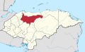
 Olanchito Location in Honduras | |
| Coordinates: 15°29′N 86°35′W / 15.483°N 86.583°W | |
| Country | Honduras |
| Department | Yoro |
| Government | |
| • Type | Democratic Municipality |
| • Mayor | José Tomás Ponce Posas (Libre)[1] |
| Area | |
| • Municipality | 2,019 km2 (780 sq mi) |
| Population (2020 projection)[2] | |
| • Municipality | 118,395 |
| • Density | 59/km2 (150/sq mi) |
| • Urban | 67,680 |
| Time zone | UTC-6 (Central America) |
| Climate | Aw |

Olanchito is a town with a population of 45,270 (2020 calculation)[3] and a municipality in the Honduran department of Yoro. The municipality was founded in 1530 and today comprises 70 villages, over 300 hamlets, and around 100,000 inhabitants.[4] It is located 107 miles (172 km) North-East of Tegucigalpa, the country's capital. Olanchito is in the Central Time Zone, with a UTC offset of -6 hours. The city is the birthplace of many exponents of Honduran literature, such as Ramón Amaya Amador. Olanchito has his manuscripts, his collection of books, the table at which he wrote, and even his ashes.[5] Known locally as the Civic City, Olanchito's main industry is based around agriculture.
History[]
The conquest of Honduras began with the arrival of several expeditions sent by Hernán Cortés to extend the domain of Spain in Central America. In 1525 he seized the town of Trujillo, which would become an important Atlantic port and the first capital of Honduras. Truxillo served as an outpost for the colonisation of the hostile territory of Olancho Valley. Hernando de Saavedra, Governor of Honduras, had a dispute with his counterpart in Nicaragua, Pedrarias Davila, on the rich gold deposits and rivers of Olancho. After several battles between rival groups of Spanish for control of the area, the town of San Jorge de Olancho was established. But because of the mistreatment of the natives of Olancho, they unexpectedly rebelled and attacked the place, destroying it completely. In this rebellion, Captain Juan de Grijalva, one of the conquerors of the Aztec empire, was killed. The survivors were scattered, some to the town of Border of Caceres, in 1526, and others to the Valley of Aguan.
With the death of Diego de Salcedo, Governor of Honduras in 1530, the province was in chaos. But the important issue of extending the settlement and continuing the conquest of people who were not yet subjugated continued. Stories differ as to who founded the settlement that became Olanchito and are somewhat confusing. According to the statistical yearbook of Antonio Vallejo, this town was founded by Captain Diego de Alvarado in 1530, with the name of San Jorge de Olanchito."[6] The Guatemalan historian José Mata Gavidia explains: "With these and other graces came to Guatemala D. Pedro de Alvarado, for the year April 30. bringing people of Mexico, and some that found here in Nicaragua, Diego de Alvarado sent brother Jorge to found the city, called Olanchito, in the province of Honduras."[7]
It follows that the town of San Jorge de Olanchito was founded in 1530, located on the right bank of the Aguán river. Its first inhabitants were the few survivors of San Jorge de Olancho and others sent by Pedro de Alvarado, becoming a stage of , which led from Truxillo to Olancho. Ten years later (1540) the Governor Francisco de Montejo, was ordered to continue the colonisation of Olancho and sent his officer Alonzo Caceres, who established a settlement with the same last name: "San Jorge de Olancho" (The Viejo). Years later Alonzo de Reinoso founded the village of "New Salamanca", which was rapidly depopulated due to continuing native rebellions. Olancho, as a mining town, was flourishing, producing huge amounts of gold and silver that were shipped from the port of Truxillo and Puerto Caballos.
San Jorge de Olancho later became known as El Boqueron, and in 1611 was completely destroyed. Historians attribute it to a volcanic eruption, or an earthquake, and some legends to divine causes, such as Biblical case of Sodom and Gomorrah. The survivors of this catastrophe, migrated in several directions as their ancestors had done a century earlier. Some founded the city of Juticalpa and others headed to San Jorge de Olanchito and Truxillo.
Over the years, some people moved to the left bank of Aguán river, and on the route leading to the native village of Agalteca, established a place they called "San Jorge de Olancho" (The New). With the move of all of the residents of the town to the new place, it took its name "San Jorge de Olanchito", and the old site was known then as "Old City" or "San Juan El Sevillano".
It is unknown the exact date of the foundation of the present city of Olanchito but this may have occurred between 1613–1620. The settlers were colonising the upper valley, and the road leading to Yoro, sites were established "Santa Barbara" in 1657, by Captain Pedro de Aliendo and Subiñas and "Santa Cruz" in 1682, by Don John of the Cross.[8]
In a report presented by Ing Luis Diez Navarro (1742–1745), to the King of Spain says: "The capital is that city of Comayagua, and has four cities named Gracias a Dios, that is the West, San Pedro Sula at northeast, San Jorge Olanchito at Levante [East] ... Forward the Partido of San Jorge Olanchito is Sonaguera, and Port of Truxillo distant twenty leagues"[9]
Another document concerning the invasion of the English: says: "In 1747, the British themselves with Miskito natives until Sonaguera village, where they committed great crimes and would have done more damage but for the energetic attitude of Governor Tablada. So says the latter adds that those foreigners who spared no means to intimidate Olanchito and Olancho El Viejo."[10]
In 1797, there was still a war between Spain and England: "In part this Captaincy General directed by the Lord Mayor Governor of the Province of Comayagua, Ramon Anguiano, from Olanchito in early this month have reported the following ads: On April 26, before five in the afternoon, the British had place, two warships and a brigantine at the Voca of Truxillo Port given these and other provisions they go to the place known as The Ofrecedora, which contributed effectively to the back the Governor Intendant, as expressed through a cordon of Olanchito troops who had settled in contours Sonaguera."[11]
In the late eighteenth century, due to this situation, the archive and the treasury of Real Hacienda de Truxillo were forwarded to the town of Olanchito.
Economic development[]
Today the city of Olanchito is the most important city in the department of Yoro thanks to its growing achievements in education, industry, livestock, and agriculture. The economic development of the city was influenced by the presence of the Standard Fruit Company, an American company that settled in the Aguan Valley in 1899. They played a significant role in the government of Honduras and in local development issues. Its practices are certified.[12]
Sports[]
The local football club, Social Sol, play in the Honduran second division. They play their home games at the Estadio San Jorge.
Notable people[]
- Ramón Amaya Amador, a famous novelist, was born here.
- Placido Betancourt, mayor in 1899.
- José Roberto Figueroa, who played for Honduras at the 1982 World Cup.
References[]
- ^ AMHON: Asociación de Municipios de Honduras. "Alcaldes y Alcaldesas" [Mayors and Municipalities] (in Spanish). Archived from the original on 2 October 2015. Retrieved 28 December 2017.
- ^ Citypopulation.de Population of departments and municipalities in Honduras
- ^ Citypopulation.de Population of cities in Honduras
- ^ "Olanchito Destination Guide". Retrieved 12 January 2017.
- ^ "Olanchito-la-bella-ciudad-civica de Honduras". Retrieved 12 January 2017.
- ^ José Milla and Vidaurre. History of Central America continued by Gomez Carrillo, Chapter XI, p, 228, Vol I, 1879–1905 Guatemala
- ^ Jose Mata Gavidia (1969) p, 136. Guatemala No. 189 C: A:
- ^ "New Lands File Index" National Printing 2nd edition 1901. Tegucigalpa. p. 182 to 218
- ^ Manuel Sanchez Rubio. History of the Port of Truxillo Vol II p. 251 (1975) B: C: H: Printing shops Lopez y Cia
- ^ University Magazine No 1, p. 55, Volume VII Tegucigalpa 15 January 1915
- ^ Guatemala Gazette, Wednesday 17 May 1797, Folio 113
- ^ "Standard Fruit de Honduras". Retrieved 12 January 2017.
- Historical data on the origin of the city of Olanchito by Eric E. Steiner published in the Journal-COSECIO Olanchito (1986)
External links[]
| show |
|---|
| show Authority control |
|---|
- Municipalities of the Yoro Department