Old Dawson Trail
| Old Dawson Trail | |
|---|---|
| Route information | |
| Length | 530 mi[1] (850 km) |
| Existed | 1871–present |
| Major junctions | |
| East end | Port Arthur (now Thunder Bay), Ontario, Canada |
| West end | St. Boniface (now Winnipeg), Manitoba, Canada |
| Location | |
| Provinces | Manitoba, Ontario |
| Highway system | |
|
| |
The Old Dawson Trail is the remnant of the first all-Canadian route that linked the Great Lakes with the Canadian prairies. It was a water and land route that began at Port Arthur, Ontario (now Thunder Bay) and ended at St. Boniface, Manitoba (now Winnipeg). The land portions of the trail are usually referred to as Dawson Road.
Planning[]
In 1857, the Government of Canada commissioned engineer Simon J. Dawson to survey a route from Lake Superior to the Red River Colony, thereby allowing travel from the east without having to take the existing routes through the United States. Dawson surveyed the route in 1858 and construction began in 1868. The entire trail, including the roads, was completed in 1871 and afterwards named after Dawson.[2][1]
Route[]
The Dawson Trail started as a road heading northwest from Port Arthur along the Shebandowan River, up to Shebandowan Lake. From there, the trail followed a series of lakes and rivers heading west, eventually ending up at the Rainy River and Lake of the Woods along the International Boundary. After crossing Lake of the Woods, the road continued for approximately 10 miles (16 kilometres) through the U.S. at Northwest Angle, overland back into Canada to Richer, Manitoba and then to its end at St. Boniface. The total distance of the trail was approximately 530 miles (850 kilometres). Travelers were required to load and unload their freight as many as 70 times throughout the journey.[1][3]
Use[]
The Wolseley Expedition used the trail before the route was completed to reach the Red River Colony and quell the Red River Rebellion of 1870. This rebellion led to the establishment of the Province of Manitoba later that year. In 1873, the Dawson route was used by some 1,600 people, however, most travelers still preferred to use the much less arduous southern route through Duluth and Emerson. Much of the Dawson Trail was abandoned after the completion of the railroad between Fort William and Winnipeg in the 1880s, although local residents continued to make use of the roads.[4]
Today[]
Segments of the Old Dawson Trail are still in use today in both provinces. Ontario Highways 102 and 11 follow Dawson Road from Thunder Bay to Shebandowan. From there, Highway 11 generally follows the original water route west to Rainy River. The highways are part of MOM's Way, a network of modern highways connecting Winnipeg and Thunder Bay.
In Manitoba, Dawson Road formed the original course of Manitoba Highway 12 from St. Boniface to Ste. Anne. The southern part of Highway 12's current alignment forms Manitoba's segment of MOM's Way; Dawson Road is now part of Provincial Road 207 between the communities of Richer and Lorette. The abandoned road between Northwest Angle and Richer has mostly fallen into disrepair, except for segments that are now part of Provincial Roads 503 and 505, accessible via the Trans-Canada Highway from the north and Provincial Road 308 from the east. Much of Dawson Road in and around Winnipeg remains active and bear the original name, but has been disconnected since the construction of the Red River Floodway and Lagimodiere Boulevard.
A cairn and plaque commemorating the Dawson Road was erected by the Historic Sites and Monuments Board of Canada in 1933. The landmark is located next to the local municipal office in Ste. Anne, Manitoba.[1]
Gallery[]

Dawson Trail marker on Provincial Road 207 in the Rural Municipality of Taché, Manitoba
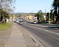
Dawson Road in Thunder Bay, Ontario (2008)

Dawson Road monument in Ste. Anne, Manitoba

Inscription on Dawson Road monument in Ste. Anne, Manitoba


References[]
- ^ a b c d "Dawson Road Plaque (Ste. Anne)". Manitoba Historical Society. March 2012. Retrieved 4 September 2012.
- ^ "Dawson Road". Marianapolis College. April 2005. Retrieved 4 September 2012.
- ^ "Manitoba Heritage Council Commemorative Plaques-Dawson Road". Government of Manitoba. Retrieved 4 September 2012.
- ^ "Dawson Road". The Canadian Encyclopedia. Retrieved 4 September 2012.
External links[]
- Historic trails and roads in Manitoba
- Historic trails and roads in Ontario
- Events of National Historic Significance (Canada)
- Red River Colony
- Roads in Thunder Bay
- Streets and squares in Winnipeg
- Saint Boniface, Winnipeg