Oleśnica, Świętokrzyskie Voivodeship
Oleśnica | |
|---|---|
Town | |
 | |
 Coat of arms | |
 Oleśnica | |
| Coordinates: 50°27′12″N 21°03′54″E / 50.45333°N 21.06500°E | |
| Country | |
| Voivodeship | Świętokrzyskie |
| County | Staszów |
| Gmina | Oleśnica |
| Sołectwo | Oleśnica |
| Elevation | 182.1 m (597.4 ft) |
| Population (31 December 2009 at Census)[1] | |
| • Total | |
| Time zone | UTC+1 (CET) |
| • Summer (DST) | UTC+2 (CEST) |
| Postal code | 28–220 |
| Area code(s) | +48 41 |
| Car plates | TSZ |
| Website | http://www.olesnica.realnet.pl/ |

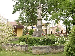
Oleśnica[2][3][4] [ɔlɛɕˈnit͡sa] is a town in Staszów County, Świętokrzyskie Voivodeship, in south-central Poland. It is the seat of the gmina (administrative district) called Gmina Oleśnica. It lies in historic Lesser Poland, approximately 15 kilometres (9 mi) south-west of Staszów and 58 km (36 mi) south-east of the regional capital Kielce.[5] The village has a population of ![]() 1,962, and used to be a town from 1470 to 1869.
1,962, and used to be a town from 1470 to 1869.
During the reign of King Kazimierz Wielki, Oleśnica was the seat of a Roman Catholic parish, which covered the area of 49 square kilometers. The village furthermore served as main residence of the noble Oleśnicki family (later, it belonged to the Zborowski family and the Lubomirski family). The father of Cardinal Zbigniew Oleśnicki was born here.
Oleśnica received Magdeburg rights in the year 1470, and during the Polish Golden Age, it was a small town, with 12 artisans. Furthermore, since the mid-16th century, it was a local center of the Protestant Reformation, with a Calvinist prayer house, opened here in 1563 by Mikolaj Zborowski. The population of the town remained small – in 1673, it was only 184. Oleśnica was completely destroyed in the Great Northern War, and after the Partitions of Poland it briefly belonged to the Habsburg Empire, to be annexed in 1815 by the Russian-controlled Congress Poland, where it remained until 1915. Due to proximity of the tightly locked Austrian – Russian border, Oleśnica's development was halted, and finally, after the January Uprising, it lost the town charter.
Several notable people were born in or connected with Oleśnica. Among them were Dobieslaw Oleśnicki, the castellan of Wojnicz, Lublin and Sandomierz, the starosta of Krakow, who participated in the Battle of Grunwald and commanded the siege of the Malbork Castle in 1410, and Cardinal Zbigniew Olesnicki, the Bishop of Krakow in 1423–1455, as well as many members of the Zborowski family.
Demography[]
According to the 2002 Poland census, there were 1,961 people residing in Oleśnica village, of whom 50.2% were male and 49.8% were female. In the village, the population was spread out, with 28.5% under the age of 18, 38.6% from 18 to 44, 17% from 45 to 64, and 16% who were 65 years of age or older.[1]
Table 1. Population level of village in 2002 — by age group[1] SPECIFICATION Measure
unitPOPULATION
(by age group in 2002)TOTAL 0–9 10–19 20–29 30–39 40–49 50–59 60–69 70–79 80 + I. TOTAL person 1,961 264 353 251 304 266 179 162 131 50 — of which in % 100 13.5 18 12.8 15.5 13.6 9.1 8.3 6.7 2.5 1. BY SEX A. Males person 985 139 196 133 151 147 94 65 46 14 — of which in % 50.2 7.1 10 6.8 7.7 7.5 4.8 3.3 2.3 0.7 B. Females person 976 125 157 118 153 119 85 97 85 36 — of which in % 49.8 6.4 8 6 7.8 6.1 4.3 4.9 4.3 1.8
Figure 1. Population pyramid of village in 2002 — by age group and sex[1]
Table 2. Population level of village in 2002 — by sex[1] SPECIFICATION Measure
unitPOPULATION
(by sex in 2002)TOTAL Males Females I. TOTAL person 1,961 985 976 — of which in % 100 50.2 49.8 1. BY AGE GROUP A. At pre-working age person 558 303 255 — of which in % 28.5 15.5 13 B. At working age. grand total person 1,089 587 502 — of which in % 55.5 29.9 25.6 a. at mobile working age person 756 396 360 — of which in % 38.6 20.2 18.4 b. at non-mobile working age person 333 191 142 — of which in % 17 9.7 7.3 C. At post-working age person 313 95 218 — of which in % 16 4.8 11.2

References[]
- ^ a b c d e "Local Data Bank (Bank Danych Lokalnych) – Layout by NTS nomenclature (Układ wg klasyfikacji NTS)". demografia.stat.gov.pl: GUS. 10 March 2011.
- ^ Bielec, Jan (ed.); Szwałek, Stanisława (1981). Wykaz urzędowych nazw miejscowości w Polsce. T. II: K – P [List of official names of localities in Poland, Vol. II: K – P] (in Polish). Ministry of Administration, Spatial Economy and Environmental Protection (1st ed.). Warsaw, Poland: Central Statistical Office.CS1 maint: extra text: authors list (link)
- ^ Sitek, Janusz (1991). Nazwy geograficzne Rzeczypospolitej Polskiej [Geographical names of the Republic of Poland] (in Polish). Ministry of Physical Planning and Construction, Surveyor General of Poland, Council of Ministers' Office, Commission for Establishing Names of Localities and Physiographical Objects (1st ed.). Warsaw, Poland: Eugeniusz Romer State Cartographical Publishing House. ISBN 83-7000-071-1.
- ^ "Oleśnica, wieś, gmina Oleśnica, powiat staszowski, województwo świętokrzyskie" [Oleśnica, village, Oleśnica Commune, Staszów County, Świętokrzyskie Province, Poland]. Topographical map prepared in 1:10,000 scale. Aerial and satellite orthophotomap (in Polish). Head Office of Geodesy and Cartography, Poland, Warsaw. 2011. geoportal.gov.pl. Retrieved 27 April 2011.
- ^ "Central Statistical Office (GUS) – TERYT (National Register of Territorial Land Apportionment Journal)" (in Polish). 2008-06-01.
| Seat |  | |
|---|---|---|
| Other villages | ||
| Parts of village |
| |
| Hamlets of village |
| |
| Colony |
| |
- Villages in Staszów County
- Lesser Poland
- Kielce Governorate
- Kielce Voivodeship (1919–1939)