Omitama
Omitama
小美玉市 | |
|---|---|
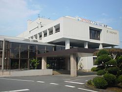 Omitama city hall | |
 Flag  Seal | |
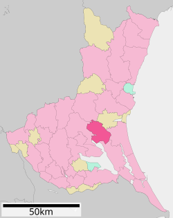 Location of Omitama in Ibaraki Prefecture | |
 Omitama | |
| Coordinates: 36°14′21.4″N 140°21′9.2″E / 36.239278°N 140.352556°ECoordinates: 36°14′21.4″N 140°21′9.2″E / 36.239278°N 140.352556°E | |
| Country | Japan |
| Region | Kantō |
| Prefecture | Ibaraki |
| Area | |
| • Total | 144.74 km2 (55.88 sq mi) |
| Population (October 2020) | |
| • Total | 48,754 |
| • Density | 340/km2 (870/sq mi) |
| Time zone | UTC+9 (Japan Standard Time) |
| - Tree | Zelkova serrata |
| - Flower | Cosmos |
| - Bird | Egret |
| Phone number | 0299-48-1111 |
| Address | 835 Katakura, Omitama-shi, Ibarak-ken 319-0192 |
| Website | Official website |


Omitama (小美玉市, Omitama-shi) is a city located in Ibaraki Prefecture, Japan. As of 1 July 2020, the city had an estimated population of 48,776 in 18,311 households and a population density of 337 persons per km². The percentage of the population aged over 65 was 30.0%.[1] The total area of the city is 144.74 square kilometres (55.88 sq mi).
Geography[]
Omitama is located in central Ibaraki Prefecture, in the low-lying flatlands north of Lake Kasumigaura.
Surrounding municipalities[]
Ibaraki Prefecture
Climate[]
Omitama has a Humid continental climate (Köppen Cfa) characterized by warm summers and cool winters with light snowfall. The average annual temperature in Omitama is 13.7 °C. The average annual rainfall is 1357 mm with September as the wettest month. The temperatures are highest on average in August, at around 25.6 °C, and lowest in January, at around 2.8 °C.[2]
Demographics[]
Per Japanese census data,[3] the population of Omitama has been steadily increasing over the past 40 years.
| Year | Pop. | ±% |
|---|---|---|
| 1920 | 25,143 | — |
| 1930 | 26,330 | +4.7% |
| 1940 | 28,341 | +7.6% |
| 1950 | 37,280 | +31.5% |
| 1960 | 35,675 | −4.3% |
| 1970 | 36,967 | +3.6% |
| 1980 | 48,200 | +30.4% |
| 1990 | 52,269 | +8.4% |
| 2000 | 51,593 | −1.3% |
| 2010 | 47,026 | −8.9% |
History[]
The city of Omitama was established on March 27, 2006, from the merger of the towns of Ogawa and Minori (both from Higashiibaraki District), and the village of Tamari (from Niihari District). The new city took its name from portions of the three older town and village names from which it was formed, Ogawa, Minori, Tamari.
Government[]
Omitama has a mayor-council form of government with a directly elected mayor and a unicameral city council of 20 members. Omitama contributes one member to the Ibaraki Prefectural Assembly. In terms of national politics, the city is part of Ibaraki 2nd district of the lower house of the Diet of Japan.
Economy[]
Agriculture is the mainstay of the local economy, with cash crops including chives, strawberries and melons.
Education[]
Omitama has 11 public elementary schools and four public middle schools operated by the city government, and one public high school operated by the Ibaraki Prefectural Board of Education.
Transportation[]

Railway[]
![]() JR East – Jōban Line
JR East – Jōban Line
Highway[]
 Jōban Expressway – Minori Parking Area
 National Route 6
 National Route 355
Airport[]
Military facilities[]
Sister city relations[]
 Abilene, Kansas, USA
Local attractions[]
This section needs expansion. You can help by . (December 2015) |
Noted people from Omitama[]
- Yuya Niwa, politician
- Jun Yanagisawa, professional football player
References[]
- ^ "Ibaraki prefectural official statistics" (in Japanese). Japan.
- ^ Omitama climate data
- ^ Omitama population statistics
External links[]
| Wikimedia Commons has media related to Omitama, Ibaraki. |
- Official Website (in Japanese)
| show Authority control |
|---|
- Cities in Ibaraki Prefecture
- Omitama