Onion Creek (Texas)
| Onion Creek (Texas) | |
|---|---|
 Onion Creek in McKinney Falls State Park | |
 | |
| Location | |
| Country | United States |
| Physical characteristics | |
| Source | |
| • location | Dripping Springs, Texas |
| Mouth | |
• location | Colorado River |
• elevation | 374 feet (114 m) |
| Length | 79 miles (127 km) |
| Basin size | Onion Creek Watershed |
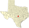
Onion Creek is a small tributary stream of the Colorado River in Texas. It begins 12 mi (19 km) southeast of Johnson City, Blanco County, Texas, and flows approximately 79 mi (127 km) eastward into the Colorado River, 2 mi (3.2 km) northwest of Garfield in Travis County, Texas.[1] While areas surrounding the creek's origin in Blanco County are primarily rural, areas closer to its mouth in Travis County have more urban and industrial development.[2] Passing near Dripping Springs, Driftwood, and Onion Creek, Onion Creek is the source of the waterfalls in McKinney Falls State Park.[1] Onion Creek's watershed spans an area of 211 sq mi (550 km2).
2013 Flood[]
On October 31, 2013 Onion Creek experienced historic levels of flooding, cresting at 40.15 ft, a level not seen since 1921. Over the course of 4h 9-10in of rain fell in the Onion Creek watershed.[3][4][5]
See also[]
References[]
- ^ a b "Onion Creek (Blanco County)". Handbook of Texas Online. Texas State Historical Association. Retrieved January 27, 2013.
- ^ Gundlach, Laura. "Effects of Urbanization on the Onion Creek Watershed" (PDF). University of Texas at Austin. Retrieved January 27, 2013.
- ^ https://cdn.ymaws.com/www.tfma.org/resource/resmgr/2014_Spring_Conference_Presentations/D2-The_Hallowwen_Flood-Travi.pdf
- ^ "Memories of 2013 flood haunt Onion Creek residents forced to flee".
- ^ "Historic flash flood leaves devastation in Austin".
- "An Analysis of Texas Waterways". Retrieved 2006-05-04.
- USGS Geographic Names Information Service
- USGS Hydrologic Unit Map - State of Texas (1974)
External links[]
| Wikimedia Commons has media related to Onion Creek (Texas). |
- Rivers of Texas
- Tributaries of the Colorado River (Texas)
- Rivers of Blanco County, Texas
- Rivers of Travis County, Texas
- Geography of Austin, Texas
- Greater Austin geography stubs
- Texas river stubs
