Onyx River
| Onyx River | |
|---|---|
 Onyx River flowing into Lake Vanda | |
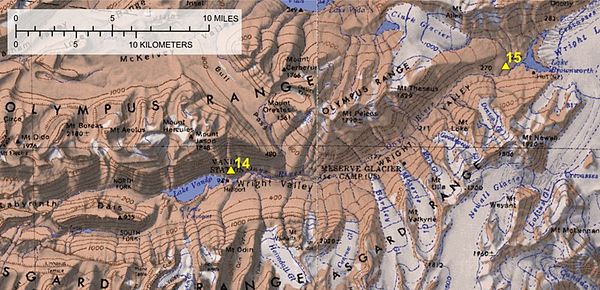
 Onyx River Map | |
| Location | |
| Country | Antarctica |
| Physical characteristics | |
| Source | Lake Brownworth |
| • coordinates | 77°25′48″S 162°45′0″E / 77.43000°S 162.75000°E |
| Mouth | Lake Vanda |
• coordinates | 77°33′24″S 161°45′0″E / 77.55667°S 161.75000°ECoordinates: 77°33′24″S 161°45′0″E / 77.55667°S 161.75000°E |
| Length | 32 km (20 mi) |
The Onyx River is an Antarctic meltwater stream which flows westward through the Wright Valley from Wright Lower Glacier and Lake Brownworth at the foot of the glacier to Lake Vanda, during the few months of the Antarctic summer. At 32 kilometres (20 mi) in length, it is the longest river in Antarctica.[1]
Geography[]
The Onyx River flows away from the ocean, an example of endorheic drainage, as the Wright Lower Glacier blocks the mouth of the Wright Valley. It has several tributaries, and there are multiple meteorological stations along the length of the river. Flow levels are highly variable, both during the day and between summers, with the river failing to reach the lake some years. In contrast, it can cause significant erosion in flood years, and was rafted in 1984 by New Zealand researchers. At one time, the river's discharge reached 20 cubic metres per second (700 cu ft/s).[2]
Environment[]
There are no fish in the Onyx River, but it supports microscopic life, and the algal blooms can be quite extensive. The environment consists mainly of cyanobacteria and other algae. A few small animals (nematodes, tardigrades, and rotifers) live in the river. Skuas are also occasionally present in the area.[3]
Monitoring[]
The Onyx River is one of the many sites studied by the United States Antarctic Program of the National Science Foundation. The Antarctica New Zealand program once maintained a semi-permanent camp at Lake Vanda which has since been removed. There is a small research shelter at Lake Vanda at its eastern end. Nearby is the Comprehensive Test Ban Treaty Seismic station at Bull Pass.
See also[]
References[]
- ^ Nick Middleton. Rivers: A Very Short Introduction. (page 26) ISBN 9780199588671
- ^ [1]. The Antarctic Sun. 27 September 2013. Retrieved 18 April 2015
- ^ McKnight, Diane M.; Niyogi, Dev K.; Alger, Alexander S.; Bomblies, Arne; Conovitz, Peter A.; Tate, Cathy M. (December 1, 1999). "Dry Valley Streams in Antarctica: Ecosystems Waiting for Water". BioScience. 49 (12): 985–995. doi:10.2307/1313732. JSTOR 1313732.
References[]
- "Antarctica’s longest river", p 16, and "What the flood revealed", pp 15–21, Antarctic Sun, January 26, 2003
- Onyx river and Dry Valleys low altitude aerial videos
- Rivers of Antarctica
- Rivers of Victoria Land
- McMurdo Dry Valleys