Oosthuizen
Oosthuizen | |
|---|---|
Village | |
 | |
 Coat of arms | |
 | |
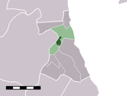 The village centre (darkgreen) and the statistical district (lightgreen) of Oosthuizen in the former municipality of Zeevang. | |
| Coordinates: 52°34′15″N 4°59′45″E / 52.57083°N 4.99583°ECoordinates: 52°34′15″N 4°59′45″E / 52.57083°N 4.99583°E | |
| Country | Netherlands |
| Province | North Holland |
| Municipality | Edam-Volendam |
| Area | |
| • Total | 6.76 km2 (2.61 sq mi) |
| Population (2009)[1] | |
| • Total | 3,224 |
| • Density | 480/km2 (1,200/sq mi) |
| Time zone | UTC+1 (CET) |
| • Summer (DST) | UTC+2 (CEST) |
| Postal code | 1474 |
| Dialing code | 0299 |

Oosthuizen is a village in the Dutch province of North Holland. It is a part of the municipality of Edam-Volendam, and lies about 8 km north of Purmerend.
Oosthuizen was a separate municipality until 1970, when the new municipality of Zeevang was created.[2]
In 2001, the village of Oosthuizen had 2940 inhabitants. The built-up area of the village was 0.49 km², and contained 1153 residences.[3] The statistical district "Oosthuizen", which covers the village and the surrounding countryside including the hamlet of Etersheim, has a population of around 3220.[4]

Church in Oosthuizen
Notable people[]
- Adriaan de Bruin (ca. 1700-1766)
References[]
- ^ Gemeente Zeevang (2009) "Gemeente in cijfers" Gemeentegids Amsterdam: De Telefoongids BV pp. 7.
- ^ Ad van der Meer and Onno Boonstra, Repertorium van Nederlandse gemeenten, KNAW, 2011.
- ^ Statistics Netherlands (CBS), Bevolkingskernen in Nederland 2001 [1]. Statistics are for the continuous built-up area.
- ^ Statistics Netherlands (CBS), Statline: Kerncijfers wijken en buurten 2003-2005 [2]. As of 1 January 2005.
External links[]
| Wikimedia Commons has media related to Oosthuizen. |
- J. Kuyper, Gemeente Atlas van Nederland, 1865-1870, "Oosthuizen". Map of the former municipality, around 1868.
| Authority control |
|
|---|
This North Holland location article is a stub. You can help Wikipedia by . |
Categories:
- Populated places in North Holland
- Former municipalities of North Holland
- Geography of Edam-Volendam
- North Holland geography stubs