Orb (river)
| Orb | |
|---|---|
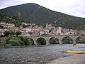
 The Orb in Béziers | |
| Native name | L'Orb (m) (French) |
| Location | |
| Country | France |
| Physical characteristics | |
| Source | |
| • location | Massif Central |
| • elevation | 820 m (2,690 ft) |
| Mouth | |
• location | Mediterranean Sea |
• coordinates | 43°14′47″N 3°17′54″E / 43.24639°N 3.29833°ECoordinates: 43°14′47″N 3°17′54″E / 43.24639°N 3.29833°E |
| Length | 135.6 km (84.3 mi) |
| Basin size | 1,400 km2 (540 sq mi) |
| Discharge | |
| • average | 25 m3/s (880 cu ft/s) |

The Orb is a 135.6-kilometre (84.3 mi) long river in the Hérault department in southern France.[1] It flows into the Mediterranean Sea at Valras-Plage. The river flows through the towns of Bédarieux and Béziers, where it is crossed by the canal du Midi on the Orb Aqueduct. In ancient times, the Orb was crossed at Capestang by the 1,500-metre (4,900 ft) long Roman Pont Serme.[2]
Geography[]
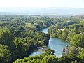
The Orb flows through the following communes:
- Ceilhes-et-Rocozels
- Avène
- Le Bousquet-d'Orb
- La Tour-sur-Orb
- Bédarieux
- Hérépian
- Lamalou-les-Bains
- Le Poujol-sur-Orb
- Roquebrun
- Cessenon-sur-Orb
- Lignan-sur-Orb
- Béziers
- Sauvian
- Sérignan
- Valras-Plage

Tributaries[]
The following rivers flow into the Orb:
- Jaur 30 kilometres (19 mi)
- Lirou 30 kilometres (19 mi)
- Mare 29 kilometres (18 mi)
- Taurou 25 kilometres (16 mi)
- Vernazobre 24 kilometres (15 mi)
- Rieutort 18 kilometres (11 mi)
- Héric 14 kilometres (9 mi)
References[]
- ^ Sandre. "Fiche cours d'eau - L'Orb (Y25-0400)".
- ^ Colin O’Connor: Roman Bridges, Cambridge University Press 1993, ISBN 0-521-39326-4, p. 99
External links[]
| Wikimedia Commons has media related to Orb River. |
| hide Authority control | |
|---|---|
| General |
|
| National libraries | |
| Other |
|
This Hérault geographical article is a stub. You can help Wikipedia by . |
Categories:
- Rivers of France
- Rivers of Occitanie
- Rivers of Hérault
- Coastal basins of the Mediterranean Sea in France
- Hérault geography stubs
- France river stubs