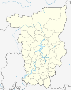
Orda, Perm Krai
Orda
Орда | |
|---|---|
Selo | |
 Flag | |
show Location of Orda | |
 Orda Location of Orda | |
| Coordinates: 57°11′44″N 56°55′12″E / 57.19556°N 56.92000°ECoordinates: 57°11′44″N 56°55′12″E / 57.19556°N 56.92000°E | |
| Country | Russia |
| Federal subject | Perm Krai |
| Administrative district | Ordinsky District |
| First mentioned | 1662 |
| Population | |
| • Total | 5,375 |
Administrative status | |
| • Capital of | Ordinsky District |
| Time zone | UTC+5 (MSK+2 |
| Postal code(s)[3] | |
| OKTMO ID | 57638428101 |
Orda (Russian: Орда) is a rural locality (a selo) and the administrative center of Ordinsky District of Perm Krai, Russia, located on the Kungur River (a tributary of the Iren River. Population: 5,375 (2010 Census);[1] 5,404 (2002 Census);[4] 4,850 (1989 Census).[5]
Orda was first mentioned in written sources in 1662.[citation needed] It has served as the administrative center of Ordinsky District since 1924, with a brief interruption in 1963–1965. It is named for the .
Near Orda is the only entrance to the Orda Cave, one of the longest underwater caves and the largest underwater gypsum cave in the world.
References[]
- ^ Jump up to: a b Russian Federal State Statistics Service (2011). Всероссийская перепись населения 2010 года. Том 1 [2010 All-Russian Population Census, vol. 1]. Всероссийская перепись населения 2010 года [2010 All-Russia Population Census] (in Russian). Federal State Statistics Service.
- ^ "Об исчислении времени". Официальный интернет-портал правовой информации (in Russian). June 3, 2011. Retrieved January 19, 2019.
- ^ Почта России. Информационно-вычислительный центр ОАСУ РПО. (Russian Post). Поиск объектов почтовой связи (Postal Objects Search) (in Russian)
- ^ Russian Federal State Statistics Service (May 21, 2004). Численность населения России, субъектов Российской Федерации в составе федеральных округов, районов, городских поселений, сельских населённых пунктов – районных центров и сельских населённых пунктов с населением 3 тысячи и более человек [Population of Russia, Its Federal Districts, Federal Subjects, Districts, Urban Localities, Rural Localities—Administrative Centers, and Rural Localities with Population of Over 3,000] (XLS). Всероссийская перепись населения 2002 года [All-Russia Population Census of 2002] (in Russian).
- ^ Всесоюзная перепись населения 1989 г. Численность наличного населения союзных и автономных республик, автономных областей и округов, краёв, областей, районов, городских поселений и сёл-райцентров [All Union Population Census of 1989: Present Population of Union and Autonomous Republics, Autonomous Oblasts and Okrugs, Krais, Oblasts, Districts, Urban Settlements, and Villages Serving as District Administrative Centers]. Всесоюзная перепись населения 1989 года [All-Union Population Census of 1989] (in Russian). Институт демографии Национального исследовательского университета: Высшая школа экономики [Institute of Demography at the National Research University: Higher School of Economics]. 1989 – via Demoscope Weekly.
Categories:
- Rural localities in Perm Krai
- Osinsky Uyezd


