Osan
This article needs additional citations for verification. (February 2012) |
Osan
오산시 | |
|---|---|
Municipal City | |
| Korean transcription(s) | |
| • Hangul | 오산시 |
| • Hanja | 烏山市 |
| • Revised Romanization | Osan-si |
| • McCune-Reischauer | Osan-si |
 Flag Emblem of Osan | |
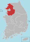
 Location in South Korea | |
| Country | |
| Region | Sudogwon |
| Administrative divisions | 6 dong |
| Area | |
| • Total | 42.76 km2 (16.51 sq mi) |
| Population (2011) | |
| • Total | 193,892 |
| • Density | 2,824.2/km2 (7,315/sq mi) |
| • Dialect | Seoul |
Osan (Korean pronunciation: [o.san]) is a city in Gyeonggi Province, South Korea, approximately 35 km (22 mi) south of Seoul. The population of the city is around 200,000. The local economy is supported by a mix of agricultural and industrial enterprises.
It is famous for one of the largest markets in South Korea, , which has been in continuous operation since 1792.[citation needed] The city was the scene of brutal battles with communist forces taking the city during the Korean War in 1950 (see Battle of Osan), before being then taken back by American forces soon afterwards; there is a statue dedicated to UN forces on the outskirts of the city.
The United States Air Force base named after the city, Osan AB, is not actually located in the city, but is instead 8 km (5.0 mi) south, in the Songtan section (formerly a separate city) of Pyeongtaek.
Osan Station is a large subway station located in the heart of Osan. It is part of the Seoul Subway Line 1 and the KTX. There is a bus terminal next to the subway station and many buses stop in front of the subway station.
Name[]
Osan came to be called by its current name in 1914, at the time of a general reorganization of local governments under Japanese rule. At that time it became Osan-myeon, part of Suwon. This name in turn was taken from that of a local stream, the . However, prior to the Japanese occupation, the name had been rendered in hanja as 鰲山, meaning "soft-shelled turtle mountain." Because of the complexity of the 鰲 ("o") character, and because crows were abundant in the area, the Japanese changed the name to 烏山, meaning "crow mountain school."[citation needed]
Statistics[]
- based on the data created in dec 2011
| Population: | 193,892 |
| Daily Deaths: | 1.1 |
| Daily Marriage: | 3.7 |
| Daily Divorce: | 0.9 |
| Fires a Day: | 0.3 |
| Students per Teacher: | 29 |
| Number of Cars: | 71,572 |
Administrative districts[]
The administrative districts of Osan City consists of six administrative districts and 24 legal districts. Osan City has a population of 228,111 and 97,348 households as of the end of June 2020.[1]
| Name | Hangul | Hanja | Household | Population | Area | Legal districts |
|---|---|---|---|---|---|---|
| Chopyeong-dong | 초평동 | 楚坪洞 | 6,946 | 16,204 | 6.48 km² | Beoreum-dong (벌음동; 伐音洞), Dugok-dong (두곡동; 斗谷洞), Part of Gasu-dong (가수동; 佳水洞), Part of Nueup-dong (누읍동; 樓邑洞), Seo-dong (서동; 西洞), Tap-dong (탑동; 塔洞) |
| Daewon-dong | 대원동 | 大園洞 | 26,921 | 64,484 | 6.20 km² | Part of Busan-dong (부산동; 釜山洞), Cheongho-dong (청호동; 淸湖洞), Part of Galgot-dong (갈곶동; 葛串洞), Gohyeon-dong (고현동; 高峴洞), Part of Osan-dong (오산동; 烏山洞), Won-dong (원동; 園洞) |
| Jungang-dong | 중앙동 | 中央洞 | 14,080 | 36,243 | 3.66 km² | Part of Busan-dong, Part of Eungye-dong (은계동; 銀溪洞), Part of Osan-dong |
| Namchon-dong | 남촌동 | 南村洞 | 12,895 | 19,925 | 6.06 km² | Cheonghak-dong (청학동; 靑鶴洞), Gajang-dong (가장동; 佳長洞), Part of Galgot-dong, Part of Gasu-dong, Part of Gwol-dong (궐동; 闕洞), Part of Osan-dong |
| Sema-dong | 세마동 | 洗馬洞 | 12,519 | 31,862 | 13.32 km² | Jigot-dong (지곶동; 紙串洞), Oesammi-dong (외삼미동; 外三美洞), Segyo-dong (세교동; 細橋洞), Seorang-dong (서랑동; 西廊洞), Yangsan-dong (양산동; 陽山洞) |
| Sinjang-dong | 신장동 | 新場洞 | 23,987 | 59,393 | 7.04 km² | Part of Eungye-dong, Geumam-dong (금암동; 錦岩洞), Part of Gwol-dong, Naesammi-dong (내삼미동; 內三美洞), Sucheong-dong (수청동; 水淸洞) |
| Total | 97,348 | 228,111 | 42.76 km² |
Sister cities[]
 Hidaka, Saitama, Japan [2]
 Ürümqi, Xinjiang, China
 Killeen, Texas, U.S.
- Miami, Florida, U.S.
 Qazvin, Iran
Economy[]
Kyochon, a fried chicken chain, has its head office in Osan.[3]
See also[]
- List of Korea-related topics
- List of cities in South Korea
- Geography of South Korea
References[]
- ^ [1]." Retrieved on March 1, 2020.
- ^ "International Exchange". List of Affiliation Partners within Prefectures. Council of Local Authorities for International Relations (CLAIR). Archived from the original on 4 January 2016. Retrieved 21 November 2015.
- ^ "Contact." Kyochon. Retrieved on November 3, 2009.
- 오산시의 지명 유래. Retrieved 2006-03-23.[permanent dead link]
External links[]
- City government website (in English)
- City Council website (in English)
Coordinates: 37°08′59″N 127°04′38″E / 37.149799°N 127.077116°E

| Authority control |
|
|---|
- Osan
- Cities in Gyeonggi Province