Osterburken
show This article may be expanded with text translated from the corresponding article in German. (February 2009) Click [show] for important translation instructions. |
Osterburken | |
|---|---|
 Main train station | |
 Coat of arms | |
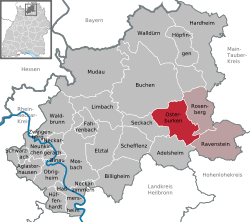
show Location of Osterburken within Neckar-Odenwald-Kreis district | |
 Osterburken | |
| Coordinates: 49°25′51″N 9°25′34″E / 49.43083°N 9.42611°ECoordinates: 49°25′51″N 9°25′34″E / 49.43083°N 9.42611°E | |
| Country | Germany |
| State | Baden-Württemberg |
| District | Neckar-Odenwald-Kreis |
| Subdivisions | 4 |
| Government | |
| • Mayor | Jürgen Galm (CDU) |
| Area | |
| • Total | 47.32 km2 (18.27 sq mi) |
| Elevation | 247 m (810 ft) |
| Population (2020-12-31)[1] | |
| • Total | 6,549 |
| • Density | 140/km2 (360/sq mi) |
| Time zone | UTC+01:00 (CET) |
| • Summer (DST) | UTC+02:00 (CEST) |
| Postal codes | 74706 |
| Dialling codes | 06291, 06292, 06295 |
| Vehicle registration | MOS, BCH |
| Website | www.osterburken.de |


Osterburken (![]() pronunciation (help·info)) is a town in the Neckar-Odenwald district, in Baden-Württemberg, Germany. It is situated 28 km southwest of Tauberbischofsheim, 50 km northeast of Heilbronn, 90 km east of Heidelberg, 60 km southwest of Würzburg and 30 km east of Mosbach. The S1 S-Bahn line of VRN public transport service operates between Homburg (Saarland) and Osterburken, hence the train station here is used frequently to transfer to and from other trains.
pronunciation (help·info)) is a town in the Neckar-Odenwald district, in Baden-Württemberg, Germany. It is situated 28 km southwest of Tauberbischofsheim, 50 km northeast of Heilbronn, 90 km east of Heidelberg, 60 km southwest of Würzburg and 30 km east of Mosbach. The S1 S-Bahn line of VRN public transport service operates between Homburg (Saarland) and Osterburken, hence the train station here is used frequently to transfer to and from other trains.
| show Towns and municipalities in Neckar-Odenwald (district) |
|---|
References[]
- ^ "Bevölkerung nach Nationalität und Geschlecht am 31. Dezember 2020". Statistisches Landesamt Baden-Württemberg (in German). June 2021.
| show Authority control |
|---|
This Neckar-Odenwald location article is a stub. You can help Wikipedia by . |
Categories:
- Towns in Baden-Württemberg
- Neckar-Odenwald-Kreis
- Karlsruhe region geography stubs