Ouled Hamla
Aïn Zitoun | |
|---|---|
Commune and town | |
 | |
 | |
 Aïn Zitoun | |
| Coordinates: Coordinates: 36°05′N 6°28′E / 36.083°N 6.467°E | |
| Country | |
| Province | Oum El Bouaghi Province |
| Population (1998) | |
| • Total | 5,993 |
| Time zone | UTC+1 (CET) |

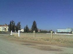
Ouled Hamla (In Arabic أولاد حملة) is a town located in Daira of Ain M'lila - Wilaya d Oum El Bouaghi - Algeria.
Bordered on the north-west by the municipality of Teleghma (wilaya of Mila), the Commune south-west by the municipality of (wilaya of Constantine) to North-east, and by Ain M'lila south-east. The commune of Ouled Hamla covers an area of 152 km ². The population is estimated at 11,546 inhabitants, or a density of 75.96 inhabitants km2.
The main crops have been maintained over the centuries, including cereal, including wheat and barley. Other important agricultural products include potato, tomato, pepper, carrot ... etc.
Etymology[]
From about 1830 to 1962, the name of Ouled Hamla was Bertaux, for the name of a French colonel who lived there during the French colonization.
The word ouled means "sons of" in Maghrebi Arabic.
Capital: Oum El Bouaghi | ||
| Districts |  | |
| Communes |
| |
- Communes of Oum El Bouaghi Province