Pánuco River
| Pánuco River Río de Canoas | |
|---|---|
 Pánuco River, a.k.a. Río de Canoas. Copper-plate engraving from Dutch artist Jan Karel Donatus van Beecq. | |
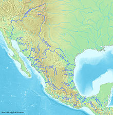 Major rivers of Mexico, with Pánuco near the center | |
 Location of mouth | |
| Native name | Río Pánuco (Spanish) |
| Location | |
| Country | |
| States | Mexico Hidalgo Querétaro San Luis Potosí Tamaulipas Veracruz |
| Physical characteristics | |
| Source | |
| • location | Confluence of Moctezuma and |
| • coordinates | 21°58′05″N 98°33′48″W / 21.96806°N 98.56333°W |
| • elevation | 3,800 metres (12,500 ft) |
| Mouth | |
• location | Gulf of Mexico at Ciudad Madero |
• coordinates | 22°16′00″N 97°47′00″W / 22.26667°N 97.78333°WCoordinates: 22°16′00″N 97°47′00″W / 22.26667°N 97.78333°W |
• elevation | 0 m (0 ft) |
| Length | 510 kilometres (320 mi) |
| Basin size | 84,956 square kilometres (32,802 sq mi) |
| Discharge | |
| • location | Las Adjuntas |
| • average | 481 cubic metres per second (17,000 cu ft/s) |

The Pánuco River (Spanish: Río Pánuco, Spanish pronunciation: [ˈpanuko] (![]() listen)), also known as the Río de Canoas, is a river in Mexico fed by several tributaries including the Moctezuma River and emptying into the Gulf of Mexico. The river is approximately 510 kilometres (320 mi) long and passes through or borders the states of Mexico, Hidalgo, Querétaro, San Luis Potosí, Tamaulipas, and Veracruz. Since one of the headwaters of the Moctezuma River is the Tula River, the Pánuco ultimately drains the Valley of Mexico containing Mexico City.
listen)), also known as the Río de Canoas, is a river in Mexico fed by several tributaries including the Moctezuma River and emptying into the Gulf of Mexico. The river is approximately 510 kilometres (320 mi) long and passes through or borders the states of Mexico, Hidalgo, Querétaro, San Luis Potosí, Tamaulipas, and Veracruz. Since one of the headwaters of the Moctezuma River is the Tula River, the Pánuco ultimately drains the Valley of Mexico containing Mexico City.
Description[]

Near its source, the Pánuco serves as a drainage channel for Mexico City. From there, it becomes the state border between Hidalgo and Querétaro as it moves toward San Luis Potosí. It takes the name Río Pánuco only upon reaching the state of Veracruz. It empties into the Gulf of Mexico at Tampico and Ciudad Madero, where it forms the border between the states of Tamaulipas and Veracruz. The Tampico Bridge crosses the river near its mouth on the Gulf.
In total, the Pánuco is more than 500 km in length, though only the last 15 km is navigable for larger ships. According to the Atlas of Mexico, it is the fourth-largest river in Mexico by volume of runoff, and forms the sixth-largest river basin in Mexico by area. The complete watershed of the Pánuco and its tributaries drains portions of Tamaulipas, San Luis Potosí, Guanajuato, Querétaro, Hidalgo, Mexico, Puebla, and Veracruz.
In 1519, during his cartographic expeditions along the western coast of the Gulf of Mexico, Spanish explorer Alonso Álvarez de Pineda established a settlement on the river, which he named Las Palmas, though it was abandoned after he was killed in battle with indigenous peoples living nearby.[1]:132,309
Ecology[]

The Pánuco River basin is rich in fish. There are almost 100 fish species, including a few that were introduced.[2] There are many endemics: six Nosferatu cichlid species, five Tampichthys minnows, nine "northern swordtails" (genus Xiphophorus), three Gambusia species, two Ictalurus catfish, the bluetail goodeid (Ataeniobius toweri), dusky splitfin (Goodea gracilis), relict splitfin (Xenoophorus captivus), pygmy shiner (Notropis tropicus), checkered pupfish (Cualac tessellatus), broadspotted molly (Poecilia latipunctata), Tamasopo cichlid (Herichthys tamasopoensis), Calabazas shiner (Notropis calabazas) and (Ictiobus labiosus).[2] Additionally, a couple of still-undescribed species are known from this river basin.[2][3] A few of the endemics are seriously threatened.[4]
See also[]
References and external links[]
- "River Basins", Atlas of Mexico, 1975, with topographical map
- "Panuco", Freshwater Ecoregions of the World
- "Tales of Southern Rivers", by Zane Grey , 1924, True story of descent of Santa Rosa and Panuco Rivers
References[]
- ^ Diaz, B., 1963, The Conquest of New Spain, London: Penguin Books, ISBN 0140441239
- ^ Jump up to: a b c Soto-Galera, E.; Alcántara-Soria, L.; Paulo-Maya, J. (2011). "Estado actual de la ictiofauna dulceacuícola de la provincia del complejo Tamesí-Pánuco" (PDF). Instituto Politécnico Nacional. Escuela Nacional de Ciencias Biológicas. Informe final SNIB-CONABIO proyecto No. FM027. México, D.F.
- ^ Schönhuth, S.; I. Doadrio; O. Dominguez-Dominguez; D.M. Hillis; R.L. Mayden (2008). "Molecular evolution of southern North American Cyprinidae (Actinopterygii), with the description of the new genus Tampichthys from central Mexico". Molecular Phylogenetics and Evolution. 47 (2): 729–756. doi:10.1016/j.ympev.2007.11.036.
- ^ Ceballos, G.; E.D. Pardo; L.M Estévez; H.E. Pérez, eds. (2016). Los peces dulceacuícolas de México en peligro de extinción. ISBN 978-607-16-4087-1.
| hide Authority control | |
|---|---|
| General |
|
| National libraries | |
| Other | |
This article related to a river in Mexico is a stub. You can help Wikipedia by . |
- Pánuco River
- Rivers of San Luis Potosí
- Rivers of Tamaulipas
- Rivers of Veracruz
- Drainage basins of the Gulf of Mexico
- Tampico
- Mexico river stubs