Pâncota
This article needs additional citations for verification. (October 2012) |
Pâncota | |
|---|---|
 Coat of arms | |
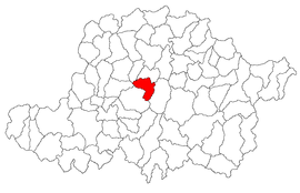 Location in Arad County | |
 Pâncota Location in Romania | |
| Coordinates: 46°19′21″N 21°41′13″E / 46.32250°N 21.68694°ECoordinates: 46°19′21″N 21°41′13″E / 46.32250°N 21.68694°E | |
| Country | Romania |
| County | Arad |
| Government | |
| • Mayor (2020–2024) | Dan-Ștefan Pocrișer[1] (PSD) |
| Area | 66.96 km2 (25.85 sq mi) |
| Population (2011)[2] | 6,946 |
| • Density | 100/km2 (270/sq mi) |
| Time zone | EET/EEST (UTC+2/+3) |
| Vehicle reg. | AR |

Pâncota (Hungarian: Pankota) is a town in Arad County, Crișana, Romania. The town is situated at a 37 km distance from the county capital (Arad), in the central zone of the county, at the contact zone of the Arad Plateau and Zărand Mountains. The administrative territory of the town is 70.9 square km. The town administers one village, Măderat (Magyarád).
The first mention in documents of the locality dates back to 1202-1203 when it was known as villa Pankota.
History[]

This section needs expansion. You can help by . (May 2013) |
The centre of the town was ravaged by invaders for several times. The Turks captured the town repeatedly. In 1687[citation needed] it got under the administration of the Habsburg empire as confirmed by the Treaty of Karlowitz in 1699.
Until 1918, Pâncota was part of the Austrian monarchy, province of Hungary;[3] in Transleithania after the compromise of 1867 in the Kingdom of Hungary.
The post-office was opened in 1855. The Treaty of Trianon (1920) attributed the Arad region to Romania (the Great Romanian Union).
Economy[]
The town's present-day economy can be characterized by a powerful dynamic force with significant developments in all the sectors. Industry of building materials, furniture industry, light industry, food industry, services and tourism are the most representative economic sectors. Pâncota is an important centre of winegrowing, in the Maderat region, with the vineyards Pâncota, Silindia and Mocrea.[4]
Tourist attractions[]
Among the most significant touristic sights of the town are the urban environs along Tudor Vladimirescu Street, the old post office, the "Sulkowski" palace, the Matca channel - an important hydrotechnical work and the Green House (Casa verde) situated on the main Boulevard.
Demographics[]
| Year | Pop. | ±% |
|---|---|---|
| 1977 | 7,206 | — |
| 1992 | 7,446 | +3.3% |
| 2002 | 7,418 | −0.4% |
| 2011 | 6,651 | −10.3% |
| Source: Census data | ||
According to the 2011 census its population counts 6651 inhabitants. From an ethnical point of view it has the following structure: 78.54% are Romanians, 10.91% Roma, 6.63% Hungarians, 2.13% Germans, 0.25% Slovaks, 0.91% Ukrainians and 0.1% are of other or undeclared nationalities
References[]
| Wikimedia Commons has media related to Pâncota. |
- ^ "Results of the 2020 local elections". Central Electoral Bureau. Retrieved 8 June 2021.
- ^ "Populaţia stabilă pe judeţe, municipii, oraşe şi localităti componenete la RPL_2011" (in Romanian). National Institute of Statistics. Retrieved 4 February 2014.
- ^ Handbook of Austria and Lombardy-Venetia Cancellations on the Postage Stamp Issues 1850-1864, by Edwin MUELLER, 1961.
- ^ "VinClub". Dce.gov.ro. Archived from the original on 2012-12-21. Retrieved 2012-10-14.

| Authority control |
|
|---|
This Arad County location article is a stub. You can help Wikipedia by . |
- Populated places in Arad County
- Towns in Romania
- Localities in Crișana
- Arad County geography stubs