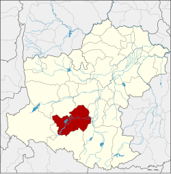
Pak Thong Chai district
This article does not cite any sources. (May 2018) |
Pak Thong Chai
ปักธงชัย | |
|---|---|
 District location in Nakhon Ratchasima province | |
| Coordinates: 14°43′11″N 102°1′17″E / 14.71972°N 102.02139°ECoordinates: 14°43′11″N 102°1′17″E / 14.71972°N 102.02139°E | |
| Country | Thailand |
| Province | Nakhon Ratchasima |
| Seat | Mueang Pak |
| Area | |
| • Total | 1,374.3 km2 (530.6 sq mi) |
| Population (2007) | |
| • Total | 115,244 |
| • Density | 83.9/km2 (217/sq mi) |
| Time zone | UTC+7 (ICT) |
| Postal code | 30150 |
| Geocode | 3014 |
Pak Thong Chai (Thai: ปักธงชัย, pronounced [pàk tʰōŋ t͡ɕʰāj]) is a district (amphoe) in the southern part of Nakhon Ratchasima province, northeastern Thailand.
History[]
The area was an important city in the Khmer era, controlled by Mueang Phimai. In the reign of King U Thong of Ayutthaya it was named Mueang Pak. When King Narai the Great built Mueang Nakhon Ratchasima as the northeastern frontier city of Ayutthaya, Mueang Pak was a frontier city of Nakhon Ratchasima, then called Dan Chapo (ด่านจะโปะ). King Taksin the Great changed the name of the city to Pak Thong Chai and set aside this area for Lao people from Vientiane kingdom. He promoted Phia Upparacha of Vientiane to be Phraya Wongsa Akkharat (พระยาวงษาอรรคราช), the governor of Pak Thong Chai.
King Chulalongkorn (Rama V) changed the city status to a district (amphoe) in 1908 as part of the thesaphiban administrative reforms.
Geography[]
Neighboring districts are (from the north clockwise): Sung Noen, Mueang Nakhon Ratchasima, Chok Chai, Khon Buri, and Wang Nam Khiao.
Administration[]
The district is divided into 16 sub-districts (tambons), which are further subdivided into 215 villages (mubans). There are six sub-district municipalities (thesaban tambons): Mueang Pak, covering parts of tambons Mueang Pak and Thong Chai Nuea; Pak Thong Chai, part of tambon Pak Thong Chai; and Takhop covering part of tambon Takhop; Nok Ok, Lam Nang Kaeo, and Bo Pla Thong, and Nok Ok, Lam Nang Kaeo, and Bo Pla Thong each cover parts of the same-named tambons.
| No. | Name | Thai | Pop. |
|---|---|---|---|
| 1. | Mueang Pak | เมืองปัก | 18,515 |
| 2. | Takhu | ตะคุ | 12,224 |
| 3. | Khok Thai | โคกไทย | 4,577 |
| 4. | Samrong | สำโรง | 3,445 |
| 5. | Takhop | ตะขบ | 14,214 |
| 6. | Nok Ok | นกออก | 6,083 |
| 7. | Don | ดอน | 4,279 |
| 9. | Tum | ตูม | 5,476 |
| 10. | Ngio | งิ้ว | 6,514 |
| 11. | Sakae Rat | สะแกราช | 8,787 |
| 12. | Lam Nang Kaeo | ลำนางแก้ว | 5,020 |
| 16. | Phu Luang | ภูหลวง | 5,384 |
| 17. | Thong Chai Nuea | ธงชัยเหนือ | 8,362 |
| 18. | Suk Kasem | สุขเกษม | 4,732 |
| 19. | Kasem Sap | เกษมทรัพย์ | 3,535 |
| 20. | Bo Pla Thong | บ่อปลาทอง | 4,097 |
Missing numbers correspond to tambons which now form Wang Nam Khiao District.
External links[]
- amphoe.com (Thai)
- Districts of Nakhon Ratchasima province
- Isan geography stubs
