Palo Alto, Aguascalientes
Palo Alto | |
|---|---|
| Nickname(s): Palo Ranch | |
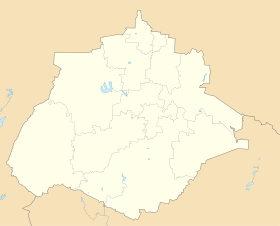 Palo Alto Location in Mexico | |
| Coordinates: 21°55′N 101°58′W / 21.917°N 101.967°WCoordinates: 21°55′N 101°58′W / 21.917°N 101.967°W | |
| Country | |
| State | Aguascalientes |
| Municipality | El Llano |
| Population (2010) | |
| • Total | 5,399 |
| Time zone | UTC-6 (Central Standard Time) |
| • Summer (DST) | UTC-5 (Central Daylight Time) |
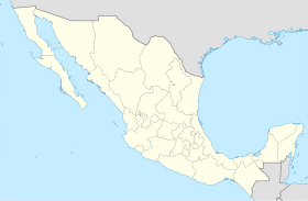

Palo Alto is a town in the Mexican state of Aguascalientes. It stands at 21°55′N 101°58′W / 21.917°N 101.967°W. It serves as the municipal seat for the surrounding municipalities of El Llano.
As of 2010, Palo Alto had a total population of 5,399.[1]
References[]
- ^ "El Llano". Catálogo de Localidades. Secretaría de Desarrollo Social (SEDESOL). Retrieved 23 April 2014.
External links[]
| show |
|---|
| show Authority control |
|---|
This article about a location in the Mexican state of Aguascalientes is a stub. You can help Wikipedia by . |
Categories:
- Populated places in Aguascalientes
- Central Mexico geography stubs