Palos Heights station
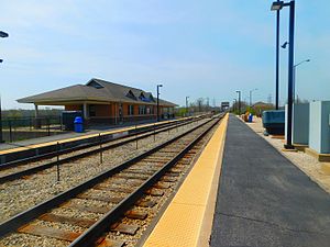 The Palos Heights station in April 2016. | |||||||||||
| Location | 11451 Southwest Highway Palos Heights, Illinois | ||||||||||
| Coordinates | 41°40′55″N 87°48′26″W / 41.6820°N 87.8073°WCoordinates: 41°40′55″N 87°48′26″W / 41.6820°N 87.8073°W | ||||||||||
| Owned by | Metra | ||||||||||
| Platforms | 2 side platforms | ||||||||||
| Tracks | 2 | ||||||||||
| Connections | Pace Buses | ||||||||||
| Construction | |||||||||||
| Disabled access | Yes | ||||||||||
| Other information | |||||||||||
| Fare zone | D | ||||||||||
| History | |||||||||||
| Opened | 1986[citation needed] | ||||||||||
| Passengers | |||||||||||
| 2018 | 232 (average weekday)[1] | ||||||||||
| Rank | 160 out of 236[1] | ||||||||||
| Services | |||||||||||
| |||||||||||
| |||||||||||

Palos Heights is a station on Metra's SouthWest Service in Palos Heights, Illinois. The station is 18.6 miles (29.9 km) away from Union Station, the northern terminus of the line.[2] In Metra's zone-based fare system, Palos Heights is in zone D. As of 2018, Palos Heights is the 160th busiest of Metra's 236 non-downtown stations, with an average of 232 weekday boardings.[1]
Bus connections[]
- 769 Palos Heights/Oak Lawn-Soldier Field Express
- 774 Palos Heights/Oak Lawn-Guaranteed Rate Field Express
References[]
- ^ Jump up to: a b c "Commuter Rail System Station Boarding/Alighting Count: Summary Results Fall 2018" (PDF). Metra. April 2019. Archived from the original (PDF) on 26 May 2019.
- ^ Metra Railfan Tips - SouthWest Service
External links[]
This Illinois train station-related article is a stub. You can help Wikipedia by . |
Categories:
- Metra templates
- Metra stations in Illinois
- Railway stations in Cook County, Illinois
- Railway stations in the United States opened in 1986
- Illinois railway station stubs