Pan de Azúcar, Uruguay
Pan de Azúcar | |
|---|---|
City Municipality | |
 Pan de Azúcar | |
| Coordinates: 34°48′0″S 55°13′0″W / 34.80000°S 55.21667°WCoordinates: 34°48′0″S 55°13′0″W / 34.80000°S 55.21667°W | |
| Country | |
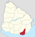
| Department | |
| Founded | 1874 |
| Founded by | Félix de Lizarza |
| Elevation | 79 m (259 ft) |
| Population (2011 Census) | |
| • Total | 6,597 |
| Time zone | UTC -3 |
| Postal code | 20300 |
| Dial plan | +598 443 (+5 digits) |
| Climate | Cfa |

Pan de Azúcar is a city in the southwest of the Maldonado Department in Uruguay. It takes its name from a nearby hill (Cerro Pan de Azúcar, actually located in the neighbouring municipality of Piriápolis), topped by a huge cross.
Pan de Azúcar is also the name of the municipality to which the city belongs. It includes the zones: Pan de Azúcar, Gerona, Kilómetro 110, Nueva Carrara, Puntas de Pan de Azúcar, Laguna del Sauce, Laguna de los Cisnes.
Location and geography[]
The city is located on the junction of Route 7 with Route 60, 10 kilometres (6.2 mi) north-northeast of Piriápolis (via Route 37) and about 34 kilometres (21 mi) (via Routa IB) west-northwest from the capital city, Maldonado. The stream flows by the southwest limits of the city.
History[]
It was founded on October 1874 by . Lizarra counted with the help of inhabitants from the city of San Carlos.
Its status was elevated to "Pueblo" (village) by Decree of 20 April 1887,[1] and on 7 September 1961 it was further elevated to "Ciudad" (city) by the Act of Ley N° 12.908.[2]
Population[]
In 2011 Pan de Azúcar had a population of 6,597.[3] According to the Intendencia Departamnetal de Maldonado, the municipality of Pan de Azúcar has a population of 9,500.[4]

| Year | Population |
|---|---|
| 1908 | 3,409 |
| 1963 | 4,190 |
| 1975 | 5,125 |
| 1985 | 5,513 |
| 1996 | 6,532 |
| 2004 | 7,098 |
| 2011 | 6,597 |
Source: Instituto Nacional de Estadística de Uruguay[1]
Places of worship[]
- (Roman Catholic)
See also[]
References[]
- ^ Jump up to: a b "Statistics of urban localities (1908–2004)" (PDF). INE. 2012. Retrieved 8 September 2012.
- ^ "LEY N° 12.908". República Oriental del Uruguay, Poder Legislativo. 1961. Archived from the original on 6 October 2014. Retrieved 8 September 2012.
- ^ "Censos 2011 Cuadros Maldonado". INE. 2012. Retrieved 25 August 2012.
- ^ "Presupuesto-2011-2015". Intendencia Departamnetal de Maldonado. 2012. Archived from the original on 24 April 2011. Retrieved 11 September 2012.
External links[]
| Wikimedia Commons has media related to Pan de Azúcar (Uruguay). |
| show Authority control |
|---|
This article about a place in Maldonado Department is a stub. You can help Wikipedia by . |
- Populated places in the Maldonado Department
- Populated places established in 1874
- 1874 establishments in Uruguay
- Uruguay geography stubs