Pangkajene and Islands Regency
Pangkajene & Islands Regency
Kabupaten Pangkajene dan Kepulauan | |
|---|---|
|
Coat of arms | |
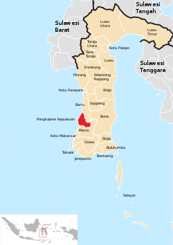 Location within South Sulawesi | |
 Pangkajene & Islands Regency Location within South Sulawesi | |
| Coordinates: 4°45′S 119°30′E / 4.750°S 119.500°ECoordinates: 4°45′S 119°30′E / 4.750°S 119.500°E | |
| Country | |
| Province | |
| Capital | Pangkajene |
| Area | |
| • Total | 1,112.29 km2 (429.46 sq mi) |
| Population (2020 Census)[1] | |
| • Total | 345,775 |
| • Density | 310/km2 (810/sq mi) |
| Time zone | UTC+8 (WITA) |


The Pangkajene and Islands Regency (Indonesian: Kabupaten Pangkajene dan Kepulauan, usually shortened to Pangkep) is a regency of South Sulawesi Province of Indonesia. The regency lies primarily on the mainland of Sulawesi's southern peninsula, but also includes the Spermonde Islands (Kepulauan Spermonde) off the west coast of that peninsula, as well as other small islands further west and southwest. The principal town lies at Pangkajene on Sulawesi, but there are a series of further towns like Lejang, Labakkang, Bontobonto and Segeri proceeding northwards from Pangkajene along the Trans-Sulawesi Highway. The total land area is 1,112.29 km2, and the population was 305,737 at the 2010 Census and 345,775 at the 2020 Census.[2]
Administrative Districts[]
The Regency comprises thirteen administrative Districts (Kecamatan), tabulated below with their areas and their populations at the 2010 Census [3] and the 2020 Census.[4] The table also includes the number of administrative villages (rural desa and urban kelurahan) in each district.
| Name | Land Area in km2 |
Population Census 2010 |
Population Census 2020 |
Number of villages |
|---|---|---|---|---|
| 120.00 | 18,318 | 19,349 | 9 | |
| 91.50 | 12,920 | 14,618 | 7 | |
| 55.44 | 16,895 | 17,728 | 9 | |
| 85.56 | 12,343 | 13,565 | 7 | |
| 47.39 | 41,701 | 48,656 | 9 | |
| 76.48 | 32,970 | 38,940 | 8 | |
| 143.48 | 15,450 | 16,560 | 5 | |
| 112.20 | 8,637 | 10,099 | 6 | |
| Bungoro | 90.12 | 38,851 | 43,879 | 8 |
| 98.46 | 43,730 | 51,616 | 8 | |
| 75.22 | 29,915 | 34,401 | 10 | |
| 78.28 | 20,037 | 22,339 | 6 | |
| 40.16 | 13,870 | 14,025 | 6 | |
| Totals | 1,112.29 | 305,737 | 345,775 | 103 |
The Regency includes four districts which cover 115 small islands off the west and south coasts of South Sulawesi Province. Liukang Tangaya comprises 55 islands off the south and southwest of Sulawesi; Liukang Tupabbiring and Liukang Tupabbiring Utara together comprise the 43 Spermonde Islands off the west coast of South Sulawesi; and Liukang Kalmas comprises 17 other islands more to the west of South Sulawesi.
Climate[]
Pangkajene has a tropical monsoon climate (Am) with moderate to little rainfall from June to October and heavy to very rainfall from November to May. The following climate data is for the town of Pangkajene.
| hideClimate data for Pangkajene | |||||||||||||
|---|---|---|---|---|---|---|---|---|---|---|---|---|---|
| Month | Jan | Feb | Mar | Apr | May | Jun | Jul | Aug | Sep | Oct | Nov | Dec | Year |
| Average high °C (°F) | 29.6 (85.3) |
29.8 (85.6) |
30.3 (86.5) |
30.9 (87.6) |
31.2 (88.2) |
31.0 (87.8) |
31.1 (88.0) |
31.7 (89.1) |
32.1 (89.8) |
32.2 (90.0) |
31.2 (88.2) |
30.0 (86.0) |
30.9 (87.7) |
| Daily mean °C (°F) | 26.3 (79.3) |
26.5 (79.7) |
26.7 (80.1) |
26.9 (80.4) |
27.0 (80.6) |
26.5 (79.7) |
26.1 (79.0) |
26.2 (79.2) |
26.7 (80.1) |
27.1 (80.8) |
27.0 (80.6) |
26.5 (79.7) |
26.6 (79.9) |
| Average low °C (°F) | 23.0 (73.4) |
23.3 (73.9) |
23.1 (73.6) |
23.0 (73.4) |
22.9 (73.2) |
22.1 (71.8) |
21.1 (70.0) |
20.8 (69.4) |
21.3 (70.3) |
22.1 (71.8) |
22.9 (73.2) |
23.0 (73.4) |
22.4 (72.3) |
| Average rainfall mm (inches) | 584 (23.0) |
511 (20.1) |
388 (15.3) |
234 (9.2) |
219 (8.6) |
100 (3.9) |
54 (2.1) |
32 (1.3) |
48 (1.9) |
109 (4.3) |
301 (11.9) |
588 (23.1) |
3,168 (124.7) |
| Source: Climate-Data.org[5] | |||||||||||||
References[]
| show Regencies and cities of South Sulawesi |
|---|

| Wikimedia Commons has media related to Pangkajene and Islands Regency. |
| show Authority control |
|---|
This South Sulawesi location article is a stub. You can help Wikipedia by . |
- Regencies of South Sulawesi
- Sulawesi geography stubs