Papakura
Papakura | |
|---|---|
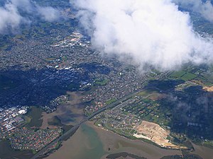 Aerial view of Papakura and the Auckland Southern Motorway | |
 | |
| Country | New Zealand |
| City | Auckland |
| Electoral ward | Manurewa-Papakura Ward |
| Local board | Papakura Local Board |
| Established | 1845 |
| Population (2018) | |
| • Total | 22,296 |
| Train station(s) | Papakura railway station |
| Hospitals(s) | Counties Manukau District Health Board |
| Wattle Downs | Takanini | Ardmore |
| (Towards Manukau Harbour) |
|
Red Hill |
| Pahurehure, Rosehill | Drury | Ōpaheke |
Papakura is a southern suburb of Auckland, in northern New Zealand. It is located on the shores of the Pahurehure Inlet, approximately 32 kilometres south of the Auckland CBD. It is under the authority of the Auckland Council.
Papakura is a Māori word believed to have originated from papa, meaning earth or flat (abbreviation of Papatūānuku) and kura meaning red,[1] reflecting the rich, fertile soil upon which the community was founded.
History[]
A village was established at Papakura in the late 1840s by a small group of settler families who sought to farm in the area. Among these early settlers was George Cole, a Welsh immigrant whose legacy in the town has been preserved through Coles Crescent, one of the major thoroughfares in the town centre. The tract of land that was initially purchased was subdivided in 1853, with the street layout that was built initially remaining largely in place today.[2]
In 1862, construction of the Great South Road, from Auckland to the Waikato, commenced.[3] The road passed through Papakura and was constructed during the New Zealand Wars to transport supplies to the colonial militias and British Army forces fighting in the Invasion of the Waikato. It was guarded by armed constabulary and was a designated military road. It remains the primary north-south thoroughfare through Papakura and part of the road forms the main street of the Papakura town centre.
In 1875, Papakura railway station opened, linking the town to Auckland to the north and Hamilton to the south.
In 1882, the Papakura Town District was established, for many years the only such district within what is now the southern portion of the Auckland urban area. In spite of this, the town was not particularly developed, and by 1914 had a population of just 700.[2]
In 1911, the first controlled powered flight in New Zealand took place in Papakura. The flight took place inside a single paddock within the racecourse of the now-defunct Papakura Racing Club. The flight was piloted by Vivian Walsh and was carried out in a Howard Wright 1910 Biplane, the parts for which were imported from England in 1910 and assembled by members of the Auckland Aeroplane Syndicate.[4]
The Papakura Military Camp was established on the outskirts of the town in 1939 and remains an important base for the New Zealand Army, being the home of the New Zealand Special Air Service. [5] The camp was initially built by the Stevenson family construction business. [6] In the early 2000s some land was set aside for new housing developments.
During the major reformation of local government in 1989, Papakura became a district. Prior to 1989, a smaller area was known as Papakura City. The new district included parts of the surrounding rural countryside that had previously been part of Manukau City. The newly amalgamated area was known as the Papakura District. Instead of being an independent city, as Papakura had been previously, the district became a part of the also newly-created Auckland Regional Council area.
From October 2010, after a review of the Royal Commission on Auckland Governance, the various cities and districts of the Auckland Region were amalgamated into a single unitary authority, governed by the Auckland Council. As well as the Papakura District, the other cities and districts within the Auckland Region, such as the neighbouring Manukau City, as well as the regional council itself, were abolished with the entire area merged into a single authority. Papakura and the other suburbs of the former Papakura District are now in the Papakura Local Board within the Manurewa-Papakura Ward of the Auckland Council. The entirety of Papakura and the former district is included as part of the Auckland urban area for statistical purposes, forming part of its southern boundary.
Demographics[]
| Year | Pop. | ±% p.a. |
|---|---|---|
| 2006 | 17,466 | — |
| 2013 | 19,029 | +1.23% |
| 2018 | 22,296 | +3.22% |
| Source: [7] | ||
Papakura, comprising the statistical areas of Papakura West, Papakura North, Papakura Central, Papakura North East, Papakura Kelvin, Papakura Massey Park and Papakura East, had a population of 22,296 at the 2018 New Zealand census, an increase of 3,267 people (17.2%) since the 2013 census, and an increase of 4,830 people (27.7%) since the 2006 census. There were 6,585 households. There were 10,980 males and 11,313 females, giving a sex ratio of 0.97 males per female, with 5,688 people (25.5%) aged under 15 years, 5,202 (23.3%) aged 15 to 29, 9,183 (41.2%) aged 30 to 64, and 2,220 (10.0%) aged 65 or older.
Ethnicities were 46.2% European/Pākehā, 34.2% Māori, 21.6% Pacific peoples, 16.9% Asian, and 2.7% other ethnicities (totals add to more than 100% since people could identify with multiple ethnicities).
The proportion of people born overseas was 25.7%, compared with 27.1% nationally.
Although some people objected to giving their religion, 41.0% had no religion, 37.5% were Christian, 5.0% were Hindu, 1.4% were Muslim, 0.9% were Buddhist and 7.3% had other religions.
Of those at least 15 years old, 2,334 (14.1%) people had a bachelor or higher degree, and 3,849 (23.2%) people had no formal qualifications. The employment status of those at least 15 was that 8,385 (50.5%) people were employed full-time, 1,824 (11.0%) were part-time, and 1,110 (6.7%) were unemployed.[7]
Papakura industrial area[]
| Year | Pop. | ±% p.a. |
|---|---|---|
| 2006 | 201 | — |
| 2013 | 195 | −0.43% |
| 2018 | 204 | +0.91% |
| Source: [8] | ||
The area southeast of Papakura is almost entirely industrial.
Papakura Industrial had a population of 204 at the 2018 New Zealand census, an increase of 9 people (4.6%) since the 2013 census, and an increase of 3 people (1.5%) since the 2006 census. There were 51 households. There were 105 males and 99 females, giving a sex ratio of 1.06 males per female. The median age was 32.7 years, with 57 people (27.9%) aged under 15 years, 36 (17.6%) aged 15 to 29, 96 (47.1%) aged 30 to 64, and 12 (5.9%) aged 65 or older.
Ethnicities were 50.0% European/Pākehā, 32.4% Māori, 25.0% Pacific peoples, and 17.6% Asian (totals add to more than 100% since people could identify with multiple ethnicities).
The proportion of people born overseas was 26.5%, compared with 27.1% nationally.
Although some people objected to giving their religion, 33.8% had no religion, 42.6% were Christian, 5.9% were Hindu, 1.5% were Muslim, 2.9% were Buddhist and 11.8% had other religions.
Of those at least 15 years old, 12 (8.2%) people had a bachelor or higher degree, and 36 (24.5%) people had no formal qualifications. The median income was $26,800. The employment status of those at least 15 was that 78 (53.1%) people were employed full-time, 9 (6.1%) were part-time, and 9 (6.1%) were unemployed.[8]
Education[]
The following schools are located in Papakura (schools in Takanini and other adjacent suburbs are excluded):
Papakura High School is a secondary school (years 9–13) with a roll of 883.[9] The school was established in 1954.[10] In 2020, Māori students were 59% of the roll and Pacific Islands students were 29%.[11]
Papakura Intermediate is an intermediate school (years 7–8) with a roll of 273.[12] The school opened in 1962. From 2000 to 2017 it was called Mansell Senior School.[13] In 2018, Māori students were 74% of the roll and Pacific Islands students were 22%.[14]
Papakura Normal School and Edmund Hillary School are full primary schools (years 1–8) with rolls of 663 and 229 students, respectively.[15][16] Papakura Normal opened as Papakura North School in 1953, and changed to its current name when it affiliated to Ardmore Teachers College in 1958.[17] Edmund Hillary opened in 1963. Its name pays tribute to the mountaineer.[18]
Papakura Central School, Kelvin Road School and Cosgrove School are contributing primary schools (years 1–6) with rolls of 414, 430 and 506 students, respectively.[19][20][21] Papakura Central traces its origins back to 1876.[22] Kelvin Road opened in 1968.[23] Cosgrove opened in 1959.[24]
All these schools are coeducational. Rolls are as of November 2021.[25]
Facilities[]
Government[]
In addition to the Local Council Chambers, Papakura is served by a large police station (one of Auckland's busiest), a District Court, and a WINZ office. In the Pitcairn sexual assault trial of 2004, the Papakura Courthouse was where the Pitcairn Supreme Court sat to hear the case.
Armed Forces[]
Papakura once served a large military population, but now only the SAS special forces are based at Papakura.[26] Nearby houses were originally Army Homes, but are now in private hands. The army base was made much smaller 2010s and become a residential area for a large number of modern houses, both detached and terraced. The subdivision is called McLennan Housing Development next to McLennan Park, home of Papakura Football Club. McLennan being the name of the farming brothers that first settled in the area from Scotland.[27]
Transport[]

State Highway 1 and the North Island Main Trunk railway run through the Papakura District. State Highway 1 ran down Great South Road through central Papakura until 1965, when it was bypassed by the Auckland Southern Motorway.[28]
Public transport is provided by train and bus services, with frequent trains on the Southern Line between Papakura and the CBD (Britomart). Recent investment has focused on upgrading and refurbishing the region's trains and suburban railway stations, most recently with the opening of a modern station facility at the town centre. Papakura is the final stop for most southbound public transport in Auckland, and Papakura is the third busiest station on the rail network. Drawn by frequent services into and out of the city, rail commuters come from Papakura itself, Franklin County and the northern Waikato. Though the motorway and Great South Road flow relatively freely at peak times, road commuters are affected by the acute traffic congestion as they get closer to metropolitan Auckland.
Sport and Recreation[]
Some notable sports facilities include an indoor-outdoor swimming pool, an international-quality athletics track, a sports stadium, and venues for rugby, netball, cricket, golf, tennis, badminton, soccer, and many other sports. The council also operates a library and a theatre. Papakura also has a number of skate parks, and a skate bowl.
Papakura is home to association football club Papakura City, who compete in the Lotto Sport Italia NRFL Division 2, rugby union club Papakura RFC who are members of the Counties Manukau Rugby Union, rugby league club Papakura Sea Eagles, who compete in the Auckland Rugby League's Fox Memorial competition (division 1), and Papakura Cricket Club who compete in the Counties Manukau Cricket Association competition. Papakura and the surrounding area is represented by the Counties Manukau Steelers in first-class rugby union and Northern Districts in first-class cricket.
Museum[]
Papakura Museum showcases the area's local history.[29][30] It opened in the 1980s.[31]
Notable people[]
- Fleur Adcock – Poet
- John Afoa - Rugby union player, All Black
- Sir Edmund Hillary - Mountaineer and explorer
- Katrina Grant – Southern Steel and Silver Ferns netballer
- Lance Hamilton – International cricketer
- Jerome Kaino - Rugby union player, All Black
- Keven Mealamu – Rugby union player, All Black
- Reg Mombassa – Artist and musician
- P-Money – Hip-hop DJ
- Blair Pocock – International cricketer
- Kieran Read – Rugby union player, All Black
- Joe Rokocoko – Rugby union player, All Black
- David Sabine – Cricketer
- Kimberley Smith – Long-distance runner
- John Walker – Middle-distance runner, Olympic gold medallist
- George Hawkins – Politician, Member of Parliament
Notable buildings[]
- Christ Church (Anglican)[32] established in 1862 with Selwyn Chapel.
References[]
- ^ "1000 Māori place names". New Zealand Ministry for Culture and Heritage. 6 August 2019.
- ^ a b Historic Heritage Evaluation: Papakura-Karaka War Memorial (PDF) (Report). Auckland Council. 2017.
- ^ "War in Waikato". nzhistory.govt.nz. New Zealand History. Retrieved 21 July 2020.
- ^ "New Zealand's first controlled powered flight". nzhistory.govt.nz. New Zealand History. Retrieved 21 July 2020.
- ^ "17. – Auckland places – Te Ara: The Encyclopedia of New Zealand". Teara.govt.nz. 1 July 2015. Retrieved 22 February 2016.
- ^ "Our History". Archived from the original on 24 February 2012. Retrieved 12 April 2013.
- ^ a b "Statistical area 1 dataset for 2018 Census". Statistics New Zealand. March 2020. Papakura West (162800), Papakura North (163000), Papakura Central (163200), Papakura North East (163300), Papakura Kelvin (163500), Papakura Massey Park (163600) and Papakura East (163900). 2018 Census place summary: Papakura West 2018 Census place summary: Papakura North 2018 Census place summary: Papakura Central 2018 Census place summary: Papakura North East 2018 Census place summary: Papakura Kelvin 2018 Census place summary: Papakura Massey Park 2018 Census place summary: Papakura East
- ^ a b "Statistical area 1 dataset for 2018 Census". Statistics New Zealand. March 2020. Papakura Industrial (164100). 2018 Census place summary: Papakura Industrial
- ^ Education Counts: Papakura High School
- ^ "About Papakura High School". Papakura High School. Retrieved 21 September 2020.
- ^ "Papakura High School - 03/02/2020". Education Review Office. 3 February 2020.
- ^ Education Counts: Papakura Intermediatel
- ^ "Our Journey". Papakura Intermediate. Retrieved 21 September 2020.
- ^ "Papakura Intermediate - 09/03/2018". Education Review Office. 9 March 2018.
- ^ Education Counts: Papakura Normal School
- ^ Education Counts: Edmund Hillary School
- ^ "Welcome". Papakura Normal School. Retrieved 21 September 2020.
- ^ "Our History". Edmund Hillary School. Retrieved 21 September 2020.
- ^ Education Counts: Papakura Central School
- ^ Education Counts: Kelvin Road School
- ^ Education Counts: Cosgrove School
- ^ "The History of Papakura Central School". Papakura Central School. Retrieved 21 September 2020.
- ^ "50 Year Jubilee Celebrations". Kelvin Road School. 27 October 2018.
- ^ "Cosgrove Primary School". Cosgrove School. Retrieved 21 September 2020.
- ^ "New Zealand Schools Directory". New Zealand Ministry of Education. Retrieved 22 December 2021.
- ^ "Forces and Locations". New Zealand Defence Force. Retrieved 19 August 2006.
- ^ "About | McLennan". mclennan.co.nz. Retrieved 30 August 2021.
- ^ "Auckland Motorways 2008" (PDF). New Zealand Transport Agency. Retrieved 3 February 2017.
- ^ "Papakura Museum". Papakura Museum.
- ^ "Papakura Museum on NZ Museums". nzmuseums.co.nz. Te Papa.
- ^ "Papakura Museum". thebigidea.nz. The Big Idea - Te Aria Nui Charitable Trust.
- ^ "Old All Saints Church (Anglican)". Register of Historic Places. Heritage New Zealand. Retrieved 27 January 2021.
External links[]
- Photographs of Papakura held in Auckland Libraries' heritage collections.
Coordinates: 37°3′45″S 174°56′31���E / 37.06250°S 174.94194°E

- Suburbs of Auckland
- Populated places around the Manukau Harbour